Buffalo Point operates from March 15 to November 14 within Buffalo National River, offering 65 sites with electric and water hookups for RVs up to 65 feet. The National Park Service manages this established campground with nightly rates ranging from $20 to $50, and reservations are available for advance planning.
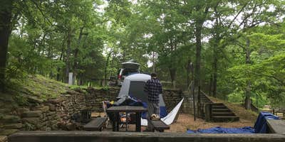
Five distinct loops spread across forested terrain near the Buffalo River, each with different characteristics. B Loop sits closest to the large sandbar and boat ramp, though Susan R. notes "you can not access the river from these sites" despite the proximity. A paved walkway leads down to the swimming area from B Loop. Sites feature multi-level designs typical of CCC construction, with picnic tables often positioned on elevated platforms reached by steps.
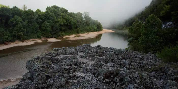
The Buffalo River provides the main draw for most campers, with float trips available through nearby outfitters. Water levels can fluctuate dramatically after rainfall - one reviewer documented a 13-foot rise following heavy storms. A rope swing operates across from A Loop, though strong swimming skills are required to handle the current. The Indian Rockhouse Trail offers a moderately challenging four-mile loop, while shorter trails provide access to overlooks above the river valley.
Cell service remains limited throughout the campground, with reception only available at the hilltop before descending to the camping areas. Road access can be rough during wet conditions. The on-site restaurant serves meals with river views, and a concession stand provides basic supplies. Bath houses offer hot water and good pressure, though cleanliness varies by season and maintenance schedule.
For additional camping options in the region, consider campgrounds around Buffalo National River or nearby Rush Campground — Buffalo National River for a more primitive tent-only experience.
Description
Overview
Buffalo Point is a convenient, fun-filled destination for families and adventurists of all types. It's perched along the Buffalo National River, providing exciting river sports and hiking opportunities. In peak season, a restaurant is open at the facility, serving up meals for those who want a break from preparing them.
Recreation
The wild river is a gathering place for water activities. Many campers spend their days fishing, hiking, canoeing or kayaking. Evenings are ideal for gathering next to the fire to revamp for another great day out on the river.
Facilities
Buffalo Point offers campsites with water, electricity and even a classic pay telephone. It's the only area in the park with a restaurant, open daily from Memorial Day to Labor Day and on weekends only from mid-April to Memorial Day Weekend and Labor Day Weekend to mid-October.
Natural Features
The campground is set along Buffalo National River, one of the few free-flowing rivers remaining in the contiguous United States. The river runs 135 miles without dams and cuts through the Arkansas Ozarks and into the White River. The region is surrounded by droves of lush hardwood trees and grassy open meadows.
Nearby Attractions
Two popular attractions within the Buffalo Point Area are the Indian Rockhouse Trail and the Rush Historic District. Rush was a zinc mining community until the zinc market collapsed and the settlement was deserted. Tours about the town's history are available. Buffalo Point is the former Buffalo River State Park developed in the 1930's as project of the Civilian Conservation Corps. Blanchard Springs Caverns, an extraordinary living cave, is a one-hour drive from Buffalo Point.
Charges & Cancellations
Please see the Recreation.gov Rules and Reservation Policies.
Reservation Info
Some sites at Buffalo Point are available for reservation at www.recreation.gov (1-877-444-6777) and others are first come, first serve. Flush restrooms, dump station, showers, water, and electricity are available from March 15 - November 14 when fees are charged. Fees are not charged from November 15 to March 14 when only B Loop is open with no amenities, just a vault restroom.
RV Road Trip Guides


Location
Public CampgroundBuffalo Point — Buffalo National River is located in Arkansas
Directions
From Springfield, MO: Take Highway 65 South through Branson to Harrison. Stay on Highway 65 through Harrison, turn left on Highway 62 and travel to Yellville. At Yellville turn right on Highway 14 East. Travel 17 miles (27 km) to Highway 268 East. Turn left on 268 to Buffalo Point. From Little Rock, AR: Take Highway 65 North to Marshall, at Marshall turn right on Highway 27 North about 11 miles (18 km) to Harriet. Turn left on Highway 14 West and travel about 14 miles (22.5 km) to Highway 268 East. Turn right on Highway 268 to Buffalo Point.
Address
2229 HWY 268 EAST
Yelville, AR 72687
Coordinates
36.085365 N
92.5656549 W
Connectivity
 T-MobileNo Coverage
- VerizonNo Coverage
 AT&TLTESome Coverage
Connectivity
- T-MobileNo Coverage
- VerizonNo Coverage
- AT&TLTESome Coverage
Access
- Drive-InPark next to your site
- Walk-InPark in a lot, walk to your site.
- Boat-InSites accessible by watercraft.
Site Types
- Tent Sites
- RV Sites
- Standard (Tent/RV)
- Group
- Cabins
Features
For Campers
- Market
- Trash
- Firewood Available
- Reservable
- Drinking Water
- Electric Hookups
- Toilets
- Alcohol
- Pets
- Fires
For Vehicles
- Sanitary Dump
- Water Hookups
- 50 Amp Hookups
- Big Rig Friendly
Drive Time
- 1 hr 59 min from Little Rock, AR
- 2 hrs 2 min from Springfield, MO
- 2 hrs 15 min from Fayetteville, AR
- 2 hrs 46 min from Jonesboro, AR


