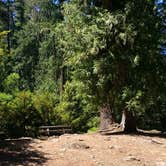
Rough road access is the first thing to plan around at Shellrock Creek, a small Forest Service campground in Mt. Hood National Forest with a handful of drive-in and walk-in sites along a creek in the Clackamas area of Oregon. Vehicles longer than 16 feet should not attempt the approach. Sites are compact, fitting one larger tent or two smaller ones, with cars parking just a few feet away, which makes hauling gear straightforward.
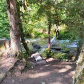
Water access is the defining feature here. One site sits directly on the stream bank, and reviewers consistently mention it as the most sought-after spot. The creek runs alongside most of the sites, and Aria R. describes the setting as "right off the road but not much road noise, lots of stream sounds." There is no potable water on site, so campers should bring their own or plan to filter from the creek. Cell service is effectively nonexistent, at least on T-Mobile.
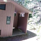
The composting toilet was noted as clean in recent visits, though reviewers recommend bringing your own toilet paper. Trash service is available. Fishing and short trail exploration are the main activities, and pets are welcome. The campground tends to fill less quickly than nearby alternatives, making it worth checking when Buck Lake Camping is at capacity. Campers wanting more pet-friendly options near Mt. Hood National Forest will find additional choices across the forest. Lake Harriet, about two miles southwest, is a nearby alternative for campers wanting a different setup.
Description
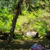
Shellrock Creek Campground is primitive camping at its finest. It is located on the banks of Shellrock Creek which feeds into the Oak Grove Fork and then eventually the Clackamas River. This campground delivers a feeling of really being “out there”. Each site is separated by dense growth allowing for camper privacy. Shellrock Creek is a small brook in the woods which creates that tranquil sound of running water which can be heard throughout the campground.
RV Road Trip Guides

Map & DirectionsShellrock Creek is located in Oregon near Mt. Hood National Forest
 Public Campground
Directions
From Estacada, OR - travel east on Highway 224 for about 26 miles. Turn left onto Forest Service Road 57 and continue about 7 miles. Turn left onto Forest Service Road 58 and continue about 1/2 a mile to the campground.
Coordinates
45.0850003 N
121.92100075 W
Connectivity
 T-MobileNo Coverage
- VerizonNo Coverage
- AT&TNo Coverage
Connectivity
- T-MobileNo Coverage
- VerizonNo Coverage
- AT&TNo Coverage
Access
- Drive-InPark next to your site
- Walk-InPark in a lot, walk to your site.
Site Types
- Tent Sites
Features
For Campers
- ADA Access
- Trash
- Picnic Table
- Toilets
- Alcohol
- Pets
- Fires
For Vehicles
- Pull-Through Sites
Drive Time
- 1 hr 22 min from Portland, OR
- 1 hr 48 min from Salem, OR
- 2 hrs 7 min from Albany, OR
- 2 hrs 23 min from Corvallis, OR