Best Dispersed Camping near Tiller, OR
Want to go dispersed camping near Tiller? Dispersed camping is the perfect way to get off the grid. Each dispersed site offers quick access to one or more of Tiller's most popular destinations.
Elderberry Flat Campground provides 11 campsites along the tranquil and beautiful West Fork of Evans Creek, a tributary to the famous Rogue River. There is a paved road that provides easy access to the campground which is typically open from late May to September. The area offers a variety of recreation activities including camping, biking, hiking, hunting, OHV riding, picnicking, swimming, and wildlife viewing. The campground provides multiple access points to the creek to enjoy the cool water on hot summer days. Granite sand bars, calm water, and gentle sloping access provide family friendly access to the water. Campsites are equipped with picnic tables and grills and there is one pit toilet. There is no fee to use the campground but a 14 day limit is enforced.
14-day camping is allowed from May-October. Oregon Sno-Park Permit is required between Nov. 1 and April 30.
Mt. Thielsen Wilderness encompasses 54,914 acres and runs along the crest of the Cascades 80 miles east of Roseburg and just north of Crater Lake National Park. Elevations range from 5,000' to the 9,182' summit of Mount Thielsen. Born of the same volcanic activity that created Crater Lake, this is the land of fire and ice.
Much of the Mount Thielsen Wilderness is made up of high alpine forests and open meadows. The terrain is moderate but becomes very steep toward the crest of the Cascade Mountains. Timberline stands at about 7,200 feet, just above a forest of mountain hemlock and fir mixed with whitebark pine. Lodgepole pine dominates the vegetation at lower elevations. The many streams in the area carry a substantial amount of snowmelt in spring.
The Pacific Crest National Scenic Trail winds through the Mount Thielsen Wilderness for 26 miles along the summit of the Cascade Range. For a more serene wilderness adventure, hike into Lake Lucille or Maidu Lake on the North Umpqua Trail #1414. The trail passes over deep pumice that was deposited when Mt. Mazama erupted to form Crater Lake. The famed North Umpqua Wild and Scenic River begins at Maidu on its long trek to the Pacific Ocean.
After parking right off the trail head and hiking down about 0.8 miles, you have three “established” spots to chose from. I say established in quotations because they are marked with plaques but are all the way rustic sites. The middle sight is definitely the biggest and is where me and four others stayed for two nights. This is a very busy national park in the summer months but going the first week of October (as suggested by the ranger) made it so that we were the only ones in this area. We did have a couple backpackers stop for the night at the first site but other than that is was really quite. The lightning springs trail itself is incredibly long and we only went to where water was flowing so that we could fill up. We opted to hike out the first day and then drive to the Watchman Lookout Trail head and do that one first. It was only 0.8 miles long but I believe a 400 foot elevation change. Absolutely incredibly view. After that we drove north and did the Cleetwood Cove Trail which was around a mile with a 600 foot elevation change. This allows you to get right next to the water. Both hikes we semi challenging but well worth it. While the backcountry campsites do not allow fires, there are other location around Rim Village that have established sites that you can. When we went it was a little colder and windy but the tree coverage offered some shielding from that. There are plenty of other longer hikes as well in the area and other established sites if you are looking to have a more traditional camping experience. The Rim Village center was open and we were able to get a meal and visit the gift shop as well as go farther south and get our NPP stamped. Definitely recommend checking the NP website to see what is opened and closed as well as fire bans. We were lucky that the entire loop was open and got to drive all the way around the second day. While not directly at these sites, there are trash and bathroom areas really close. Really all around incredible views and an incredible weekend stay.
Great spot. Go all the way to the end of the road to reach the top. There is ample room to turn around, in spite of a step climb.
Was able to pull 15' trailer up with 4wd.
Wide open sky for solar and starlink.
Mid 60s f during day in early October. 40 f at night.
Large, paved parking lot. Plenty of room for big rigs and vault toilets. Some road noise, but nothing that bothered us. Great location for access to Glacier NP and a small town with a few restaurants was not far away.
Huge thanks to Rogue Snowmobilers - there was Wi-Fi available while we were there, which helped out a lot!
We absolutely loved camping here. During our off season stay it was fun and with all the ATV trails it was our favorite place to camp.
Our neighbor campers decided they could ride the trails without helmets and found out the hard way that is is a no no. They were brought back to the camp without their bikes and in the back of a National Forest Service Enforcement vehicle. After being spoken to about the importance of following the rules of the trails, they were left at camp and had to find their own way back to their motorcycles.
Fortunately we did not have the same experience. It can get very dusty so just be prepared for that. The trails are absolutely great and access to the Rogue River is just icing on the cake.
It was so nice to have areas provided for unloading bikes and ATV's so folks could safely load and unload their toys.
Stayed for over a week and the only thing is it buts up to a quad/dirt bike trail. Other than that quiet and peaceful!
Quiet camping area off 138. You come up to what looks like a county shop, but keep going to the left, and you're here. A handful of sites. We were easily able to park out jeep a ways in.
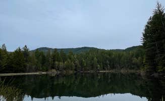
The road getting up to it wasn't too bad. Some bigger potholes that we're easy enough to avoid. The pond at the top was beautiful with tons of bats flying around at night. Super cool!
This was a lovely place to camp for the night. There were probably 10-15 campsites, and I was the only one there when I showed up. Campsites have picnic tables and fire pits and there is a pit toilet. Many trees which provide shade. Some mosquitos but not too bad. Very easy to find with the directions and it was also on GAIA GPS.
BE CAREFUL got a nail in the tire here. Ended up with a flat giving me a headache 😒. Otherwise the campsite was amazing, would have been 5 stars if not for the nail.
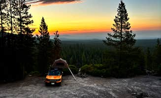
Came here not really knowing what to expect and we were surprised with what we got. Road was was easy to get up, however 4x4 is definitely needed for the spots up on the rocks. Lovely view where we were! Lots of little camp fires scattered around the area .
We needed a place to set up for a quick sleep on our way down to Yosemite from Washington. I navigated using Google Maps due to other reviews saying Apple made it confusing. This led us right to the pond/camp sites. The road is a little rough with potholes but it’s not terrible if you just drive slow over the holes. There is a few split offs/2-way roads along this dirt road, the last one being a tree with a smiley face and an arrow leading you where to go. Didn’t get lost at all and it was already dark when we got there. No one was there, it was peaceful, clean and quiet. There is a pit toilet/bathroom with toilet paper. No trash cans so you’ll have to pack out your trash. I recommend this spot for anyone willing to drive 10-15 minutes off the freeway for some dispersed camping.
Seemed to be plenty of spots when I got there on a Sunday. Far enough from the main highway, I didn’t hear any traffic in the middle of the night. A caveat however, the east side of hill itself seems to be an active rock quarry. That means if you are waking up on a work day, it may be somewhat of a rude awakening
We had to go in a ways before finding a suitable spot, but it was very secluded. We camped near the road but nobody came through the whole night we stayed. An owl swooped right through our camp site and scared the crap out of us. Easy route in and out.
It looked like a decent place to camp with river access. I was disappointed the camp was closed due to fire. I saw a couple campers but I didn't stay.
This is a lovely spot. Just a few campsites around a pond. Just overnighted here. Saw some folks camping and fishing. A bit of a challenge to find. Take speaker road to the end of pavement and then follow the dyrt map carefully. The correct location is pinned.
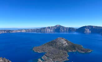
This is a good campsite to stay to look at Crater Lake. It is about 15 minutes to the south entrance of the park and then another 15 minutes to the Rim Village. Huge thanks to the Rogue Snowmobilers who make this site so great. There was a rec area we ate dinner in and played cards. The only issue with the site is the mosquitos. Make sure to have bug spray and make a fire
Plenty of parking with bathrooms . We were the only ones there in our camper van got in late driving from the redwoods on the way to crater . Lots of stars . No cell service
Entrance across from Annie Creek Sno Park. Stay left at first fork.
Potential for 2 spots, left spot had some ground bees.
We picked this dispersed camping near Lemolo Lake since it was an open area that we could run our Starlink. There was also some cell service. Lemolo lake also has several Campgrounds to choose from if you want to pay. In the area we visited Lemolo Falls and Warm Spring Falls. We weren't disappointed. The area does have mosquitoes to contend with. Where we camped there was a picnic table and rock fire ring. Be mindful of the no fire season.
Easy to access road. So so many spots below, and a few great ones up the hill. We stayed below since we arrived late at night. Nice little walk in the morning up the hill, good views. Quick drive to crater lake. There were mosquitoes, but some deet and no prob.
Looked like a great place to camp. Arrived at about 3:30pm and unfortunately all sites were occupied by then. After reading the prior couple reviews, I hoped this would have availability on a Thursday afternoon. Bummer. I noticed one group was playing music, so evening might not have been as quiet as I'd prefer.
We drove to this little spot after a busy day at crater lake July 2nd. We arrived about 6pm. Having seen a YouTube video about this spot in advance, we 4x4 straight to the top in my f150. Little bumpy but no problem getting up. At the very top, another truck with a RTT beat us, but we took the sheltered spot deep in the “rock quarry” center area.
We were worried about mosquitos due to so many reviews complaining, but it was pretty clear overall. There were a few, but really not a nuisance at all. I did use deet lotion, but my partner didn’t and she didn’t seem to mind at all. We walked to the tippy top section where are are trees and there were swarms on misquotes, but down in the rocks was pretty clear.
Got a fire started under the full moon and had a wonderful night with my family. 10 out of 10.
Nice quiet spot off the main road. There are several flat spots for tents or small campers. The road is pretty good though we didn’t try to go up the mountain. There are lots of bugs and you can hear the occasional chainsaw, so just be aware.
Pavement turns to dirt road to get to the sites. Each site has a fire ring and a table. The vault toilet has a trash can and was stocked with TP when we were there but we bring our own.
The trails down to the river are loose dirt and steep but we drove to the other side of the river to lounge in the sun.
Lots of skeeters! Bring your bug spray
There are only about 6 little sites here and a boat ramp for the little lake. There is one long-drop toilet (no TP) and many sites had picnic tables. I'm not sure if all did, but ours did. We also had a fire pit.
We were there 2 nights and only had one other group show up the whole time.
There is a dangerous low-head dam at the beginning of the lake near the campground, so please keep track of your kids/pets!
I would certainly stay here again - it's about 12 minutes from the Umpqua Hot Springs!
It's best if you have four wheel drive or all wheel drive. Wouldn't recommend going in the winter months or rainy season. It is a very fun drive though taxing and it is slow going. But was out there it is complete quiet and solitude. And make sure you stock up on anything you need cuz there's nothing there
Subaru Impreza got up the road just fine! Location is about 20 minutes off i5. Hard to find with Apple Maps but we switched over to google maps and it was a lot easier!
Frequently Asked Questions
Which is the most popular dispersed campsite near Tiller, OR?
According to TheDyrt.com, the most popular dispersed campground near Tiller, OR is Burma Pond BLM with a 4.6-star rating from 7 reviews.
What is the best site to find dispersed camping near Tiller, OR?
TheDyrt.com has all 28 dispersed camping locations near Tiller, OR, with real photos and reviews from campers.