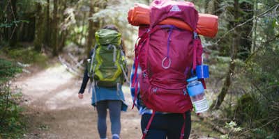
Burnt Lake, near Mount Hood, Oregon, is a fantastic destination for those looking to immerse themselves in nature. This campground offers a unique experience with its scenic views and well-defined trails, making it a great choice for both seasoned backpackers and beginners.
The area features multiple campsites scattered around the lake, providing a sense of seclusion while still being close to the water. Visitors have noted that the trail leading to the lake is well-maintained and not overly challenging, making it accessible for newcomers. One camper highlighted, “This was a great intro to backpacking,” which speaks to its suitability for those just starting out.
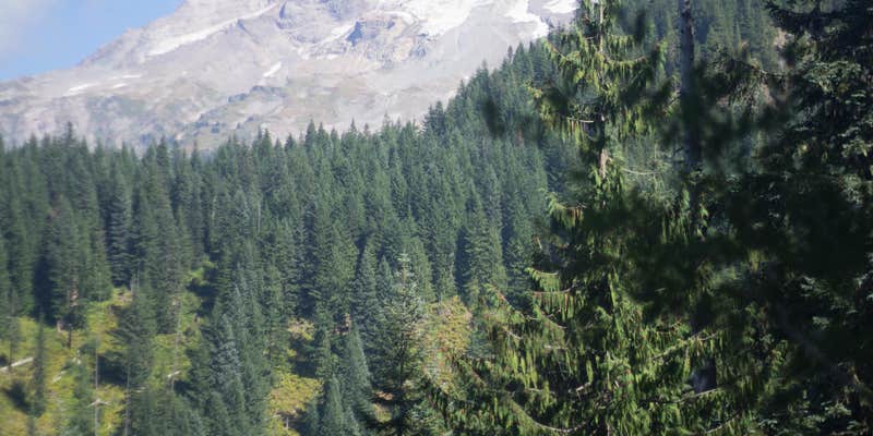
For those who enjoy breathtaking views, the west side of the lake is particularly stunning at sunset, with a clear view of Mt. Hood. Campers have also mentioned the beauty of the surrounding landscape, with opportunities for hiking and exploration in the nearby area. Just be prepared for a bit of a trek, as it’s about four miles from the trailhead to the campsites.
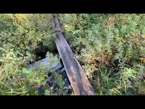
While amenities are limited—there are no toilets or drinking water—this adds to the rustic charm of Burnt Lake. Just remember to pack out what you pack in. If you’re looking for a peaceful getaway with plenty of natural beauty, Burnt Lake is definitely worth considering.
Description
This trail enters the Mt. Hood Wilderness on the west side of Mount Hood. This trail accesses Burnt Lake and Zigzag Mountain with views above treeline. The north side also has wonderful old cedar snags showing remnants of a wildfire that came through around 1900.
Starting from the north Burnt Lake trailhead, this trail begins at Forest Road 1825-109 (2,680’) and ends at Forest Road 2627-207 (3,320’). From Forest Road 1825-109, the trail climbs steadily up to Burnt Lake (4,120’). There is a nice loop trail around the lake accessing several campsites. From the lake the trail continues up a steep climb 0.6 mile and reaches Zigzag Ridge (4,720’). Soon after, the trail reaches Zigzag Mountain Trail #775. Turn right onto Zigzag Mountain Trail #775 and follow the ridge westward 0.3 miles until Burnt Lake Trail #772 drops over the south side of the ridge descending to Devil’s Meadow area. From Devil’s Meadow the trail follows an easier grade down an old roadway to West Zigzag trailhead at Forest Road 2627-207.
RV Road Trip Guides


Map & DirectionsBurnt Lake is located in Oregon near Government Camp
Directions
North Burnt Lake trailhead: From Portland, OR - follow U.S. Hwy 26 17.5 miles east of Sandy to Zigzag. At Zigzag, approximately 0.4 mile past milepost 42, turn left (north) on Lolo Pass Road (Forest Road 18). After 4 miles, turn east at Forest Road 1825 and continue 0.6 miles. Turn right across a bridge and continue another 1.1 miles to a fork in the road. Stay right at the fork and continue a 0.7 mile past Lost Creek Campground to Forest Road 1825-109. Turn right onto Forest Road 1825-109 and travel 1 mile to the trailhead at the end of the road. (A Recreation Pass is required at North Burnt Lake trailhead) South access to Burnt Lake Trail is from West Zigzag trailhead. From Portland, follow US Hwy 26 for 20.2 miles east of Sandy and turn left (north), approximately 250 feet before milepost 46, at Zigzag Mountain Road (Forest Road 2627) . Follow this road for 4.3 miles to its end (the road eventually becomes Forest Road 2627-207). The trail begins 100 yards before the end of the road on the left (west) side of the road.
Coordinates
45.35116281 N
121.80380055 W
Connectivity
 T-MobileNo Coverage
 VerizonLTESome Coverage
- AT&TNo Coverage
Connectivity
- T-MobileNo Coverage
- VerizonLTESome Coverage
- AT&TNo Coverage
Access
- Walk-InPark in a lot, walk to your site.
- Hike-InBackcountry sites.
- Boat-InSites accessible by watercraft.
Site Types
- Tent Sites
Features
For Campers
- Pets
Drive Time
- 1 hr 18 min from Portland, OR
- 1 hr 54 min from Salem, OR
- 1 hr 57 min from Longview, WA
- 2 hrs 12 min from Albany, OR