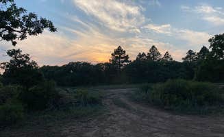
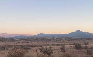
Dispersed camping near Navajo Dam, New Mexico provides access to the high desert landscapes of northwestern New Mexico. Elevations range from 5,500 to 7,000 feet, with summer daytime temperatures often exceeding 90°F while dropping to the 40s at night. Cell service varies significantly between camping areas, with stronger coverage at elevated sites near Bloomfield and spotty reception in lower canyons.
What to do
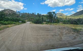
Mountain biking at Alien Run Trailhead: The trailhead basecamp serves as an excellent staging area for mountain biking adventures. "Awesome spot and perfect for MTBing," notes Michael S., while another visitor mentions "it's a gravel parking lot at a mountain biking trailhead. Pit toilet and single covered picnic table. On a Mesa so decent views and full bars of fast cell signal."
Hike the Simon Canyon area: Simon Canyon Trailhead Basecamp offers walk-in tent camping with trail access to unique geological features and the San Juan River. Located in a secluded area, the site includes basic toilet facilities and picnic tables for day use or overnight stays.
Night sky photography: The dark skies at Madden Peak Road dispersed camping areas provide excellent stargazing conditions. "We decided to drive further up the mountain, gaining some elevation but it was much more secluded," writes one camper who explored the walking paths behind their campsite to "get to know the vegetation and animals in the area."
OHV trail exploration: The dispersed camping near Brown Springs features extensive off-highway vehicle trails. "OHV trails are all over. I am not a OHV guy, but looks to be OHV haven. Flat and hilly areas for lots of fun," reports Roger W., who recommends avoiding the area during heavy rain.
What campers like
Reliable connectivity: Durfield Dispersed Camping receives praise for exceptional cell service. "Roads are gravel but super easy. 2wd car no problem. Full verizon 5g uw, in many spots, the tower is a few 100 yards away," notes a camper who appreciated staying connected while camping.
Accessible pit toilets: Several primitive camping areas maintain clean toilet facilities despite their remote locations. At Alien Run Trailhead, a camper describes "flat, very clean pit toilets, picnic tables with shade and a great trail. 100%!"
Privacy between sites: The Fossett Gulch Road dispersed camping area provides secluded sites. "We followed the USFS road for about 1/2 mile up the hill. Found a nice spot and backed in for the night. No AT&T coverage so we had no distractions," reports one camper who enjoyed the isolation.
Proximity to local attractions: Bisti / De-Na-Zin Wilderness Area serves as a convenient base for exploring unique geological formations. "This free campground positioned us well to beat the heat and hike through the badlands first thing in the morning! Pit toilets available next to the parking lot as well as a pavilion area with tables," reports Jordyn M.
What you should know
Seasonal closures affect access: Several dispersed camping areas close during winter months. For Madden Peak Road, one camper notes it was "closed from November to May 31st," while another visitor to Durfield Dispersed Camping simply reported "Closed Dec - April."
Weather conditions change rapidly: Flash flooding and high winds can occur with little warning. At Bayfield/Durango Dispersed Camping, visitors recommend using the exact coordinates to find the entrance: "The gate was closed from Dec 1- April 30. Looked like it would have been a nice spot."
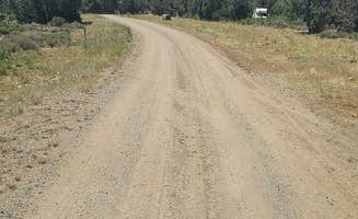
Road conditions vary significantly: Many access roads require careful navigation. For Fossett Gulch Road, a camper notes "Dirt road is in very good shape. No cell signal. A couple quick pull off sites right inside the gate would be good for a quick sleep. The other sites are 10-15 minutes drive down the dirt road."
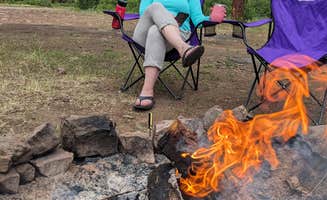
Fire restrictions change seasonally: Always check current restrictions before planning your stay. At Bayfield/Durango Dispersed Camping, a visitor commented that "Some areas are rough yet our Bronco and Bushwhacker conquered it. Keep driving until you find a spot. Private and secluded. Fire pits at most spots."
Tips for camping with families
Protected picnic areas: Look for sites with covered structures for shade and wind protection. At Bisti / De-Na-Zin Wilderness Area, one camper noted "The covered picnic area has three tables and a grill" with "a tiny stream of clear water that meanders around the picnic area."
Select sites away from natural hazards: The terrain around Navajo Dam includes steep drop-offs and unstable soil. At Bayfield/Durango Dispersed Camping, a camper advised "Was great for an overall site - plenty of space for the kids to explore and find rocks and sticks."
Consider drive times to facilities: Most dispersed sites lack basic amenities. As one camper at Durfield BLM Boondocking noted, "Good Verizon coverage, plenty of camp spots, was a bit surprised to see how busy it was" — making communication possible in emergencies.
Wildlife awareness: Cattle and native wildlife frequently move through camping areas. At Durfield Dispersed Camping, a reviewer mentioned "there is also a heard of cows that wonder around freely and poop. But overall a good easy spot to camp and be connected."
Tips from RVers
Site selection for larger rigs: Angel Peak NM Badlands has limited space for larger vehicles. "We are full-timers in a 36 ft Class A with a Cherokee Trailhawk tow. We were here for a few days in mid April. The road in is rough to start and is a little washboardy in places, but not too bad most of the way for dirt and gravel road anyway."
Arrival timing matters: Most dispersed areas fill quickly on weekends. At Angel Peak, a visitor observed "If you get there later in the afternoon on a weekend you will have a hard time finding a place in the official camping spots but you can disperse camp if the camp ground area is full."
Leveling challenges: Many sites require significant leveling. One RVer at Angel Peak noted, "After dropping our tow, we managed to get our 36' MH up and into it on the second attempt and then did a bit of jockeying around to find a spot reasonable level. The ground is rather soft in some places."
Communication options: Cell coverage varies by provider. An RVer at Angel Peak reported "AT&T coverage was just ok, with 1-2 Bars of 5G service and speeds of up to 2 MB/s without a booster. We had an unobstructed view of the sky and so we were able to receive all 3 SW Dish satellites and Starlink had up to 9 MB/s."


