Camper submitted image from Huntersville Forest Landing - 1

View Photos

Camper submitted image from Huntersville Forest Landing - 2
Nature
Camper submitted image from Huntersville Forest Landing - 3
Signs & Maps
Unlock Planning Tools in App

Established Camping

Huntersville Forest Landing

CAMPER SUMMARY PRESENTED BYFord

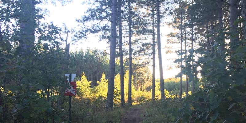
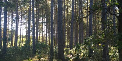
Huntersville Forest Landing is located near Menahga, MN, surrounded by forested terrain. Temperatures range from lows in the 50s Fahrenheit during summer nights to highs in the 70s, while winter can see temperatures drop below freezing. Campers can explore the nearby Huntersville State Forest and the Crow Wing River for outdoor activities.

Suggest an Edit

Location

Huntersville Forest Landing is located in Minnesota

Detail location of campground

Directions

From Menahga take Stocking Lake Rd. (E) 4 mi. to Co. Rd. 23; turn left (N) 1 mi. to 380th St.; turn right (E) 3 mi. to 199th Ave.; turn right (S) 1 mi. to sign; turn left approx. 2 mi.

Coordinates

46.73900065 N
94.92800028 W

Open in Google Maps

Connectivity

Presented byT-Mobile SatelliteT-Mobile is introducing T-Satellite to extend coverage in the outdoorsLearn More
  • signal strength bars
    T-Mobile
    No Coverage
  • signal strength bars
    VerizonLTE
    Some Coverage
  • signal strength bars
    AT&TLTE
    Some Coverage

Detours Nearby

LOCAL FAVORITES PRESENTED BYToyota Trucks
Sunnybrook Park

Sunnybrook Park

40 min away

Sunset Pines Campground

Sunset Pines Campground

44 min away

Drive Time

Presented byToyota Trucks

Connectivity

Presented byT-Mobile SatelliteT-Mobile is introducing T-Satellite to extend coverage in the outdoorsLearn More
  • signal strength bars
    T-Mobile
    No Coverage
  • signal strength bars
    VerizonLTE
    Some Coverage
  • signal strength bars
    AT&TLTE
    Some Coverage

Access

  • Drive-In
    Park next to your site

Site Types

  • Tent Sites
  • RV Sites

Features

For Campers

  • Drinking Water
  • Toilets
  • Pets
  • Fires

2025 Detourist Giveaway

Presented byToyota Trucks

Review Campgrounds. Win Prizes.

Enter to Win

Reviews

Add Review

5 Stars

4 Stars

3 Stars

2 Stars

1 Star

0%
50%
50%
0%
0%

3.5

out of 5

2 Reviews

Reviewed May. 12, 2017

A stop on our canoe trip

We were headed down the Crowe Wing River and stopped here to grab a snack. A few tent pads, a few fire rings. Was fine while we were stopped, but I heard from a friend that later in the day, it got really busy here. Not sure if that's typical because of location, but I think there might be better, quieter places to camp.

Reviewed Sep. 27, 2016

Awesome single track dirt bike trails!

The trails here are amazing! Very well kept by the Twin Cities Trail Riders. Even a newer rider could handle the single track at a slow pace. There are also state forest roads and ATV trails for a different experience. Not a huge fan of the campground - bunch of sites out in the open by the road in what looks like an old baseball diamond - but you could probably ride in a little further and find a fun spot to camp.

  • Review photo of Huntersville Forest Landing by Casie S., September 27, 2016
  • Review photo of Huntersville Forest Landing by Casie S., September 27, 2016
  • Review photo of Huntersville Forest Landing by Casie S., September 27, 2016

Frequently Asked Questions

What amenities are available at Huntersville Forest Campground?

Huntersville Forest Campground offers basic amenities including tent pads and fire rings. The campground has a simple setup with sites positioned near the road. While the amenities are minimal, the location provides excellent access to the extensive trail system in the surrounding forest, which is well-maintained by the Twin Cities Trail Riders. The campground is suitable for those seeking a no-frills camping experience with a focus on outdoor recreation rather than facilities.

Are there any photos of Huntersville Forest Campground to view before visiting?

Photos of Huntersville Forest Campground can be found on the official Minnesota DNR website and various camping platforms including The Dyrt. These images typically show the open camping area, tent pads, and surrounding forest environment. For the most up-to-date visual information, contact the Minnesota DNR directly or check their official website where they maintain a gallery of their managed campgrounds and recreation areas.

Is there a map available of Huntersville State Forest and its campground?

Yes, maps of Huntersville State Forest and its campground are available through the Minnesota Department of Natural Resources (DNR). These maps detail the forest roads, ATV trails, single-track trails, and camping areas. The Minnesota DNR website offers downloadable maps, and printed versions may be available at local DNR offices or visitor centers. Maps are especially helpful for navigating the extensive trail system maintained within the forest, including the popular trails maintained by the Twin Cities Trail Riders.

Where is Huntersville State Forest Campground located and how do I get there?

Huntersville State Forest Campground is located in north-central Minnesota within Huntersville State Forest. The campground sits alongside the Crow Wing River, making it a convenient stop for paddlers. To reach the campground, follow state highways to the forest area, then look for signs directing to the forest landing and campground. The site is accessible via forest roads, which may vary in condition depending on the season. Consider checking with the Minnesota DNR for specific directions based on your starting point.