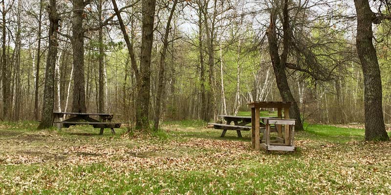
County-managed Huntersville Township provides drive-in and boat-in access along the Crow Wing River near Menahga. The site includes drinking water, restrooms, picnic tables, and allows campfires, with reservations available for planning ahead.
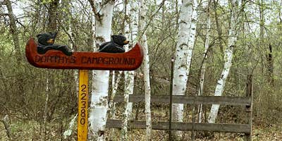
Recent changes have created access confusion for paddlers. One reviewer notes the campground was purchased by private outfitters and now operates as their basecamp, restricting use to guided trip participants only despite retaining the original township signage. Independent canoeists can no longer camp here as they could when it served as a public water trail site. For broader options in the region, campers can explore campgrounds near Horton or check nearby Huntersville Forest Landing Campground.
RV Road Trip Guides


Map & DirectionsHuntersville Township is located in Minnesota near Horton
Coordinates
46.76800062 N
94.9050004 W
Connectivity
 T-MobileNo Coverage
 VerizonLTESome Coverage
- AT&TLTESome Coverage
Connectivity
- T-MobileNo Coverage
- VerizonLTESome Coverage
- AT&TLTESome Coverage
Access
- Drive-InPark next to your site
- Boat-InSites accessible by watercraft.
Site Types
- Tent Sites
- Group
Features
For Campers
- Trash
- Picnic Table
- Reservable
- Drinking Water
- Toilets
- Fires
Drive Time
- 1 hr 41 min from Fargo, ND
- 1 hr 51 min from St. Cloud, MN
- 2 hrs 44 min from Grand Forks, ND
- 2 hrs 59 min from Duluth, MN


