
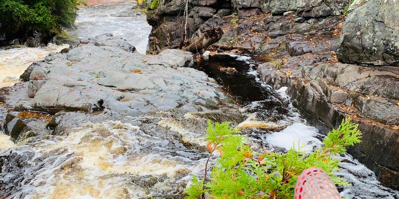
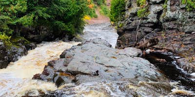
Ottawa National Forest's Sturgeon River Gorge Wilderness sits within a hike-in or walk-in only area, meaning no drive-up access. The entrance is unmarked, and the approach involves switchback terrain descending into the gorge, with views of waterfalls along the river at the bottom. Cell service is listed as available. Reviewers note the area feels remote and sees relatively little foot traffic. Nearby Silver Mountain is worth factoring into trip planning. Campers interested in tent campgrounds near Ottawa National Forest will find this one of the more demanding options in the area, suited to those comfortable with rough, unmarked access and self-sufficient camping.
Description
The Wild and Scenic Sturgeon River rushes out of the northern portion of this wilderness, over the 20 foot volcanic outcroppings of Sturgeon Falls, and through a gorge that reaches 350 feet in depth and a mile in width. Throughout this rugged, steep Wilderness, the Sturgeon and Little Silver Rivers and their tributaries have carved falls, rapids, ponds, oxbows, and terraces. Stunning views are possible from the eastern rim of the gorge. Except for a few naturally bare slopes, most of the land is forested with pine, hemlock, aspen, sugar maple, birch, and basswood. When the leaves of the hardwoods change color in the fall, they form a vivid tapestry. There are few established trails in Sturgeon River Gorge Wilderness, and the few overgrown logging roads are hard to find and follow. The North Country National Scenic Trail parallels the northern and eastern boundaries for about eight miles. Sturgeon River Campground offers seven sites on the southeastern boundary. In spring and during peak runoff, kayaking and white water canoeing are challenging, and only recommended for advanced paddlers. Sturgeon River Gorge Wilderness Map
RV Road Trip Guides

Map & DirectionsSturgeon River Gorge Wilderness is located in Michigan near Watton
 Public Campground
Directions
From Sidnaw, Mi., travel east on M 28 approximately ¼ mile to FR 2200, turn left onto FR 2200. There are several locations you are able to enter into the Wilderness, it is recommended that you use the campground or approved trailhead. To access the campground travel north on FR 2200 approximately 5 miles. To access the southern most trailhead travel north on FR 2200 approximately 3 miles to FR 2224, the trailhead is on the right on FR 2224.
Coordinates
46.61811829 N
88.6986344 W
Connectivity
 T-MobileNo Coverage
- VerizonNo Coverage
- AT&TNo Coverage
Connectivity
- T-MobileNo Coverage
- VerizonNo Coverage
- AT&TNo Coverage
Access
- Walk-InPark in a lot, walk to your site.
- Hike-InBackcountry sites.
Site Types
- Tent Sites
- Standard (Tent/RV)
Features
For Campers
- Phone Service
Drive Time
- 3 hrs 21 min from Wausau, WI
- 3 hrs 35 min from Green Bay, WI
- 3 hrs 54 min from Appleton, WI
- 3 hrs 59 min from Duluth, MN



