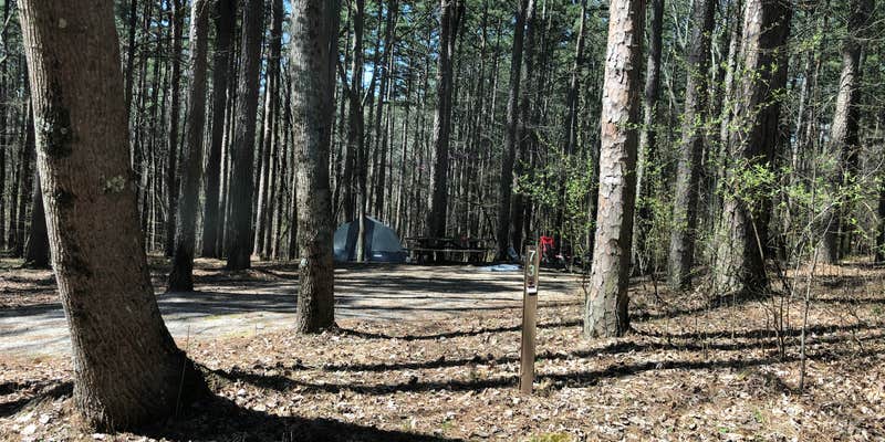
The loop road design at Pine Ridge spreads sites across two distinct areas, with electric hookups concentrated on the left loop and primitive sites scattered throughout the broader campground. Campers find themselves positioned on a ridge above Pounds Hollow Lake, with walking trails connecting the camping area to the water below. The Forest Service maintains this facility from April through mid-December at $10 per night.
Sites offer considerable space between neighbors, though the electric loop places campers closer together than the primitive areas. Art S. notes that "in April the leaves were not on the trees so there was intermittent shade," indicating seasonal variation in canopy cover. Vault toilets receive regular maintenance and cleaning, with reviewers consistently commenting on their condition compared to typical forest service facilities.
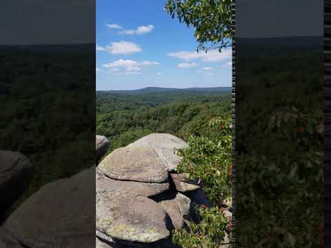
The adjacent lake restricts motorboats to electric-only operation, making it suitable for kayaking, canoeing, and fishing from the pier. A swimming area and CCC-era pavilion occupy the shoreline, while hiking trails connect to the Rim Rock Trail system. Campers report that "you can keep following it and you end up at the Rim Rock Trail," leading to cliff overlooks and cave formations. Garden of the Gods sits approximately 15 minutes away by vehicle.
Cell service proves spotty throughout most camping areas, with reception limited to spots near the water spigot and some roadways. The campground lacks dump stations and hose connections for RV water tanks, though big rigs can navigate most sites. Reviewers mention that rangers can assist with site changes if initial placement doesn't work out. For those wanting more amenities, Double M Campground provides full hookups just over a mile north.
Fee Info
Campsite $10/night - 8 people & 2 vehicle maximun Campground has 13 electric sites and 42 non-electric sites.
Reservation Info
We do not accept reservations; Campsites are first-come, first-serve.
RV Road Trip Guides

Map & DirectionsPine Ridge is located in Illinois near Karbers Ridge
Directions
From Harrisburg: Take Highway 34/145 south 6 miles, then continue on Highway 34 south for 9 miles. Turn east onto Karbers Ridge Road and go 9 miles to the recreation area entrance. From Evansville, Indiana: Take Highway 62 west & continue on IL. State Route 141 to Highway 1. Go south on Highway 1 about 24 miles to Karbers Ridge Road, then west 2 miles to the recreation area entrance.
Coordinates
37.61500058 N
88.26700097 W
Connectivity
 T-MobileNo Coverage
 VerizonLTESome CoverageVerified by 3 usersLast on 3/24/26
- AT&TNo Coverage
Connectivity
- T-MobileNo Coverage
- VerizonLTESome CoverageVerified by 3 usersLast on 3/24/26
- AT&TNo Coverage
Access
- Drive-InPark next to your site
- Walk-InPark in a lot, walk to your site.
- Hike-InBackcountry sites.
Site Types
- Tent Sites
- RV Sites
- Standard (Tent/RV)
- Group
- Tent Cabin
Features
For Campers
- ADA Access
- Trash
- Picnic Table
- Phone Service
- Drinking Water
- Electric Hookups
- Toilets
- Alcohol
- Pets
- Fires
For Vehicles
- Big Rig Friendly
Drive Time
- 1 hr 4 min from Paducah, KY
- 1 hr 13 min from Evansville, IN
- 1 hr 26 min from Owensboro, KY
- 1 hr 50 min from Cape Girardeau, MO