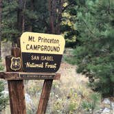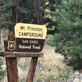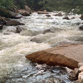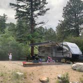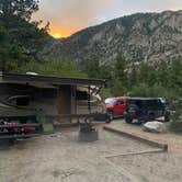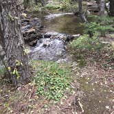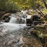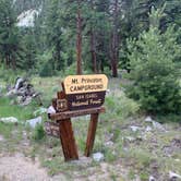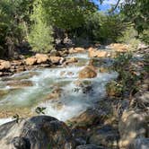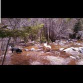
Fishing Chalk Creek, playing in the water, and day-tripping to nearby ghost towns keep campers busy at Mount Princeton, one of three Forest Service campgrounds strung along Highway 162 in Chalk Canyon. The other two, Chalk Lake and Cascade, sit within a mile or so to the west along the same canyon road. Reviewers consistently mention the sound of Chalk Creek, which runs along the south side of the campground and audibly drowns out most road noise from the highway. Mt. Princeton Hot Springs is also a short drive away for campers wanting a warm soak after a day on the trail.
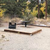
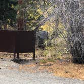
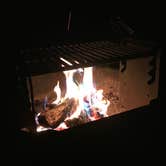
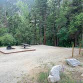
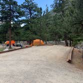
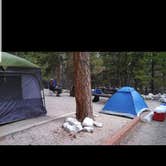
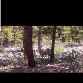
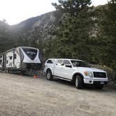
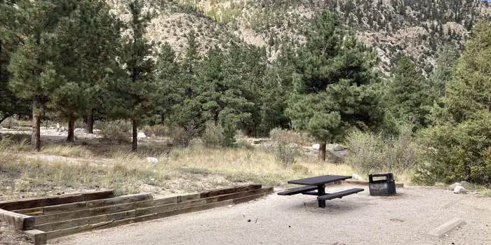
The 17 sites sit in a mixed aspen and pine forest, each with a fire ring, picnic table, and tent pad. Sites vary in privacy depending on location, and several back directly onto the creek. A camp host is on-site during the season, selling firewood by the bundle until supplies run out. Vault toilets are distributed around the campground, and a drinking water faucet is available. No showers, no electric hookups. Cell signal is unreliable here.
The access road can wash out after heavy rain, and reviewers note it has been rough at times. Flooding is also worth keeping in mind: at least one camper reported storm water inundating tent sites during a particularly wet stay. The campground fills during summer peak weekends, and campsites near Nathrop in general see heavy summer use. Book through Recreation.gov well in advance for July and August visits.
Description
Overview
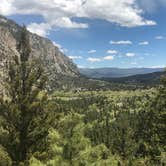
Mount Princeton Campground is located in beautiful Chalk Creek Canyon in central Colorado. This popular facility is within 4 miles of a private hot springs resort, making it an ideal location for rest and relaxation. "First come, first served" does not necessarily mean that the site will be available when you get there. Someone may get there before you. This is a popular campground and is normally full starting on Friday, sometimes as early as Thursday, so plan accordingly.
Recreation
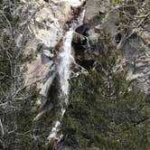
Stream fishing is best above Cascade Falls, about 2 miles west of the campground. Nearby Chalk Lake is heralded as a great family fishing lake with rainbow, brook and brown trout. Nearby ATV/UTV and 4X4 rides include Mount Antero, Baldwin Lake, Tincup Pass, Hancock Pass, Pomeroy Lakes, Hancock Lakes.
Facilities
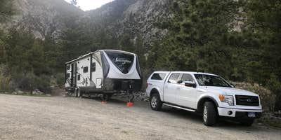
The campground offers single-family sites, a few of which are wheelchair accessible. Each site is equipped with a picnic table and campfire ring with grill. Wheelchair accessible vault toilets are provided. Firewood is sold on-site. Parking spurs are gravel.Sites #1, and 14-17 are "walk-up", first-come, first-served sites. All other sites are reservable.Site #2 is used by the host from mid-May to Labor Day weekend, after that__it is available as a "walk-up", first-come, first-served site.
Natural Features
The campground is situated at an elevation of 8,600 feet in Chalk Creek Canyon, which gets its name from the soft, white, chalk-like kaolinite canyon walls. Kaolinite is a clay mineral that was deposited by percolating hot springs. A stand of ponderosa pine and Douglas fir offers partial shade in the campground. Chalk Creek can be accessed from the campground. It flows 27 miles eastward from the Collegiate Peaks before joining the Arkansas River. Chalk Lake is about a__mile west of the campground.
Contact Info
For facility specific information, please call (661) 702-1420.
Nearby Attractions
Take a day trip to the historic ghost town of St. Elmo, just 15 minutes from the campground. An old saloon, county courthouse and many other historic structures remain from the days of its mining glory. Rock hounds come to the area in search of quartz and aquamarine. The city of Salida and Town of Buena Vista are only a short drive away where visitors can enjoy unique restaurants, shops, and art galleries. The area boasts more than 100 miles of Arkansas River to raft, fish, float or kayak, as well as fifteen 14,000 ft. mountains. Visitors can choose from recreational activities like hiking, biking, ATV/UTV riding, kayaking, rafting, fishing, horseback riding, ziplining and swimming.
Charges & Cancellations
Cancellations Individual Campsites: Cancellations up to 2 days before a reservation start date incur a $10.00 cancellation fee. A visitor who cancels a reservation the day before or on the day of arrival will pay a $10.00 service fee AND forfeit the first night's use fee including tax and applicable add-on for a campsite. Cancellations for a one-night reservation will forfeit the entire amount paid and will not be subject to an additional service fee. No-Shows A no-show visitor is one who does not arrive at a campground and does not cancel the reservation by check-out time on the day after the scheduled arrival date. Staff will hold a campsite until check-out time on the day following the arrival date. No-shows are assessed $20.00 service fee and forfeit the first night's rate, taxes and applicable add-on for a campsite. Refunds Visitors may submit a refund request through their Recreation.gov profile within 7 days of the end date of their reservation. Refunds will not be issued after the 7 days has ended. Refunds for debit or credit card payments will be issued as a credit to the original bank or credit card used to pay. For check or cash purchases, Recreation.gov will mail a Treasury check for refunds of cash, check, or money order payments to the address associated with the reservation. Treasury check refunds may take up to 6-8 weeks to arrive. In the event of an emergency closure, the Recreation.gov team or facility manager will refund all fees and will attempt to notify you using the contact information within the Recreation.gov visitor profile.
Warning 1 Alert is In Effect
There is 1 alert for this campground. Camp safely!
Warning 1 Alert is In Effect
There is 1 alert for this campground. Camp safely!
PIKE-SAN ISABEL NATIONAL FORESTS & CIMARRON AND COMANCHE NATIONAL GRASSLANDS** STAGE 1 FIRE PROHIBITIONS **** PROHIBITIONS**Pursuant to 16 U.S.C. 551 and 36 C.F.R. 261.50(a), the following are prohibited on the National Forest System (NFS) in the Leadville, Salida, San Carlos, Pikes Peak, South Park and South Platte Ranger Districts of the Pike-San Isabel National Forests & Cimarron and Comanche National Grasslands, described below and shown on the attached map incorporated into this Order as Exhibit A, hereinafter referred to as the Described Area:
- Building, maintaining, attending, or using a fire (including fires fueled by charcoal or briquettes), except if it is in
- A permanent metal or concrete fire pit or grate that the U.S. Forest Service has installed and maintained at its developed recreation sites (campgrounds and picnic areas);
- A device solely fueled by liquid or gas that can be turned on and off used in an area barren or cleared of all flammable materials within three feet of the device; or
- A fully enclosed metal stove with a chimney at least five feet in length and a mesh screen spark arrestor with a screen opening of a inch or less used in an area that is barren or cleared of all flammable materials within 10 feet of the device.36 CFR 261.52(a).
- Using an explosive. 36 C.F.R. 261.52(b)
- Smoking is prohibited, except in an enclosed vehicle or building, a developed recreation site, or while stopped in an area at least three feet in diameter that is barren or cleared of all flammable materials. 36 CFR 261.52(d)
- Welding, or operating acetylene or other torch with open flame, except if in a cleared area of at least 10 feet in diameter and a chemical pressurized fire extinguisher (with a minimum 8 oz. capacity and rating of Class 2A) is kept with the operator. 36 CFR 261.52(h) EXEMPTIONS Pursuantto36 C.F.R.261.50(e), thefollowingpersons areexemptfrom thisOrder:
- Persons with Forest Service Permit No. FS-7700-48 (Permit for Use of Roads, Trails, or Areas Restricted by Regulation or Order), specifically exempting them from this Order or a written determination by a Forest Service authorized officer that a permit is not required under 36 C.F.R. 251.50(e)(1) or (2).
- Any Federal, State, or Local Officer, or member of an organized rescue or firefighting service in the performance of an official duty. DESCRIBEDAREA All National Forest System lands, roads, and trails within the exterior boundaries of the Pikes Peak, South Platte, South Park, Leadville, Salida and San Carlos Ranger Districts of the Pike-San Isabel National Forests & Cimarron and Comanche National Grasslands, as depicted on the map attached as Exhibit A of this Order. PURPOSE Thepurposeof this Order is to protect natural resources and public health and safety. IMPLEMENTATION
- This Order shall be in effect from August 21, 2026, at 12:01 a.m. through August November 14, 2026, at 11:59 p.m., unless rescinded.
RV Road Trip Guides


Map & DirectionsMount Princeton is located in Colorado near Nathrop
 Public Campground
Directions
From Buena Vista, Colorado, take Highway 285 south to Nathrop. Turn west on County Road 162 and travel 7 miles to the campground.
Coordinates
38.7141667 N
106.2227778 W
Connectivity
 T-MobileNo Coverage
 VerizonPossible CoverageVerified by 22 usersLast on 10/16/26
- AT&TNo CoverageVerified by 7 usersLast on 10/16/26
Connectivity
- T-MobileNo Coverage
- VerizonPossible CoverageVerified by 22 usersLast on 10/16/26
- AT&TNo CoverageVerified by 7 usersLast on 10/16/26
Access
- Drive-InPark next to your site
- Walk-InPark in a lot, walk to your site.
- Hike-InBackcountry sites.
Site Types
- Tent Sites
- RV Sites
- Standard (Tent/RV)
Features
For Campers
- Trash
- Firewood Available
- Reservable
- Drinking Water
- Toilets
- Alcohol
- Pets
- Fires
For Vehicles
- Sanitary Dump
- Sewer Hookups
- Water Hookups
- Big Rig Friendly
Drive Time
- 2 hrs 6 min from Colorado Springs, CO
- 2 hrs 13 min from Pueblo, CO
- 2 hrs 29 min from Denver, CO
- 2 hrs 38 min from Boulder, CO