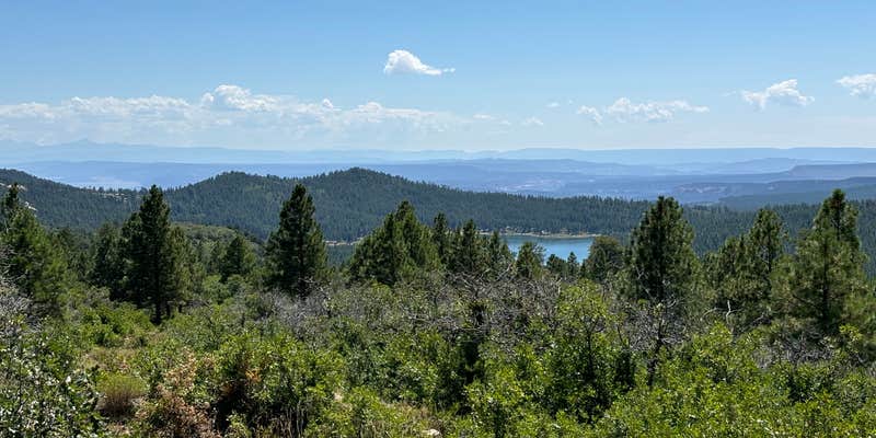
Within the Manti-La Sal National Forest, Buckeye Reservoir provides both individual and group camping options near a mountain lake. The US Forest Service manages this established campground with standard amenities including restrooms, fire pits, and ADA-accessible facilities. Big rigs can access the site via drive-in routes, though boat-in and walk-in access are also available.
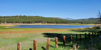
The group site accommodates multiple families with a large common area, built-in picnic tables, and an oversized fire pit for $50 per night. Campers fish for rainbow trout from the shoreline and use the lake for swimming and paddleboarding, though water levels fluctuate seasonally. A mountain bike trail starts from the campground and crosses into Utah before returning along a ridge. Cell service remains unavailable throughout most of the campground, with limited coverage only at higher elevations.
Description
Buckeye Reservoir is a 109 acre reservoir located on the west side of the La Sal Mountains in Colorado and is situated in a valley of mature Ponderosa Pines at 7,600 feet. It is a favorite fishing and camping spot. The Reservoir is planted with Rainbow Trout by the Colorado Division of Wildlife. It's located by Buckeye Campground with the nearest town being Paradox, CO.
RV Road Trip Guides


Map & DirectionsBuckeye Reservoir is located in Colorado near La Sal
Directions
Best Route: Head south from Moab on US 191 for approximately 27 miles and turn left onto Highway 46 at La Sal Junction. Continue on Highway 46 for 32 miles into Paradox, Colorado. Turn left at 5.75 Road at the USFS sign. Continue to the T-intersection and turn left on U5 Road and follow the USFS signs to Buckeye Campground. It is about 13 miles on Forest Service Road 0371 from Paradox to Buckeye Campground and it is a winding gravel road. Please drive with caution Alternative Route—Very muddy or Impassable when wet, please use caution and discretion: Head south from Moab on US 191 for approximately 27 miles and turn left onto Highway 46 at La Sal Junction. Continue about 12 miles and take a slight left at Upper Two Mile Road (Forest Service Road 0208). Continue on Upper Two Mile Road for approximately 18 miles. Follow the signs to Buckeye Campground. Note: This route crosses private property. Please respect their wishes and property and do not trespass on this land.
Coordinates
38.44134905 N
109.04214597 W
Connectivity
 T-MobileNo Coverage
- VerizonNo Coverage
- AT&TNo Coverage
Connectivity
- T-MobileNo Coverage
- VerizonNo Coverage
- AT&TNo Coverage
Access
- Drive-InPark next to your site
- Walk-InPark in a lot, walk to your site.
- Boat-InSites accessible by watercraft.
Site Types
- Tent Sites
- RV Sites
- Standard (Tent/RV)
- Tent Cabin
Features
For Campers
- ADA Access
- Toilets
- Pets
- Fires
For Vehicles
- Pull-Through Sites
- Big Rig Friendly
Drive Time
- 2 hrs 3 min from Grand Junction, CO
- 3 hrs 40 min from Farmington, NM
- 4 hrs 29 min from Provo, UT
- 5 hrs from Salt Lake City, UT


