Tent camping near Frazier Park, California centers around Los Padres National Forest, which spans over 1.75 million acres across central California. Campsites range from 4,500 feet to nearly 9,000 feet in elevation, creating significant temperature variations even during summer months. Sites at higher elevations can see nighttime temperatures drop below 40°F in summer while daytime temperatures in lower elevation sites regularly exceed 90°F.
What to do
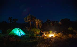
Stargazing opportunities: At Chula Vista Campground at Mt. Pinos, the night sky viewing is exceptional. "Met a guy named Bob and helped set up his telescope in the parking lot, he let anyone who wanted check out the amazing night sky!" reports Jeremiah F. The campground is a recognized dark sky location, attracting amateur astronomers.
Hiking trail access: The best tent camping near Frazier Park includes sites with direct trail connections. "Great hiking nearby thanks to all the cross country skiing trails," notes John B. about Chula Vista. Many trails connect multiple campgrounds, allowing for day hikes between locations or extended backpacking trips.
Wildlife observation: Morning and evening hours offer prime wildlife viewing. The mountains contain deer, coyotes, and occasional bears. "Lots of animals in the night. You will come across some small game animals so be aware of that," warns Jessica P. of Cherry Creek Campground. Bring binoculars for distant wildlife spotting.
What campers like
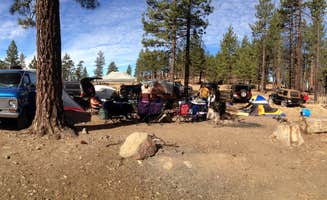
Free camping options: Several tent camping sites near Frazier Park have no fees. "Free camping! Great hiking nearby. Shady, clean sites," explains Jeremiah F. about Chula Vista. However, parking at most free sites requires an Adventure Pass ($5 daily or $30 annual).
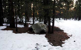
Elevated campsites: Higher elevation campgrounds provide cooler temperatures during summer. "It's a lot cooler up here so it's a nice way to get away from the summer heat," shares Antonio C. about Chula Vista. Temperature differences can exceed 20°F between valley and mountain sites.
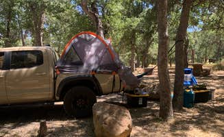
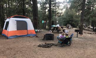
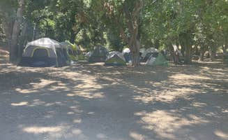
Privacy between sites: San Emigdio Campground offers secluded sites. "Super secluded lots of trails," notes Stephanie L. Many campgrounds feature natural barriers between sites, with trees and boulders creating privacy screens not found at more developed campgrounds.
What you should know
Water availability limitations: Most tent campsites require campers to bring their own water. "No water available though, so pack it in and pack it out," cautions Cierra M. about Oak Flat Campground. Plan for 1 gallon per person per day minimum.
Adventure Pass requirements: Forest Service campgrounds require parking permits. "You do need to purchase a $5 Adventure Pass in order to stay here and someone will come around to check in the morning. The fine if you don't have a pass is over $500," warns Sarah S. about Oak Flat Campground.
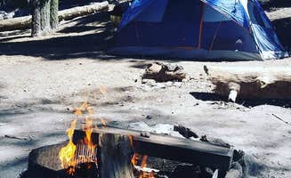
Fire restriction fluctuations: Fire regulations change frequently based on conditions. "Ranger said he has written 100 tickets this summer for people having campfires when it's posted no campfires. I think he visits the site daily," reports John B. Check current fire status before your trip as total bans are common during dry periods.
Tips for camping with families
High-elevation considerations: Higher sites may affect children differently than adults. "Mt. Pinos stands at almost 9,000 feet, one of the highest in the area, so if you are subject to altitude sickness be aware," advises a visitor to Chula Vista. Plan for potential altitude adjustment periods when camping with children.
Bathroom facilities vary: Toilet access differs significantly between sites. At Cottonwood Campground, vault toilets exist but may not have supplies. "The toilets sometimes don't have TP," reports John B. Always pack extra toilet paper and hand sanitizer.
Wildlife safety measures: Take proper food storage precautions. "Bears were active signs are posted," notes John B. about Chula Vista. Use bear-resistant containers or store food in vehicles when available to prevent attracting wildlife to your campsite.
Tips from RVers
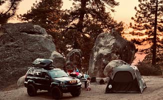
Limited RV accommodations: Most tent camping sites near Frazier Park have restrictions for larger vehicles. "If you have 4WD and a strong stomach, you can squeeze all the way up the mountain to a beautiful campsite at the end of the trail," reports Cas about Cherry Creek, indicating the challenging access for larger vehicles.
Road conditions vary: Access roads to many campgrounds can be problematic. "It can be difficult to get to if the road is rutted but a 2wd vehicle can make it up there without a problem if the road is graded," explains Ryan T. about Dutchman Campground. Check recent road reports before attempting access with larger vehicles.
Temperature preparation: Significant temperature swings affect RV camping comfort. "It is at almost 7,000 feet. It can be difficult to get to if the road is rutted but a 2wd vehicle can make it up there without a problem if the road is graded," notes Ryan T. Pack appropriate clothing for temperatures that can drop below 40°F even in summer months.