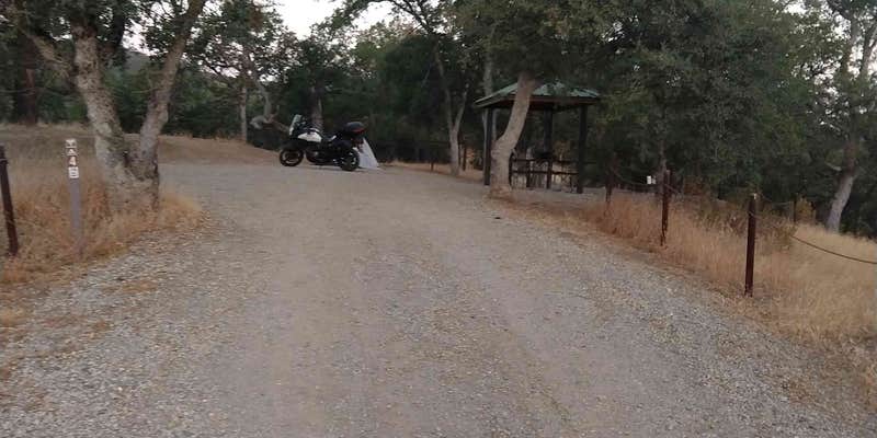
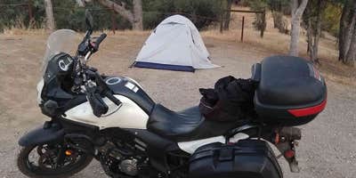
BLM's Central Coast Field Office manages Condon Peak Campground in the California Coast Range east of Coalinga, where a rocky gravel road and a moderately steep grade near the entrance keep the site count low and the crowds sparse. The campground has roughly five or six developed sites, each with a covered picnic shelter, a gravel vehicle pad, and a fire ring. Sites are spaced well apart, giving campers room without placing them on top of each other. No running water is available on-site, and the single vault toilet has received mixed marks for cleanliness, though reviewers have noted adequate toilet paper and no trash accumulation.
Road conditions vary by season and recent maintenance. A Ford Transit van handled the approach without difficulty after a recent grading, but the packed gravel surface and ruts can challenge larger RVs. Tent campers should note that the vehicle pads are hard-packed and can bend tent stakes; softer ground exists toward the site edges. Biting insects have been reported at times, so bug spray is worth packing. Verizon coverage is essentially nonexistent in the area, with some T-Mobile signal available at the campground. Jade Mill Campground sits roughly six miles to the northwest for those comparing nearby options along the same corridor.
"Beautiful views, cooling winds and don't seem to be any biting bugs," notes Helen F. from a late-summer visit, a reminder that conditions shift noticeably across seasons. Off-road vehicle use is common here, and several hiking trails provide alternatives on foot. The campground is open year-round at $6 to $20 per night, and pets are welcome. Campers comfortable with no-water, no-service conditions will find this a workable base for exploring the Coast Range.
Description
$5 vehicle permit required and is valid for one week from date of purchase.
RV Road Trip Guides


Map & DirectionsCondon Peak Campground is located in California near San Lucas
Directions
From Coalinga go west on Gale Avenue from State Highway 198, which turns right into Derrick Avenue heading north. Turn left on Los Gatos Creek Road which will take you to the Condon Peak trailhead on your right located at the San Benito-Fresno County line. From Hollister go south on State Highway 25 and turn left at Coalinga Road heading east. Continue approximately 21 miles to the Access point on your left at the San Benito-Fresno County line.
Coordinates
36.29335663 N
120.68234428 W
Connectivity
 T-Mobile5GGood CoverageVerified by 1 userLast on 7/17/26
 VerizonNo Coverage
- AT&TNo CoverageLast on 7/2/25
Connectivity
- T-Mobile5GGood CoverageVerified by 1 userLast on 7/17/26
- VerizonNo Coverage
- AT&TNo CoverageLast on 7/2/25
Access
- Drive-InPark next to your site
Site Types
- Tent Sites
- RV Sites
- Standard (Tent/RV)
Features
For Campers
- Picnic Table
- Toilets
- Pets
- Fires
Drive Time
- 1 hr 42 min from Hanford, CA
- 2 hrs from Fresno, CA
- 2 hrs 9 min from Salinas, CA
- 2 hrs 32 min from Merced, CA


