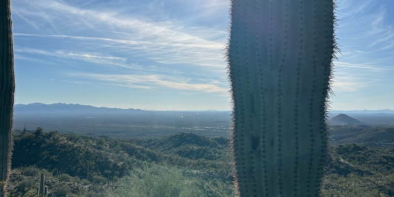
Within BLM Land managed by the Hassayampa Field Office, Boulders OHV Area operates as a dispersed camping destination built around off-highway vehicle recreation. The fenced camping zones sit along dirt roads that accommodate RVs up to 50 feet, with multiple pull-through areas for easy maneuvering. Campers access the area via what one reviewer describes as "the typical rumble strip dirt road" that remains passable for most vehicles.
The constant presence of ATVs and dirt bikes defines the atmosphere here. Weekend activity intensifies with organized events, including horse and motorcycle competitions that draw larger crowds. "Little dusty and noisy but plenty of room to camp and the trails are great," notes Chris J.. The metal fencing clearly marks camping boundaries, while fire pits scattered throughout the area provide gathering spots for evening use.
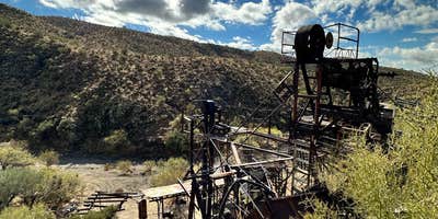
Pit toilets serve the camping areas and receive regular maintenance. Generator use is permitted, addressing the reality that this desert location offers minimal cell coverage—Verizon users report just one bar of service. Miles of washes and trails extend from the camping area toward Castle Hot Springs, leading to abandoned mine sites including Anderson Mill. Summer temperatures make this location impractical for warm-weather camping.
For a quieter alternative without OHV activity, Arizona State Trust Land Dispersed off AZ 74 (Carefree Hwy) provides desert camping without the constant vehicle noise.
Fee Info
Free
RV Road Trip Guides


Map & DirectionsBoulders OHV Area is located in Arizona near Wittmann
Directions
The staging area is located in Maricopa County, 45 miles north of downtown Phoenix, Arizona, approximately 8 miles west of the Lake Pleasant Regional Park on State Route 74 (SR74). To access the staging area from the east on Interstate 17 (Phoenix-Flagstaff), take the Carefree Highway-AZ 74 exit (MP 223) and head west towards Lake Pleasant Regional Park. To access from the west on US 60 (Peoria-Surprise), take the Morristown–AZ 74 exit (MP 120) and head east on SR74. The unmarked turnoff to the staging area is on the north side of the road between mile markers 11 and 12. Slow down when approaching the area as the turnoff can be easily overlooked. The staging area is one mile north of the highway turnoff.
Coordinates
33.8429005 N
112.44154367 W
Connectivity
 T-Mobile5GExcellent CoverageVerified by 32 usersLast on 7/6/26
- Verizon5GExcellent CoverageVerified by 34 usersLast on 7/6/26
- AT&T5GExcellent CoverageVerified by 9 usersLast on 7/6/26
Connectivity
- T-Mobile5GExcellent CoverageVerified by 32 usersLast on 7/6/26
- Verizon5GExcellent CoverageVerified by 34 usersLast on 7/6/26
- AT&T5GExcellent CoverageVerified by 9 usersLast on 7/6/26
Access
- Drive-InPark next to your site
- Walk-InPark in a lot, walk to your site.
- Hike-InBackcountry sites.
- Boat-InSites accessible by watercraft.
Site Types
- Tent Sites
- Standard (Tent/RV)
- Dispersed
- Tent Cabin
- Yurts
Features
For Campers
- ADA Access
- Trash
- Picnic Table
- Firewood Available
- Phone Service
- Reservable
- WiFi
- Showers
- Toilets
- Alcohol
- Fires
For Vehicles
- Sanitary Dump
- Sewer Hookups
- Water Hookups
- Pull-Through Sites
- Big Rig Friendly
DISPERSED CAMPING
Enjoy dispersed camping on government land and leave no trace. Pack in and pack out. No (or limited) services at this camping area. Permit may be required.
Drive Time
- 29 min from Phoenix, AZ
- 1 hr 9 min from Prescott Valley, AZ
- 1 hr 52 min from Flagstaff, AZ
- 2 hrs 49 min from Lake Havasu City, AZ


