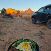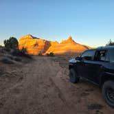
This free dispersed camping area sits on BLM land about half a mile from the Colorado River, accessible via a rough dirt road that challenges some vehicles. Campers with 4WD handle the route more easily, though several reviewers note that taking it slow helps most vehicles make it through. The area lacks formal signage marking designated spots, so visitors choose from several dispersed sites along the access road.
The main camping circle near an information sign offers views of the Colorado River and surrounding landscape. Julie K. notes the area is "quiet, flat and only half mile from the main road and Colorado River." Traffic from ATV riders heading further up the road can create some noise during busy periods, though the sound of the river provides a natural backdrop for most sites.
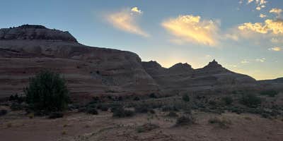
Fire rings mark established camping spots throughout the area. Campers should watch for cattle that sometimes wander onto the road. Cell reception varies by location within the camping area. The terrain offers long-distance views across open country, and the proximity to hiking and biking trails makes this a base for exploring the broader region's recreational opportunities.
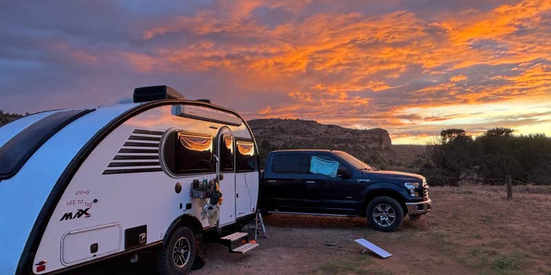
The rough access road and lack of facilities suit campers comfortable with primitive conditions who want free camping near the Colorado River corridor.
Description
The Moab Field Office maintains 38 campgrounds, over 600 campsites, for your enjoyment. These campgrounds offer views of spectacular red rock cliffs amidst a green ribbon of vegetation. Most campsites are first come, first serve, although a few larger group sites may be reserved in advanced through Recreation.gov. The Moab area serves more than 3 million visitors each year, and to protect resources, the BLM has found it necessary to restrict camping to campgrounds or designated sites in popular areas closer to town. For a map and more information about camping, please see our Moab Field Office Visitor Guide. Campgrounds are found along or adjacent to Highways 128, 313 and 279, on the Kane Creek Road, at Ken's Lake, in the Canyon Rims Recreation Area, and in the Sand Flats Recreation Area. Please see our Moab Daily Camping Map for information about camping along the Moab Daily section of the Colorado River.
Most of the field office remains open to primitive camping experiences, however dispersed camping is restricted to designated sites in certain areas, such as along the Dubinky Well Road, Gemini Bridges Road, the Black Ridge Road, and Pack Creek Roads, the area accessed by the Mill Canyon Road and the Blue Hills Road, and south of Moab in the Blue Hill/Picture Frame Arch area. There are a limited number of sites marked with a brown post and tent symbol. When dispersed camping please practice leave no trace principles such as packing out all trash and human waste.
RV Road Trip Guides


Map & DirectionsEntrada Bluffs is located in Utah near Cisco
Coordinates
38.791771184337044 N
109.2720414405168 W
Connectivity
 T-MobileNo Coverage
- VerizonNo CoverageVerified by 3 usersLast on 7/20/26
- AT&TNo Coverage
Connectivity
- T-MobileNo Coverage
- VerizonNo CoverageVerified by 3 usersLast on 7/20/26
- AT&TNo Coverage
Access
- Drive-InPark next to your site
- Walk-InPark in a lot, walk to your site.
Site Types
- Tent Sites
- RV Sites
- Standard (Tent/RV)
- Dispersed
Features
For Campers
- Reservable
- Alcohol
- Pets
- Fires
DISPERSED CAMPING
Enjoy dispersed camping on government land and leave no trace. Pack in and pack out. No (or limited) services at this camping area. Permit may be required.
Drive Time
- 1 hr 19 min from Grand Junction, CO
- 3 hrs 19 min from Provo, UT
- 3 hrs 50 min from Salt Lake City, UT
- 3 hrs 57 min from Farmington, NM