







R
Richard S. Scout
ScoutNF-9730
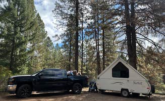
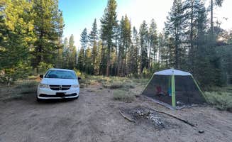
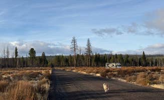
Nice wide open space. Took a nice pullout close to entry. very quiet for the night
Dispersed camping near Trail, Oregon primarily occurs on Bureau of Land Management (BLM) and U.S. Forest Service lands surrounding the Rogue River. Several free primitive sites can be found in the area, including Burma Pond BLM, USFS Rogue River Dispersed, and Elderberry Flats. These locations provide backcountry access for campers seeking minimal amenities and seclusion. The dispersed areas near Prospect OHV, Mount Thielsen Wilderness, and along forest service roads offer multiple pull-off options where camping is permitted without reservation or fee.
Many access roads require cautious navigation due to potholes, steep grades, and seasonal conditions. Burma Pond's approach features a fairly smooth but steep dirt road with occasional deep potholes that "sneak up on you when the road is shadowed," according to one visitor. High-clearance vehicles are recommended for reaching most sites, particularly after rain. Camping is generally permitted for up to 14 days in most areas. Pack-in, pack-out principles apply throughout the region as trash service is virtually non-existent. Most sites lack drinking water, restroom facilities, and cell phone reception, though some areas like Elderberry Flats and Burma Pond include pit toilets.
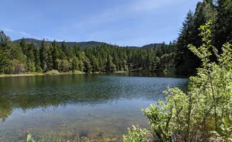
The dispersed sites provide varying experiences depending on location. Areas along the Rogue River offer swimming opportunities and fishing access. One camper described Elderberry Flats as having "11 spaces with five being beside Evans Creek. There are small swimming holes, lots of crayfish and salmon spawning beds." Burma Pond features a peaceful setting around a small body of water where "fish were jumping and the water clear," though campsites are closely spaced. For those seeking proximity to attractions, USFS Rogue River Dispersed camping provides access points within an hour of Crater Lake National Park. Wildlife sightings are common throughout the region, with minimal light pollution creating excellent stargazing conditions in most locations.
"FIRSTLY, do NOT take Sykes Creek Road or May Creek Road to access this campground. Google Maps will try to take you on the shortest (mileage) route."
"Free camping with a pit toilet winner winner chicken dinner! A bit of a drive out but a very nice campsite. The actual campground has 11 sites with picnic tables and fire pits."
"This was quite a way in on a fairly smooth but steep dirt road. Along the road were random deep pot holes so be aware they sneak up on you when the road is shadowed."
"I navigated using Google Maps due to other reviews saying Apple made it confusing. This led us right to the pond/camp sites."
"We camped near the road but nobody came through the whole night we stayed. An owl swooped right through our camp site and scared the crap out of us. Easy route in and out."
"The campsite I chose is on a portion of the road beyond what Google Maps has, so it's really off-grid. 😜You could fit two vehicles."
"During our off season stay it was fun and with all the ATV trails it was our favorite place to camp."
"When we visited Crater Lake in April, we knew we'd have to find alternative camping because the park campgrounds would be covered in several feet of snow."
"We drove to Mazama campground only to be told and they had just filled their last spot but that there was free overnight parking 18 minutes in each direction either by thousand springs snopark or Annie"
"There are bathrooms and a warming shelter that has a wood stove. The park is close to Crater Lake National Park anout 10ish miles down hwy 62. Nice pretty spot that is easy to get to."
"The spring is stunning and the ground was soft and flat. Plenty of firewood around to start a cooking fire. Bugs were bad around sunset, but bug spray helped."
"The campground is situated right next to a beautifully clear blue river and wooded hillsides—perfect for early morning serenity."
from $11 - $14 / night
"The gravel and dirt road has some ruts and holes. It’s best suited for high-clearance 4x4 vehicles, although I didn’t need to use 4x4 since the road was dry during my stay."
"Road was less treacherous than I expected - dry / October. Easy for 4Runner without 4WD enabled."
"The only issue was being close to the highway was a little annoying at night, hearing the cars drive by."
"The river is right behind you. Youll hear cars and there is no cell signal but its a cool place."
ScoutNice wide open space. Took a nice pullout close to entry. very quiet for the night
 Guide
Pretty. Several spots which are pretty well secluded from other spots by tall grasses. Easy off road. Close to highway. Would stay here again.

 Ranger
We actually loved this little stop. We ended up staying longer than I thought we would because in a heavily forested area, it’s kind of coveted to have clear open skies. Lovely trails and nice bathrooms, bonus is the fire room which we didn’t use but it was a nice amenity that they left open off season.
 Traveler
5G at the top. We did put our f150 into 4-wheel drive for the last bit of climbing, but road is great until there and there are some nice spots as well. High up and you will feel like you are on the pinnacle of a mountain. Bring water and firewood for the many rings.
 Guide
Great location for dispersed camping. The parking lot is large and can accommodate rigs of any size. It's about 30 minutes to the park entrance and there are vault toilets on site. Stay up to 14 days.
TravelerThis is a very unique site. Looks as if mostly used for logging. Long narrow roads, that weave like a maze. Not a lot of spots. As they're no sites. Did find a big clearing at the end of the road to the left when entering. Road to right was blocked by a broken down dump truck. So couldn't tell you about that side. Others have mentioned homeless encampments and not so friendly people. As of Oct 2026 area was very clean and nobody living there. Roads are very narrow and some are a bit rocky. Not a place for a 5th wheel or regular car ( may ground out on high rocks in road) river access is easy. But in October no flow so a big swamp.
GuideThis location has a down USAF plane at the bottom of the ravine..
 Guide
This is close to Crater Lake. It's a paved parking lot. There is some road noise but not bad. The stars were amazing as it is pitch black out. Animals come through the site. There were 5 other RVs when we got there and still more than enough room.
 Guide
The last half mile is the steepest most brutal hill ever. The loop at the top is narrow, sites are small, awkward and uneven. Pond is so so; very low and seemed to have an oily film. We couldn’t fit anywhere so we snagged a random pull off at the start of the loop. The amount and type of garbage I cleaned (including a crack pipe and two used needles) indicated this is popular with local trash. I’m dreading going down this hill with my rig but I’m also very ready to leave.
Dispersed camping areas near Trail, Oregon consist primarily of Forest Service and BLM-managed sites situated at elevations between 1,500-3,000 feet. Winter temperatures regularly drop below freezing at most locations, with summer highs averaging 85-95°F. Access roads typically remain snow-covered from November through April, limiting accessibility for most standard vehicles.
Mountain biking trails: Access from Prospect OHV Dispersed Camping where trails accommodate all skill levels. "If you like riding dirt bikes or quads this is the place that's local and has a nice swimming hole also," notes Robert H., highlighting the dual recreational opportunities.
Fishing at small ponds: Fish for trout at Burma Pond BLM during spring and summer months. "The fish were jumping and the water clear," reports one camper. The pond supports seasonal populations of native fish, though bringing portable fishing gear is necessary as no rental equipment is available.
Winter activities: Snow sports accessibility from November to April. Sno-Parks serve as staging areas for cross-country skiing and snowshoeing. Overnight winter parking requires sno-park permits, as one visitor explains: "Note that free overnight parking without a sno-park parking permit is only permitted between May 1 and November 14."
Privacy at higher elevations: Forest sites offer more seclusion than riverside areas. At Mount Thielsen Wilderness, campers appreciate the isolation: "This spot had the best view and most privacy our whole vacation," says Abby B. Many dispersed sites require high-clearance vehicles but reward visitors with fewer neighbors.
Wildlife viewing opportunities: Dawn and dusk offer prime wildlife spotting times. "By the fourth and fifth days, the wind picked up and the birds and critters showed themselves," notes one camper at Elderberry Flats. Mornings often provide glimpses of deer, various bird species, and occasional river otters.
Stargazing conditions: Limited light pollution creates exceptional night sky viewing. "Quiet spot not far from I5. No noise at all, just the wind in the trees and bullfrogs," notes Clayton P. about Burma Pond BLM. Most sites sit far enough from highways to minimize light interference, with best viewing during new moon phases.
Seasonal access limitations: Many roads become impassable in winter months. Forest Service roads to prime camping spots often close after first snowfall. A visitor to Thousand Springs advises, "I would avoid this spot after heavy rain as some vehicles may sink into the dirt."
Cell service availability: Coverage varies significantly by location. "Starlink mini had decent reception for being hard mounted to my roof. Cell service is basically non-existent, one bar of LTE every now and then," reports Clayton P. about Burma Pond. Most areas have no reliable service, requiring offline maps.
Fire restrictions: Regulations change seasonally based on conditions. During summer months, fire bans often take effect. Before planning for campfires, check current restrictions with Rogue River-Siskiyou National Forest offices.
Insect preparation: Mosquitoes peak during summer months near water sources. One camper at Jackson F. Kimball State Recreation Site warns, "TONS of mosquitoes. Absolutely swarmed. Bring bug spray like crazy." Long sleeves and insect repellent are essential, particularly at sites near rivers or ponds.
Swimming options: Natural water features offer cooling opportunities. "There are small swimming holes, lots of crayfish and salmon spawning beds," mentions Jennifer H. about Elderberry Flats. Water temperatures remain cold year-round, with most swimming areas lacking lifeguards or developed beaches.
Wildlife safety: Bear activity requires proper food storage. A visitor recounts: "We had a toddler and weren't willing to stick around to see how much more friendly he could be." Most dispersed sites lack bear boxes, necessitating proper food storage in vehicles or bear canisters.
Road condition alerts: Forest roads require careful navigation. "The last .3 miles was steep and though we made it in 26ft rig I would not attempt it again. I could see major problem if rain was expected," cautions Laura M. about access to Burma Pond BLM. Most forest roads feature occasional deep potholes that require slow speeds.
Leveling challenges: Few sites offer naturally level parking. At Thousand Springs Sno-Park, one RVer notes, "This is a huge paved parking lot not far from Crater lake. They have bathrooms. Can hold lots of RVs." Most dispersed sites require leveling blocks to compensate for uneven terrain.
Larger rig limitations: Many roads restrict access for vehicles over 25 feet. "Pulled in with a 29' trailer for a couple nights—solid base to explore Crater Lake. Save a satellite screenshot beforehand; cell service is weak and layout's tricky," advises Eric S. Free camping near Trail, Oregon often requires smaller vehicles for access to prime locations.
Frequently Asked Questions
What regions offer the best dispersed camping in Oregon?
Southern Oregon provides excellent dispersed camping opportunities with sites like Elderberry Flats Campground offering secluded spots along Evans Creek Road (though avoid the treacherous Sykes Creek and May Creek access routes). Central Oregon, particularly around the Cascade Mountains, features areas like Lemolo Forebay with fire rings, tables, and vault toilets. Eastern Oregon delivers more remote experiences with less crowded BLM land. The coastal mountains provide forest dispersed camping opportunities with river access. Each region offers distinct landscapes from high desert to alpine forests, with availability typically best from late spring through early fall depending on elevation and snow conditions.
Where can I find dispersed camping areas in Oregon?
Oregon offers numerous dispersed camping opportunities on public lands. Bureau of Land Management (BLM) areas like Burma Pond BLM provide scenic spots accessed via dirt roads with multiple sites available. National Forest lands also offer free camping options, such as Mount Thielsen Wilderness near Crater Lake. Most dispersed sites are primitive with limited or no facilities, though some may have fire rings or picnic tables. Access roads can vary from well-maintained to rough with potholes, so vehicle clearance should be considered. When seeking dispersed sites, look for established pullouts with evidence of previous use. Always practice Leave No Trace principles and check for any seasonal fire restrictions before your trip.
Are there good dispersed camping options near major Oregon cities?
Yes, several dispersed camping options exist near Oregon's major cities. Near Medford and Ashland in southern Oregon, Hyatt Reservoir BLM Dispersed offers free camping not far from town with lake access, though water levels can vary seasonally. For those near Eugene, Rocky Riffle provides a convenient BLM area accessible via a quick turn off the main road with various spots along a loop route. Both areas accommodate different vehicle sizes, though larger RVs may face challenges on some access roads. Portland residents can find dispersed options in Mt. Hood National Forest within 1-2 hours' drive. Most sites near cities fill quickly on summer weekends, so midweek visits or having backup locations is recommended.
Keep Exploring