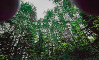
Dispersed camping areas near Roseburg, Oregon range across elevations from 800 to 4,000 feet with mixed coniferous forests dominating the landscape. The region receives moderate rainfall (40-60 inches annually) primarily between October and May, creating variable road conditions on forest service routes. Free camping options typically allow stays up to 14 days within a 30-day period.
What to do
Stargazing opportunities: Doolittle Butte provides exceptional night sky viewing with minimal light pollution. "Beautiful views of stars on a clear night. Very remote. Climb an easy dirt road back a few miles. A few deep potholes but nothing too technical," notes one Doolittle Butte camper. Another mentions "A billion stars on clear nights" with "lot's of space for big group with multiple cars."
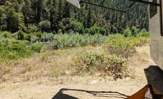
Creek exploration: Multiple creek access points allow for wading and swimming during summer months. At Elderberry Flats Campground, you'll find "small swimming holes, lots of crayfish and salmon spawning beds" according to a reviewer. The campground features "5 sites being beside Evans Creek" with easy water access.
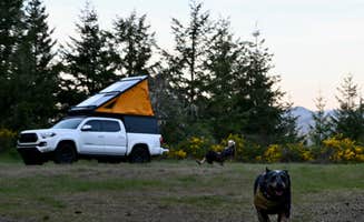
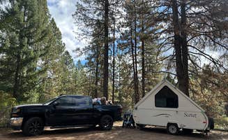
OHV riding: Designated trail systems cater to off-highway vehicles across several areas. "We absolutely loved camping here. During our off season stay it was fun and with all the ATV trails it was our favorite place to camp," writes one visitor about Prospect OHV Dispersed Camping. The area includes "areas provided for unloading bikes and ATV's so folks could safely load and unload their toys."
What campers like
Privacy and seclusion: Many sites offer significant distance between camping spots. "Stayed for over a week and the only thing is it buts up to a quad/dirt bike trail. Other than that quiet and peaceful!" notes a Prospect OHV camper about the boondocking experience. Another camper at Elderberry Flats appreciated that it "felt very safe here" despite being "a bit of a drive out."
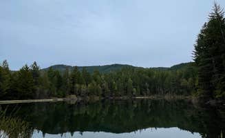
Water proximity: Several free camping areas near Roseburg feature ponds, rivers, or creeks. At Lemolo Forebay, campers enjoy "about 6 little sites here and a boat ramp for the little lake" with easy access to the water. Another notes, "we drove to the other side of the river to lounge in the sun." This location puts you "about 12 minutes from the Umpqua Hot Springs!"
Basic amenities: Some dispersed sites include primitive facilities. At Argo Bar, "There is a pit toilet, and trash and recycling bins" according to campers who enjoyed the "wide open" area "right on the river." Another reviewer noted it's "a recreation site / boat ramp" with camping that extends "past the bathrooms into more camp friendly spots, with some shade and greenery."
What you should know
Road conditions: Access roads vary significantly in quality and may require specific vehicles. At Saddle Camp, "It's best if you have four wheel drive or all wheel drive. Wouldn't recommend going in the winter months or rainy season. It is a very fun drive though taxing and it is slow going."
Fire restrictions: Check current regulations as fire bans are common during summer months. One camper at Argo Bar specifically notes "No fires at this time!" while others mention available fire rings when restrictions aren't in place. At Lemolo Forebay, "Each site has a fire ring and a table."
Limited services: Most free camping near Roseburg lacks amenities like drinking water. A camper at Saddle Camp advises to "make sure you stock up on anything you need cuz there's nothing there" while experiencing "complete quiet and solitude." Lemolo Forebay campers note the "vault toilet has a trash can and was stocked with TP when we were there but we bring our own."
Tips for camping with families
Bug preparation: Certain areas have significant insect activity, particularly near water. A Lemolo Forebay camper warns: "Lots of skeeters! Bring your bug spray." The trails there are described as "loose dirt and steep" which may present challenges for young children.
Safety awareness: Water features require supervision. At Lemolo Forebay, campers warn "There is a dangerous low-head dam at the beginning of the lake near the campground, so please keep track of your kids/pets!" Similarly, at Elderberry Flats, the creek access requires monitoring as children may want to explore the "crayfish and salmon spawning beds."
Site selection timing: Arrive early to secure preferred spots, especially during peak season. One visitor to Lemolo Forebay arrived "at about 3:30pm and unfortunately all sites were occupied by then" despite trying on a Thursday afternoon when they expected lower usage.
Tips from RVers
Access limitations: Some free camping areas have steep access roads unsuitable for larger rigs. One RVer at Elderberry Flats experienced significant difficulties: "Our day stay was due to the road being too steep for my 1993 truck camper. It got too hot and blew the transmission, made a nice long trail in the steep road."
Leveling challenges: Many dispersed sites lack level parking areas. At Argo Bar, a camper noted "We couldn't really find a flat place to park, and so ended up parking just along the bathroom, which was the flattest spot here."
Stay duration: Free camping near Roseburg typically allows 14-day stays. Argo Bar specifically notes a "14 day stay limit" with "Garbage bins and recycling and bathrooms on site."