
Harold Parrish Lower Camp - Backcountry is located in the National Forests in North Carolina. The area features forested terrain with elevations that can influence temperature, typically ranging from 30°F in winter to 85°F in summer. Nearby attractions include the Great Smoky Mountains National Park and Fontana Lake, offering opportunities for hiking and water activities.
Description
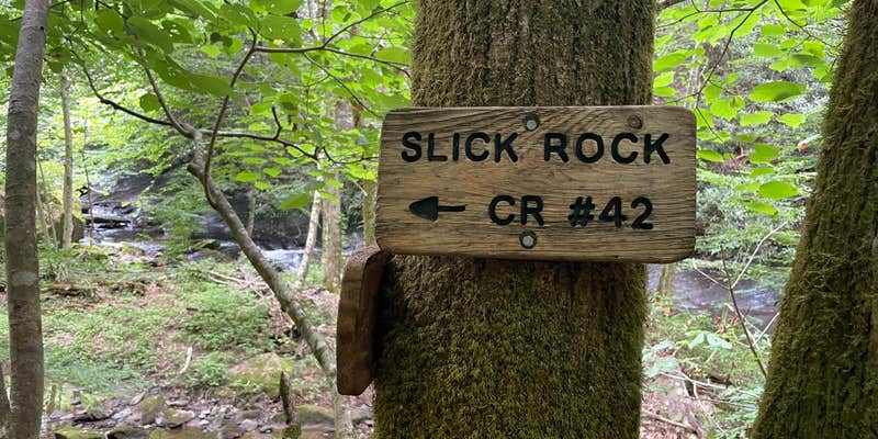
For hikers and backpackers, the Joyce Kilmer Slickrock Wilderness presents a variety of recreational hiking opportunities. There is a relatively easy two-mile long Memorial Loop Trail in the Memorial Forest, which annually greets more than 35,000 visitors, or there is a complex of hiking trails that cater to more experienced hikers, such as the 13.3 mile long Slickrock Creek Trail, considered as one of the ten toughest trails in the United States. With a 3,700 foot climb overall and 13 stream crossings, this trail is seldom completely traversed, but used in conjunction with the other trails in the Wilderness to provide excellent backpacking trips.
Other than at trailheads, camping is allowed anywhere within the Wilderness using Leave No Trace principles, but given the steepness of the topography, there are a few relatively heavily used back country camping areas. Many fishermen enter the Wilderness from the north using the Slickrock Creek Trail, Ike Branch Trail or hike down to the creek from Big Fat Gap, camping along the creek. Backpackers use the area at Naked Ground on the southern ridge, and there is an area near the Hangover that offers excellent views, but an unreliable water source. Nichols Cove area has good camping spots with abundant water, and some hikers camp near Wildcat Falls, but long sections of the various trails lack suitable spots for camping.
As a designated Wilderness, there are no trail blazes, just signs at trail junctions, so it is essential that hikers carry maps and compass, and know how to use them. It is not uncommon for very experienced hikers to get “confused” for a while in the creek area due to the multiplicity of real trails, unofficial trails, old logging trails, etc. Along the ridge, the trails are well-defined, but physically demanding.
RV Road Trip Guides


Map & DirectionsHarold Parrish Lower Camp is located in North Carolina near Croatan National Forest
Coordinates
35.454721972123686 N
83.96650661459556 W
Connectivity
 T-MobileNo Coverage
- VerizonNo Coverage
- AT&TNo Coverage
Connectivity
- T-MobileNo Coverage
- VerizonNo Coverage
- AT&TNo Coverage
Access
- Hike-InBackcountry sites.
Site Types
- Dispersed
Features
For Campers
- Alcohol
- Pets
- Fires
DISPERSED CAMPING
Enjoy dispersed camping on government land and leave no trace. Pack in and pack out. No (or limited) services at this camping area. Permit may be required.
PERMIT might be REQUIRED
We curate permit requirements across the US for our PRO members. Try PRO to see if Harold Parrish Lower Camp - Backcountry needs a permit.
Drive Time
- 1 hr 16 min from Knoxville, TN
- 1 hr 45 min from Cleveland, TN
- 1 hr 57 min from Morristown, TN
- 2 hrs 10 min from Chattanooga, TN


