Big Bend of the Colorado State Recreation Area, near Laughlin, Nevada, is a fantastic spot for those looking to enjoy the beauty of the Colorado River. With a mix of tent, RV, and glamping options, it caters to a variety of camping styles, making it a popular choice for families and friends alike.
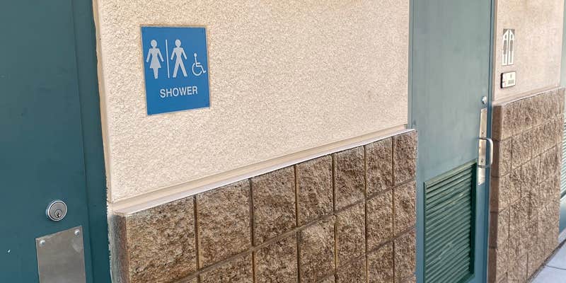
The campground boasts spacious sites with full hookups, which many visitors appreciate, especially during the hot summer months. Clean facilities, including well-maintained bathrooms and coin-operated showers, ensure you can freshen up after a day of fun in the sun. One camper noted, “The restrooms were the cleanest I’ve seen in a state and/or national park.”
The beach area is a highlight, featuring crystal-clear waters and sandy spots perfect for swimming or just lounging around. Reviewers have mentioned that the beach can get crowded, but there’s usually enough space to find a good spot to set up your canopy and relax. As one visitor put it, “The beach area is amazing... the best part of this site for sure!”
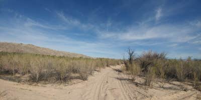
For those who enjoy outdoor activities, there are walking trails nearby, and the river offers opportunities for snorkeling and other water sports. Just keep in mind that it can get pretty hot, especially in the summer, so plan accordingly. Whether you're here for a quick getaway or a longer stay, Big Bend of the Colorado has plenty to offer for a memorable camping experience.
Description
Situated on the shores of the Colorado River at Nevada’s southern tip, Big Bend of the Colorado River includes about two miles of sandy shoreline. Because the park is downstream from Davis Dam, the river is clear and cool year round. Popular activities are camping, picnicking, boating, fishing, swimming, hiking and bird watching. The variety of waterfowl and shore birds that make this park home include mallards, coots, herons and geese. Hawks, roadrunners, quail, hummingbirds, doves and owls are also abundant in the park. The nearby town of Laughlin offers the amenities of a Nevada gaming town. Big Bend boasts a 24-unit campground that is accesible year-round. All sites are on a first come, first served basis, reservations are not available. All sites are designed to accommodate RVs with hook-ups for water, electric and sewer. In addition, most of the sites have pull-through parking pads that can accommodate any size RV. The sites also have a tent pad, a shade ramada, barbecue grill and fire pit. Three of the sites are ADA equipped and available for those visitors with the proper ADA permit. Other amenities include restroom and shower facilities. Camping is limited to 14 days in a 30-day period.
RV Road Trip Guides

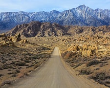
Map & DirectionsBig Bend of the Colorado State Recreation Area is located in Nevada near Needles
Directions
The park is within the Laughlin town limits, one mile south of Casino Drive on South Needles Highway.
Coordinates
34.76605556920265 N
114.77418947339142 W
Connectivity
 T-MobileNo CoverageVerified by 4 users
- VerizonNo CoverageVerified by 8 users
 AT&T5GGood Coverage
Connectivity
- T-MobileNo CoverageVerified by 4 users
- VerizonNo CoverageVerified by 8 users
- AT&T5GGood Coverage
Access
- Drive-InPark next to your site
- Walk-InPark in a lot, walk to your site.
- Boat-InSites accessible by watercraft.
Site Types
- Tent Sites
- RV Sites
- Standard (Tent/RV)
- Group
- Tent Cabin
Features
For Campers
- ADA Access
- Trash
- Picnic Table
- Firewood Available
- Phone Service
- Reservable
- WiFi
- Showers
- Drinking Water
- Electric Hookups
- Toilets
- Alcohol
- Pets
- Fires
For Vehicles
- Sanitary Dump
- Sewer Hookups
- Water Hookups
- Pull-Through Sites
- Big Rig Friendly
Drive Time
- 1 hr 48 min from Lake Havasu City, AZ
- 2 hrs 54 min from Las Vegas, NV
- 4 hrs 10 min from Prescott Valley, AZ
- 4 hrs 18 min from El Centro, CA


