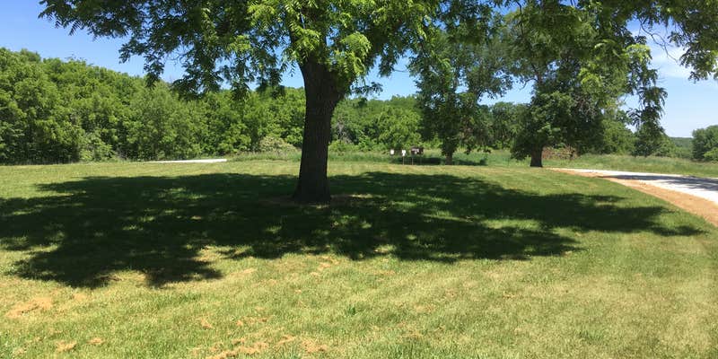
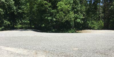
Camper submitted image from Rebel's Cove Conservation Area - 1
View All
Camper submitted image from Rebel's Cove Conservation Area - 2
Nature
Camper submitted image from Rebel's Cove Conservation Area - 3
Roads
Camper submitted image from Rebel's Cove Conservation Area - 4
Facilities
Camper submitted image from Rebel's Cove Conservation Area - 5
Buildings

Verified

Established Camping

Rebel's Cove Conservation Area

General Overview

State Park

Visit the Missouri Department of Conservation's website for more information.

Location

Rebel's Cove Conservation Area is located in Missouri

Detail location of campground

Directions

From Livonia, take Route N north 4.60 miles.

Coordinates

40.5699444406732 N
92.71636227104673 W

Open in Google Maps

The Dyrt Alerts

Get reservations at sold-out campgrounds.

Learn More

Access

  • Drive-In
    Park next to your site
  • Walk-In
    Park in a lot, walk to your site.

Stay Connected

  • WiFi
    Available
  • Verizon
    Available
  • AT&T
    Available
  • T-Mobile
    Available

Features

For Campers

  • Toilets
  • Pets
  • Fires

Reviews

Add Review

5 Stars

4 Stars

3 Stars

2 Stars

1 Star

0%
100%
0%
0%
0%

4.0

out of 5

1 Review

Reviewed Jun. 8, 2017

Rebel's Cove Conservation Area

Conservation Areas in Missouri are enjoyable if you're looking for lovely scenery, and can get by with few or no amenities. Rebel's Cove is no exception: https://nature.mdc.mo.gov/discover-nature/places/rebels-cove-ca. It is located in Putnam/Schuyler Counties in northeast Missouri along the Chariton River and borders southern Iowa. Camping is allowed in the parking area and the grassy areas next to the parking areas. A map of the 4,225 acre conservation area showing the parking/camping sites is found here: https://nature.mdc.mo.gov/sites/default/files/downloads/conservation-areas/7944map.pdf The only amenity, is a unisex toilet at site E. The best camping, in my opinion is at one of 5 sites: At site A, where there is a wonderful overlook for handicap access overlooking the Chariton River swampland, at site E where there is the bathroom, but also quite a bit of mowed grass areas, at site G, where there is an old iron bridge over the Chariton that has a wooden walkway over the river, at site B where there is a neat shelter where the superstructure is constructed out of old barn timbers and where there is a lovely view of the hillside, and at site I, which is right up next to the River. Quite a few people use kayaks on the river. The river is 20 miles or so downriver from Rathbun dam in Iowa, and outflows from the dam vary the amount of water in the Chariton. The Chariton is largely channelized, but not here, so you get a good idea of what the River used to look like.

Month of VisitJuly
  • Review photo of Rebel's Cove Conservation Area by john S., June 8, 2017
  • Review photo of Rebel's Cove Conservation Area by john S., June 8, 2017
  • Review photo of Rebel's Cove Conservation Area by john S., June 8, 2017
  • (13) View All

Frequently Asked Questions

What is the elevation of Rebel's Cove Conservation Area?

Rebel's Cove Conservation Area is located at 963 feet.

Are fires allowed at Rebel's Cove Conservation Area?

Yes, according to campers on TheDyrt.com, fires are allowed at Rebel's Cove Conservation Area, although make sure to check current fire restrictions in the area.