Within Manistee National Forest, Blacksmith Bayou Campground provides both drive-in and boat-in access for campers exploring Michigan's north-central woodlands. The US Forest Service manages this established campground with basic amenities including drinking water from a hand pump well, pit toilets, picnic tables, and designated fire rings.
Sites sit on hilly terrain that creates natural separation between camping spots, with space adequate for RVs. The campground serves as a launch point for paddlers accessing nearby waterways, though campers should note that drainage issues can affect lower-lying tent sites during heavy rain. At $5 per night, the low cost attracts extended-stay visitors. Manistee National Forest Bear Track Campground offers an alternative 2.4 miles north with different site configurations.
Description
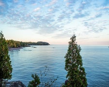
Manistee National Recreation River One of many bayous along the lower portion of the river, Blacksmith is an oxbow lake left from an old river channel. The river channel moves during geologic time, creating new meanders in the mile-wide river valley. The North Country Trail follows the ridge along the bayou and crosses the entrance road. This is a good area for ice fishing. Brochure with map : Manistee River This brochure is set to print on 11 x 17 paper, landscape (wide) orientation. To print on 8 1/2 x 11 paper set the print area to "shrink to printable area", this will make the text on the page smaller. Flickr Photo Albums Manistee River
RV Road Trip Guides

Map & DirectionsBlacksmith Bayou Campground is located in Michigan near Brethren
Directions
_ From Manistee - _ Travel east on M-55 for 15 miles. Turn left and travel north on High Bridge Rd. for 2 miles. Turn left and travel west on Chicago Ave. for 1 mile. Turn right and travel north for .5 miles to the site entrance.
Coordinates
44.25698051 N
86.03899775 W
Connectivity
 T-MobileNo Coverage
- VerizonNo Coverage
 AT&TLTESome Coverage
Connectivity
- T-MobileNo Coverage
- VerizonNo Coverage
- AT&TLTESome Coverage
Access
- Drive-InPark next to your site
- Boat-InSites accessible by watercraft.
Site Types
- Tent Sites
- RV Sites
Features
For Campers
- Picnic Table
- Drinking Water
- Pets
- Fires
Drive Time
- 1 hr 1 min from Traverse City, MI
- 1 hr 30 min from Muskegon, MI
- 1 hr 42 min from Grand Rapids, MI
- 3 hrs 45 min from Sheboygan, WI
