Tent camping near Colrain, Massachusetts provides opportunities for recreation in the northwestern part of the state where elevations range from 400-1,300 feet. The area sits at the foothills of the Berkshires with forests dominated by oak, maple and pine trees. Summer temperatures typically reach highs in the 70s-80s°F with cooler nights in the 50s-60s°F, while spring and fall camping requires preparation for wider temperature swings.
What to do
Paddling exploration: At Tully Lake Recreation Area, visitors can rent canoes and kayaks to explore numerous islands. "We take our canoe and spend the whole day at the lake. You can find lots of private areas to swim, pick blueberries and relax," notes camper Ben P.
Hiking opportunities: Trails around local campgrounds range from easy to moderate difficulty. "If you'd like to hike with children, there is an easy hike close to the entrance, along Doane's Falls, a series of 5 waterfalls along an ascending path through a wooded area," explains Nancy R. about trails near Tully Lake.
Whitewater activities: Zoar Outdoor campground connects to water recreation options. "The campground is connected to an adventure/outing company that provides white water rafting, tubing and other water activities on a nearby river. It's close to where locals jump off outcrops into the lazy river and hang out on the river side," reports Seth K.
What campers like
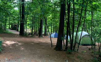
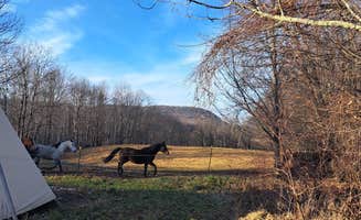
Privacy between sites: Many campgrounds in the region offer well-spaced sites. "Very lush campground, plenty of space and privacy between sites. They'll drive you in an ATV up to some of the sites that are further away from the parking lot," writes Les R. about Maple Ridge Farm.
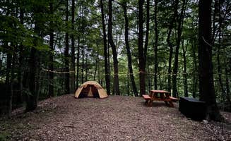
Car-free camping experience: The walk-in setup at some campgrounds creates a quieter atmosphere. "You park at the entrance, register with Ranger. Large wooden wheelbarrows are provided to bring your gear to your camp site. This means no noise or disturbances from cars entering your camp sites," explains a camper about Tully Lake Recreation Area.
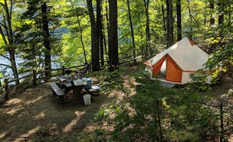
Waterfront access: Several tent sites offer lake or river proximity. "We stayed at site 1, which was HUGE and extremely private. Sites closer to the water that we saw were less private, but still very peaceful and spread out. No cars at all at the campsites, which was great for peace of mind as our toddler roamed around," reports Megan G.
What you should know
Reservation timing: Popular campgrounds fill quickly during peak season. "The sites fill up weeks out (and can completely fill the day registration opens, which is date-dependent each year...Booking for Memorial Day meant I booked in April), so you have to be on your game," advises Kris M. about Tully Lake.
Campsite logistics: Most tent sites require some planning for setup. At Barton Cove Campground, "Only real annoyance was dealing with set up and take down of the campsite- you check in at the office, grab a key to unlock the gate, drive to the campground, unlock gate, drive through gate, lock gate, unload your stuff, drive to gate, unlock gate, drive through gate, lock gate, return key, drive back to campground, walk to your site," explains Brie B.
Limited cell coverage: Expect minimal connectivity throughout the region. "Cell coverage is pretty close to absent or poor in most of the area, so download any maps you might want (driving, trail, geocaching) before you arrive," advises Jean C.
Tips for camping with families
Pack light for walk-in sites: For tent camping in Colrain area campgrounds with walk-in access, streamline gear. "Keeping gear to a minimum is a good idea," advises Miguel B., adding "From some of the sites, this will be a long walk during the night."
Consider site location carefully: When booking, think about proximity to facilities with kids. "Our site was fairly far from services, long run with small kids in the middle of the night. Not our favorite place, but to be fair mostly based on our site and neighboring campers," shares Lauren A. about her experience at Tully Lake.
Unique accommodations: For families seeking unusual options, Chester Railway Station offers a distinctive experience. "The caboose is stationed on a big grassy field, near a real railroad. It sleeps 4 and you can set up tents outside too. You hear the trains running at night. Very clean and comfortable," notes Esther L.
Tips from RVers
Limited RV options: Most campgrounds in the immediate Colrain area primarily accommodate tents rather than RVs. Seth Warner Shelter and similar backcountry options require "While hiking the Long trail I stopped at the seth warner shelter for one night. Its .2 miles off the Lt/At and sleeps 6-7 people," notes Daniel S.
Check seasonal closures: Some campgrounds have limited operating seasons or may close unexpectedly. "Closed," reports Bryce B. about Red Mill Brook, highlighting the importance of confirming current operating status before planning a trip.
Rustic facilities: Most campgrounds offer basic amenities with limited hookups. "Rustic camping only- sites have tent platforms, grill, fire pit and picnic tables. Porta potties and latrines were very clean. There is 1 or 2 places to grab water so make sure to bring refillable containers," advises a camper about Barton Cove.


 Scout
Scout