Lily Bay State Park encompasses 925 acres along Moosehead Lake's eastern shore, with Dunn Point Campground serving as one of two camping areas within this Maine Bureau of Parks and Lands property. The campground sits on a wooded peninsula where sites range from elevated positions overlooking the water to direct lakefront access points.
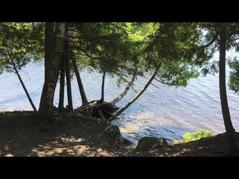
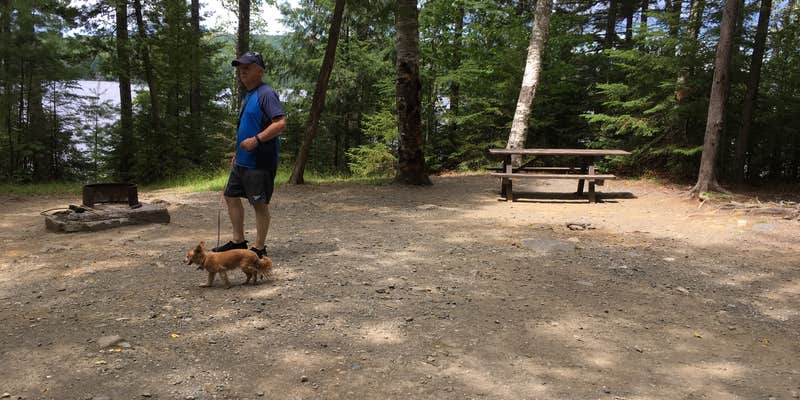
Campers describe sites as "large and heavily wooded" with enough spacing between neighbors to maintain privacy. LoneCamper C. notes that "tent campers want to avoid being next to an RV they should select sites that are classified as walk-in tent sites." Walk-in tent sites include 200T through 224T and 231T, with sites 221T, 222T, and 223T offering direct beach access rather than the elevated water views found at most lakefront positions. Vault toilets appear throughout the campground, while a central comfort station provides hot showers, flush toilets, and dishwashing sinks.
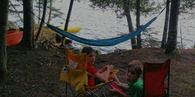
Moosehead Lake stretches over 35 miles, supporting active fishing and paddling opportunities. Several reviews mention launching kayaks directly from waterfront sites to explore Sugar Island and smaller islands in Lily Bay. The campground includes a swimming beach, playground, and boat launch, though the beach requires a walk from most campsites. Michelle R. recommends bringing "your kayaks and fishing poles" for exploring the lake system.
The park operates year-round with sites accommodating RVs up to 40 feet, though no hookups are available. Water spigots appear every few sites, and a dump station operates near the entrance. Generators run between 8 AM and 8 PM. Ice and firewood are sold on-site, while full services are available seven miles south in places to camp around Greenville. Camp hosts maintain sites between stays and provide assistance throughout the season.
For campers preferring a different layout, Rowell Cove Campground — Lily Bay State Park offers an alternative setting less than a mile northeast.
RV Road Trip Guides

Map & DirectionsDunn Point Campground is located in Maine near Greenville
Directions
Nine miles north of Greenville on the east shore of Moosehead Lake. From Routes 15/6 in the center of Greenville, head north 9 miles on the Lily Bay Road that follows Moosehead Lake's east shore to North State Park Road (on left).
Address
13 Myrle's Way
Greenville, ME 04441
Coordinates
45.572509356491224 N
69.565124048777 W
Connectivity
 T-MobileNo CoverageVerified by 7 usersLast on 6/18/26
- VerizonNo CoverageVerified by 2 usersLast on 6/18/26
- AT&TNo Coverage
Connectivity
- T-MobileNo CoverageVerified by 7 usersLast on 6/18/26
- VerizonNo CoverageVerified by 2 usersLast on 6/18/26
- AT&TNo Coverage
Access
- Drive-InPark next to your site
- Walk-InPark in a lot, walk to your site.
- Hike-InBackcountry sites.
- Boat-InSites accessible by watercraft.
Site Types
- Tent Sites
- RV Sites
- Standard (Tent/RV)
- Group
Features
For Campers
- ADA Access
- Trash
- Picnic Table
- Firewood Available
- Phone Service
- Reservable
- Showers
- Drinking Water
- Toilets
- Alcohol
- Pets
- Fires
For Vehicles
- Sanitary Dump
- Pull-Through Sites
Drive Time
- 1 hr 34 min from Bangor, ME
- 2 hrs 18 min from Lewiston, ME
- 2 hrs 55 min from Portland, ME
- 5 hrs 46 min from Burlington, VT