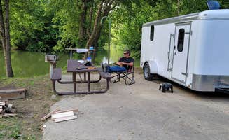
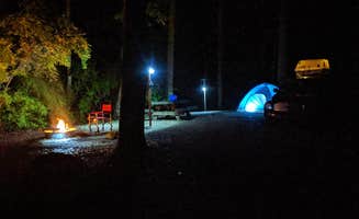
Camping sites near Manchester, Kentucky range from secluded forest locations to waterfront settings, with elevations between 800-1,200 feet throughout the region. Weather in this Cumberland Plateau area fluctuates seasonally, with summer temperatures averaging 75-85°F and winter lows often dropping below freezing. Most primitive campgrounds in the area close during winter, though some developed sites maintain year-round operations.
What to do
Hiking trail access: S-Tree Campground offers direct connections to multiple forest trails. "Would definitely reccomened this place for great hiking. And the natural beauty makes the walking absolutely awesome," notes camper Dorothy T. The campground serves as a gateway to numerous Daniel Boone National Forest trails.
Waterfall viewing: Exploring waterfalls makes for excellent day trips from area campgrounds. "There are a few different options of sites to choose from, from the basic to ones with gravel living space to ones with sewer hookups," shares Alison C. about a nearby campground, adding that multiple hiking trails lead to scenic waterways.
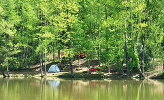
Fishing opportunities: Many campsites provide river or lake access for anglers. "We got to fish right beside our camper," reports Martha from Buckhorn Dam Campground. Fishing licenses are required and can be purchased in Manchester or at nearby towns.
What campers like
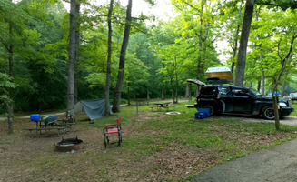
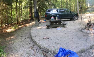
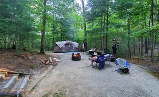
Privacy and space: Campers appreciate sites that offer seclusion. "This campground is pretty new and not too large, making it a nice quiet getaway. All the sites are concrete with nice gravel between, along with picnic tables and firepits," explains Will and Lucinda B. about Cross Mountain Campground. Good drainage during rainy periods is another valued feature at many area campgrounds.
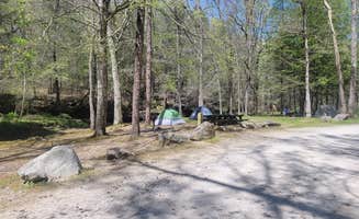
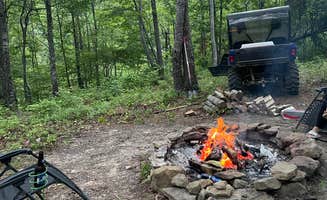
Free camping options: Budget-conscious travelers can find free camping in the region. "For a free campsite this was very well maintained. There's a privy near the campsites and a creek the runs nearby. All sites have fire rings and lamp post along with picnic tables," David M. writes about Turkey Foot Campground. Many free sites operate on a first-come, first-served basis.
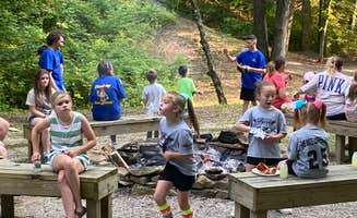
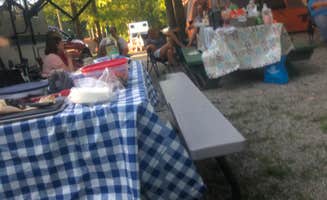
Organized activities: Some campgrounds coordinate special events. "The campground organizes fun activities for the summer holidays like tie dying, camper's only pool party, bingo, best decorated campsite, etc," shares Joanna H. about a local state park. Seasonal programming typically runs from Memorial Day through Labor Day.
What you should know
Road conditions: Access roads to remote camping areas can be challenging. "The northern road in isn't all that bad, but the south road is what I NEEDED to use to get to my various destinations, and it was a rough one," Andrew G. reports about traveling to S-Tree Campground. Some roads become impassable after heavy rain.
Low water crossings: Flash flooding can affect campground access. "The only word of caution I would give is the low water crossing. If a big storm came through you could be stuck in or out," warns Matt S. about Turkey Foot Campground. Monitor weather forecasts during rainy periods.
Site limitations: Many campgrounds have restrictions on RV size. "This small campground is good only for small campers(20ft or smaller). The spots are uneven and many backup to a large hill," Amy J. notes about a state park campground. Always check length limitations when reserving.
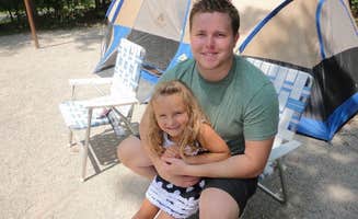
Tips for camping with families
Playground access: Levi Jackson Wilderness State Park Campground offers numerous child-friendly amenities. "Great option for young families. Many activities at the park and it is also close to the birth place of Kentucky Fried Chicken. They have nice sites for larger campers and some for small units that are more shaded," explains Keith M.
Swimming options: Several campgrounds provide water recreation for children. "In the summer season you can take a trail off of loop I that leads to the community pool to cool off," mentions one camper about Levi Jackson. Some sites also offer lake swimming during summer months.
Seasonal programming: Family-oriented activities vary throughout the year. "Staff was great - lots of activities for the kids to do through the State Park - Archery (free), Swimming Pool (free), and more free activities, horseback riding ($20pp)," reports Michael R. about a state resort park. Many programs run weekends only during spring and fall.
Tips from RVers
Hookup logistics: RVers should prepare for varied hookup placements. "Make sure to watch the 'max vehicle length' - we have a 21' van and we barely fit into our site that had a longer max length. Also, the water and electric hookup for this site is very far away from the actual site," Denise advises about Ridgeline Campground.
Water pressure considerations: Some campgrounds have stronger water systems than others. "The water pressure is really strong, be sure to use your pressure regulator!" warns Will and Lucinda B. about Cross Mountain Campground. Bring regulators and extension hoses to accommodate various setups.
Alternative overnight options: Westgate RV Campground serves as a convenient stopover. "This is a great overnight stop for us. They have complete full utility hook ups, Wi-Fi and you can walk to several restaurants and mini mart. The mini mart also has diesel," explains Cam C. This urban-adjacent option provides easy access for those traveling through the region.

 Guide
Guide