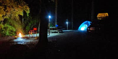
Off-road riding draws a steady crowd to S-Tree Campground, a Forest Service site tucked into the forested hills of Daniel Boone National Forest outside McKee, Kentucky. The campground has two loops, with loop B still undergoing upgrades, and sites are gravel-surfaced with picnic tables and fire rings at each one. No electricity is available. Sites are spacious and spread out, which tends to give campers room to maneuver rigs and gear.
Road access is worth planning around. The northern approach is manageable for most vehicles, but the southern road runs rougher, with low clearance a real concern for standard passenger cars. There are around 10 tent-specific sites and an additional group of larger pull-through sites suited to RVs and trailers. One practical note: there is no water on site, so campers need to arrive with enough supply for their stay. Andrew G. sums it up plainly: "Several toilets on site, but no water."
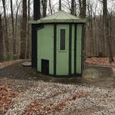
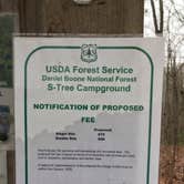
Vault toilets are available in multiple locations and reviewers consistently describe them as well-maintained. Cell coverage with Verizon runs at roughly two bars of 4G, enough for calls, though data speeds vary. No fee was being collected as of late 2025, though the Forest Service has indicated fees will be implemented once loop B is complete. Nearby, Red Hill Horse Camp and Turkey Foot Campground give riders and hikers additional staging options in the area, and those planning a broader trip can browse campgrounds near McKee for more choices. Riders who don't mind a remote setting and can haul their own water will find S-Tree a solid base.
Description
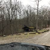
S-Tree Campground sits on a ridge above Horse Lick Creek on London Ranger District near McKee in Jackson County, Kentucky. A small picnic area features a historic picnic shelter that was constructed in the 1930s by the Civilian Conservation Corps. The campground receives heavy weekend use from off-highway vehicle users who ride the adjacent Sheltowee Trace National Recreation Trail, Section #25 and the Renfro Loop Trail. These trails may be accessed from the campground. Make this page look nicer by submitting photos of your visit to S-Tree Campground. Learn more... This campground cannot accommodate trailers 25 feet or more due to one lane roads and no turn-outs. Each campsite has a picnic table, tent pad, fire ring and lantern pole. No electricity or dump station available.Vault toilets are centrally located. Campsites and shelter are available on a first-come, first-served basis. Loop A has two double campsites. Loop B has two fire circles. All of the campsites are wooded. Picnicking nearby: A picnic shelter with tables is available on a first-come, first-served basis. Other picnic sites are located near an area where a fire lookout tower once stood. S-Tree Campground Map View S-Tree Campground Guide & Map (pdf) S-Tree Fire Tower once stood near the entrance to the campground. Towers like these were important tools in detecting and fighting devastating forest fires. Fire towers were home to the lookouts who ran them. A tower cab was just big enough for a wood stove, two cots, a cabinet, storage box, small table, and a stool. The all-important alidade, or fire finder, stood in the middle of the room. By the mid-1970s, firefighters used aircraft for fire detection. Many towers, like one that stood here, were torn down because they could no longer be maintained in a safe condition. Nearby Trails: Renfro Loop Trails Sheltowee Trace Trail #100 Section 25
RV Road Trip Guides


Map & DirectionsS-Tree Campground is located in Kentucky near McKee
 Public Campground
Directions
From Berea: From I-75 take Berea Exit 76. Head east on KY 21. Stay on KY 21E (Big Hill Road) approximately 5 miles until it ends at US 421. Turn right (south) on US 421. Take US 421 west for approximately 18 miles to McKee KY, then turn right (south) on KY 89 for 3 miles, make a slight right (west) on Forest Road 43 (S-Tree Road). Go 1 mile, turn left (south) on Forest Road 20 (Tussey Hill Road) and follow the signs. From McKee: Take US 421 west from McKee for 0.5 mile. Turn left (south) on KY 89 for 3 miles, make a slight right (west) on Forest Road 43 (S-Tree Road). Go 1 mile, turn left (south) on Forest Road 20 (Tussey Hill Road) and follow the signs.
Coordinates
37.38678802 N
84.071748 W
Connectivity
 T-MobileNo Coverage
- VerizonNo Coverage
- AT&TNo CoverageVerified by 2 usersLast on 9/30/26
Connectivity
- T-MobileNo Coverage
- VerizonNo Coverage
- AT&TNo CoverageVerified by 2 usersLast on 9/30/26
Access
- Drive-InPark next to your site
- Walk-InPark in a lot, walk to your site.
- Hike-InBackcountry sites.
Site Types
- Tent Sites
- RV Sites
- Standard (Tent/RV)
- Group
- Equestrian
Features
For Campers
- Trash
- Picnic Table
- Phone Service
- Toilets
- Pets
- Fires
For Vehicles
- Sanitary Dump
Drive Time
- 1 hr 12 min from Lexington, KY
- 1 hr 55 min from Knoxville, TN
- 2 hrs 24 min from Morristown, TN
- 2 hrs 30 min from Elizabethtown, KY