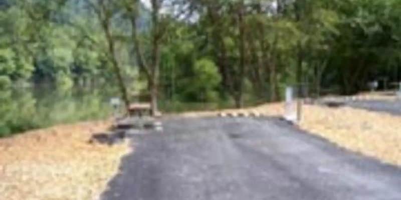
Off a winding network of single-lane mountain roads, Trace Branch sits on the shores of Buckhorn Lake in eastern Kentucky's forested hills. The US Army Corps of Engineers manages this seasonal campground, which operates from early May through late September and accommodates RVs up to 55 feet with full hookups.
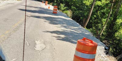
Getting here requires navigation skills and patience. As j B. warns in detail, Pleasant Valley Road should be avoided entirely due to washouts and dangerous conditions. The recommended route involves multiple turns and bridge crossings through rural Perry County. Half the campsites sit directly on the water, while others spread through the wooded terrain above the lake.
Sites include electric, water, and sewer hookups, plus fire rings and picnic tables. The campground features restrooms with showers, though maintenance can be inconsistent during busy periods. A boat ramp provides lake access for fishing and swimming. Cell service is nonexistent here, making this a true disconnect from digital life. "RV spots are a little close to your neighbor but it was quiet," notes Maze M.
Weekend crowds bring local families with children, so weekday visits offer more solitude. Spring flooding can affect access and operations, making summer and early fall the most reliable seasons for camping.
Description
Overview
The Trace Branch Campground, located on Buckhorn Lake, is a great launchpad for outdoor activities in Kentucky's lush Cumberland Plateau. The facility features plenty of shade and open grassy areas for spreading out and enjoying the landscape of the Appalachian Mountain Range.
Recreation
Buckhorn lake offers ideal conditions for anglers including seclusion from fishing pressure and boat traffic, producing some of the best muskie fishing in the area. With comfortable water temperatures,swimming and water skiing are popular in summer months and hikers are encouraged to take advantage of the area's many miles of trails.
Facilities
Trace Branch Campground boasts mostly waterfront campsites with electric and water hookups. Amenities include a shower house, playground, horseshoe pits, and a convenient fishing area.
Natural Features
Buckhorn Lake is situated in the Cumberland Plateau of eastern Kentucky. The rugged plateau landscape is deeply traversed by a series of narrow, winding valleys separated by steep watersheds with branching streams. The Kentucky River feeds the lake, originating in the southeast of the state and flowing generally northwestward.
Nearby Attractions
Nearby destinations include the Lilley Cornett Woods, Daniel Boone National Forest, Natural Bridge State Resort Park and the Red River Gorge Geological Area.
Map & DirectionsTrace Branch is located in Kentucky near Hazard
Directions
From Lexington, KY, take I-75 south 83 miles to London. Take exit 41 or 38 to Daniel Boone Parkway east and continue 44 miles to Hyden Spur. Exit towards Tim Couch Pass and turn left towards Thousandsticks onto Bull Creek Road. Go 2.5 miles to KY Highway 257, then head north about 9 miles to the Confluence bridge. Turn right and cross the bridge, then take a left on Mosley Bend Road. Continue 2 miles to Trace Branch Campground on your left.
Address
804 BUCKHORN DAM ROAD
Buckhorn, KY 41721-8808
Coordinates
37.2416667 N
83.3727778 W
Connectivity
 T-MobileNo Coverage
- VerizonNo Coverage
 AT&TLTESome Coverage
Connectivity
- T-MobileNo Coverage
- VerizonNo Coverage
- AT&TLTESome Coverage
Access
- Drive-InPark next to your site
Site Types
- Tent Sites
- RV Sites
- Standard (Tent/RV)
- Dispersed
- Group
- Tent Cabin
Features
For Campers
- Trash
- Picnic Table
- Firewood Available
- Reservable
- Drinking Water
- Electric Hookups
- Alcohol
- Pets
- Fires
For Vehicles
- Sanitary Dump
- Sewer Hookups
- Water Hookups
- 50 Amp Hookups
Drive Time
- 1 hr 47 min from Lexington, KY
- 2 hrs 11 min from Kingsport, TN
- 2 hrs 14 min from Morristown, TN
- 2 hrs 22 min from Johnson City, TN


