The approach road into Axtel Campground winds through forested terrain before reaching sites that stretch along Rough River Lake's shoreline. This Army Corps of Engineers facility operates seasonally from mid-April through October, accommodating RVs up to 80 feet with full hookups alongside primitive tent sites scattered throughout wooded areas.
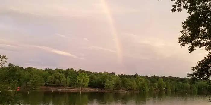
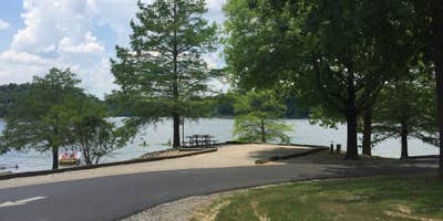
Campers consistently note the campground's family-friendly atmosphere, with children's voices carrying across the large sandy beach reserved for registered guests. The lake provides warm water swimming during summer months, though water levels fluctuate seasonally. Kevin H. observed the "lake really low, water warm - but able to kayak" during his July visit. Sites closest to the water, particularly in the E-loop, offer direct lake access for launching kayaks or casting lines, though the shoreline can turn muddy after rain due to the red clay soil.
Site spacing varies considerably throughout the campground's different loops. The 100-series sites climb hillsides above the lake, with some requiring careful navigation for larger RVs due to steep grades. MickandKarla W. noted that "shorter rigs, due to the site slopes, would be okay but ensure you know what you're getting into if you decide to bring in anything over 35' into sites 122-137." The E-loop sites along the waterfront provide more level ground but tighter spacing between neighbors.
Cell coverage proves spotty for most carriers, though Starlink users report adequate service in open areas. The campground's single dump station creates bottlenecks during busy checkout periods, positioned awkwardly along one of the main access roads. WiFi reaches most areas with varying reliability. Quiet hours are generally respected, contributing to the calm evening atmosphere that draws families back for repeat visits. For those exploring the broader region, campgrounds near Rough River Lake provide additional options around this 5,100-acre reservoir.
Description
Overview
Axtel Campground is located on the shore of Rough River Lake in south central Kentucky. The 5,100-acre lake is a hometown paradise for visitors who love the outdoors, and more than two million visitors camp, picnic, fish, swim, boat and relax on the lake shore each year.
Recreation
A wide variety of recreational activities and facilities are provided at the lake, including ample opportunities for boating and fishing. The most sought after fish are bass, crappie and catfish, and bass tournaments occur at the lake throughout the year. Additionally, pontoon, johnboat and jet ski rentals are available at the nearby marinas.
Facilities
Axtel Campground is a large facility with 158 campsites, many of which have electric hookups. All campsites provide sweeping views of the lake. A swimming area, boat ramp, dump station, flush toilets, playground, showers, drinking water, fish-cleaning station, and short trail are also provided.Wi-fi is available from an outside source.
Natural Features
The rolling, forested hills of rural south central Kentucky offer an extraordinary setting for those who visit the lake. Rough River Lake provides views of ancient sandstone, shale and limestone cliffs. An abundance of water in the area, both surface and underground, has carved through limestone to create a myriad of sinks and caverns. The lake itself is home to numerous species of wildlife, including migratory songbirds and waterfowl.
Contact Info
For facility specific information, please call (270) 257-2584.
Nearby Attractions
The historic Green Farm is adjacent to the lake. It consists of about 3,000 acres, a large ancestral home, an old water-powered mill and store and a golf course. George Washington once owned part of the land. Mammoth Cave National Park, which boasts the longest cave system in the world with more than 240 miles of mapped passageways, is about a one-hour drive away. Other nearby attractions also include the historic Holt House in Hardinsburg, the Jack Thomas House in Leitchfield, and the new Aquatic Center in Leitchfield.
Charges & Cancellations
Once a reservation has been created, there will be a $10 fee to cancel your reservation, change sites, or change dates. Cancellations made the day before you are scheduled to arrive through the day after your arrival date will also be charged the first night's use fee. No-show's are charged a $20 fee plus the first night's use fee. If you reservation is for only 1 night, and you have been charged the first night's use fee, there is no $10 or $20 service fee charged.
Map & DirectionsCOE Rough River Lake Axtel Campground is located in Kentucky near Falls of Rough
Directions
Begin at ramp onto I-64 West toward New Albany/St. Louis, traveling 22.3 miles. Take the IN-135, Exit Number 105, toward Palmyra/Corydon, onto IN-135 South toward Corydon, traveling 16.7 miles. Continue on Bypass Road KY-79 for 2.1 miles. Turn right onto KY-79, traveling 10.1 miles. Continue on 1st Avenue, KY-79S for 495 feet. Turn a slight right onto US-60, traveling 11.8 miles. Turn left onto KY-259/KY-79, traveling 9.7 miles. Turn right to stay on KY-79, traveling .7 miles. End at 663 South Highway 79, McDaniels, KY. Distance is approximately 74 miles with an approximate travel time of 1 hour, 20 minutes.
Address
663 South Highway 79
Mcdaniels, KY 40152
Coordinates
37.6225 N
86.4530556 W
Connectivity
 T-Mobile5GExcellent Coverage
- Verizon5GExcellent CoverageVerified by 3 usersLast on 7/24/26
 AT&TLTESome Coverage
Connectivity
- T-Mobile5GExcellent Coverage
- Verizon5GExcellent CoverageVerified by 3 usersLast on 7/24/26
- AT&TLTESome Coverage
Access
- Drive-InPark next to your site
Site Types
- Tent Sites
- RV Sites
- Standard (Tent/RV)
Features
For Campers
- Trash
- Picnic Table
- Reservable
- WiFi
- Drinking Water
- Electric Hookups
- Toilets
- Pets
- Fires
For Vehicles
- Sanitary Dump
- Sewer Hookups
- Water Hookups
- 50 Amp Hookups
Drive Time
- 45 min from Elizabethtown, KY
- 55 min from Owensboro, KY
- 1 hr 8 min from Bowling Green, KY
- 1 hr 15 min from Louisville, KY


