Best Dispersed Camping near Cornelia, GA
Planning a dispersed camping trip near Cornelia? With The Dyrt, it's easy to find peaceful dispersed camping near Cornelia. Search nearby dispersed campgrounds or find top-rated spots from other campers.
The Appalachian National Scenic Trail (A.T.) is open and trail shelter in Georgia are available. Hikers are advised to bring a personal tent and face coverings. Shelters might not be frequently maintained at all locations. Dispersed camping is also available. Not all privies are open or maintained. Guidance is available on the Appalachian Trail Conservancy (ATC) website for trip planning, hiking safety and COVID-19 precautions.
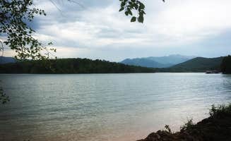
Dispersed camping in the Blue Valley area. Approximately 22 dispersed sites are available, and most have fire rings and picnic tables. A pit toilet is available. Please pack in and pack out. Wilson Lake is a short distance away offering fishing, swimming, a short trail, and wildlife viewing and birding.
Dispersed camping is permitted provided the selected site is 50 feet from streams and trails and .25 miles from the road. Venomous snakes live in these habitats. Practice water safety near the river and be aware of other natural hazards. Also, winter can bring very cold temperatures and hazardous trail conditions.
Free camping in the Francis Marion and Sumter National Forest. This is in the Andrew Pickens Ranger District. Dispersed camping is permitted on the Andrew Pickens Ranger District. Campsites must be at least 50 feet from rivers, streams or trails, and must be at least .25 miles from the road. No permit is required for dispersed camping.
The coordinates take you to Nottley Dam. We had to drive 37 minutes farther to Lake Chatuge and hopefully we find some campground since it is very dark at the moment. We ended up having to spend over $200 for a hotel. I'm going to delete my acct as other friends have similar issues with Dyrt
If you’re anywhere near Helen, GA on an ADV Bike, this summit is for you. There are three routes up the mountain so you never have to double back. There are more primitive sites at the top of the mountain (not where the Dyrt pin was dropped) on both sides of the fork. Suitable for tents and hammocks. There is one site that would support a large group or even a camper (or two) if you can get them up the steep rocky hunting trail. Sites were mostly clean with rock fire pits.
the directions get you to the general area fine. the campsites are hard to find in the dark - we ended up just stopping at the first clearing from a fork on the gravel road we saw to set up a tent. road is very bumpy, there’s a stream near some of the spots , we looked for a fire ring where we stopped in the morning and didn’t see one.
Three campsites in the immediate area. Two are on one side of the road. You have to cross thru one to get to the other. All three have creek access. We picked the single on the other side. Not a lot of flat ground options. Each site is huge. We decided to spread out but that meant having to do a lot of walking back and forth for stuff. You can pull your car into the site easily. It’s about a mile from the High Shoals Trailhead. Both waterfalls are lovely. One has a nice swimming hole. The closest town is Hiawasee. Had a grocery and an outfitters if you need supplies. There’s only two sit down restaurants—one had an hour wait; the other had run out of food.
Good camp area quite during mid week stay
I went in July and it was cool in day and cold at night nice , secluded
Great spot with room to turn around. Shaded and at trailhead of a trail down to creek and near a second trail to a waterfall. Had a few people during the day but evenings were totally quiet. A bit of extra vehicle clearance is helpful...slow and steady gets you to a great spot. No services here but good dispersed spot.
Great quietly secluded. Made an effort to go as far as I could. And even through the water in my 2015 Toyota sienna mobbed right on through. Enjoy the views!
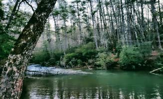
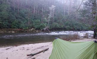
Right next to the Chattooga river. You're on the beach.
Dont park where the map tells you, you can drive to the locations on a decent narrow dirt road.
When we first arrived, the camp site we chose was on the river, but also off the main road. This area seems to be popular for local dirt bikers, but we seen people fishing and relaxing all the same.
I would have gave 5 stars, but these sites are well used and has years of careless debris around. We also heard some folks shooting guns( in the distance), which isn’t a problem for us, but reduced the relaxing nature of the visit with all this combined.
This river is amazing, low current makes its easy to walk in and there are a few little water falls we enjoyed hanging on for a bit.
There is room for two vehicles and multiple tent spots. Very secluded and fairly level. Overall a great spot. If it had an epic view I would have it at 5 stars. River is about .6 mile hike away and the road is not bad getting in. Basically 2 track forest road.
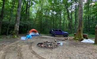
I went with my girlfriend and dog and had a blast. Is a little confusing to find but just when you question if you’re heading to the right place, you’re greeted with a fork and small trail down to a massive clearing. You could easily fit 8 cars around the area. There’s a very flat area, a fire pit, and creek surrounded by forest and mountains. Will definitely be coming back to this location.
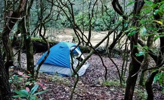
Couple things to know you don't need 4wd to get to the campsite. I do want to say though that the road down to the spot is a little wonky so be prepare for bumpy road. I will like to say there is a road literally 300 feet next to the campsite doesnt seem that busy but you might get a car once every 45 mins. Other wise the campsite is nice there was a good bit of trash thrown around. I tried cleaning up the best I can but be aware pls clean up after yourself. There are two campsite on opposite side of the road if the main one is taken. One of the nice things is if you have a tent you can get right next to the water definitely say beautiful area. Will go back.
Closest shelter to the bald where you can get an amazing view. Well cared for and in an incredible area. Just be prepared for a climb to see the view.
Nice wide camping spot. Very primitive and if you desperately need toilet facilities, there are a couple of established campgrounds just down the road
We have camped at 3 sites at this campground and have loved all of them. We were very secluded and there was very little traffic on the dirt road. Love hearing all the wonderful sounds of nature and nothing else. Wonderful creek/river by every campsite we went to. Some have picnic tables but all have fire rings and lantern posts. There's only about 10-15 sites that you can actually drive up to but I'm sure there's more if you hike in.
Decent site(s) near chatooga river. Moderate clearance vehicle required, (or hike it).
Large mountain top camp site. Moderate clearance vehicle is required to access, (or hike it) ;)
Access is rough, (moderate clearance vehicles required). Also, as courtesy - cruise the bridge and see if people are down there first, (both sides).
Sweet backcountry spot! Nice gurgling stream and hiking trails.
You can access this campsite by various means, but do your research and save yourself as many steps, because make no mistake, this is a serious hiking trail (a mile to a mile and a half, depending on route) up to the Fire Tower.
Part of the Appalachian Train, once you park your car or hike in, you'll make your way uphill over crude-cut rocks, tree roots, and muddy, narrow paths. Hiking poles are strongly recommended. The path down is just as treacherous as the path up, as moisture from the mountain drips down over craggy footholds.
While the path is popular with hikers, anyone camping should consider using a very small pack, especially since some of the trails have nothing but a chasm on one side.
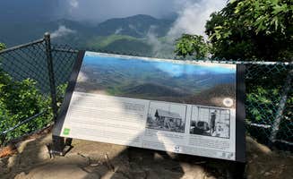
Once you make it to the Fire Tower, however, all is forgiven. The site from the bottom is breathtaking, and you can see, well, forever. Heading up the tower (the very top is closed to visitors and mothballed), you get an almost full 360º panorama of the surrounding valleys and mountains.
The camp site itself is very rustic, no amenities other than a rock fire ring, and does not face the vistas. There's a weak LTE signal at the top, but be prepared to lose your signal along the way.
Side note: I came through the Coweeta Hydrological Laboratory, which has numerous signs posted that you cannot camp there. However, it's part of the larger National Forest and it's not exactly clear where camping begins to be allowed, as there were several rustic sites along the trail at the upper end.
If you do come driving through the Coweeta Hydrological Laboratory path, be prepared for narrow, steep gravel lanes. And keep in mind that if you do park your car on one of the (few) spaces available, you're going to be very far from it, and the site didn't appear to be patrolled in any way.
This camping site is unmarked and almost literally under a bridge. There's a pull-off to either side of the structure, which quickly goes from asphalt to a very uneven dirt road which had been graveled long ago, snaking down to the river. My small car had difficulty getting down it and the drop-off from the asphalt is abrupt.
When I visited, it had rained heavily so both the road and the site were wet and muddy. The camping site itself is open, with no designated tent sites, but there is a fire ring made of rock and a few stumps and rocks to sit on.
On the plus side, there's a sign posted that the river is open trout fishing all year, with no lure or size restrictions.
There appeared to be another trail on the other side of the bridge, but I didn't travel that as I wasn't sure my car could handle the mud road.
Plenty of space for groups or even just to have some tucked back privacy. Only bad part was there was trash everywhere when we got there.
We came looking for this campsite past dark and after a half hour of driving on a gravel road we gave up searching and just parked on the side of the road for the night.
In the morning we went hunting for the campground and ended up finding at least 10 campsites scattered throughout the mountain and road. The coordinates posted weren’t very helpful so the best way to find this location is to put into the GPS the name of the nearby retreat center called “Ramah Darom”. Once you get to the entrance keep continuing up the mountain. The road will stop being paved and you’ll have a gravel road to continue on that leads you to numerous sites.
The sites arnt difficult to find in the daytime, just know there’s no signs or pointers to tell you which way to go.
I’ll post some pictures to help you find where some of the sites are.
The sites are primitive, with just fire rings but its definitely a cute spot to spend the night.
I don’t recommend RV’s.
We drove here to find that the coordinates given by the app took us to a neighborhood and once you get there the pin that shows where the campsite is supposed to be has a sign saying “disaster area”. Don’t waste your time driving here unless the coordinates get updated.
This is a backpacking campsite on the NC Bartram trail that sits right along the trail and has a clearing for about 1 tent or multiple hammocks. Although the site itself is fairly wooded you can walk 5 min up the trail to get to an opening in the trees and have some incredible views. Additionally, the water source nearby is only about a 10-15 min walk. This section of trail is part of the Bartram trail which is a wonderful through hike starting at the border with Georgia and traveling all the way up through Franklin and ending at Cheoah Bald and Stecoah Gap. You can find detailed maps of the entire route on the NC Bartram Trail website where they mark out all the campsites and water options. Definitely check out my other reviews though since some of the marked sites are better than others. This specific site sits right in the gap between two mountains where the trail dips downhill before heading back uphill. It is definitely one of the nicer sites that exist right alongside the trail and is fairly well established. Overall, I prefer the next site that is on the peak of Whiterock Mountain this is a pretty close second place and would be the better option if you are arriving late in the afternoon and need to get camp set up quick.
This site is located at the top of a small peak a short way off of the main Whiterock Mountain Trail. The split is clearly marked and will take you up a short (slippery) climb to this incredible overlook. The campsite itself is large enough for 1 or 2 tents and has several nice established fire pits. Although there isn't a water source up top you will pass a small creek slightly off the trail that provides a good place to pump water before heading up to the peak. This section of trail is part of the Bartram trail which is a wonderful through hike starting at the border with Georgia and traveling all the way up through Franklin and ending at Cheoah Bald and Stecoah Gap. You can find detailed maps of the entire route on the NC Bartram Trail website where they mark out all the campsites and water options. Definitely check out my other reviews though since some of the marked sites are better than others. Overall, this specific site is well worth the short off-route trek. Make sure to watch both of my video reviews since I got a little confused thinking I had found the site but then realized I was wrong....
This is a small site along the AT that has a nice clearing and enough space for 1-2 tents with an established fire pit. Check out my video review below to get a better idea of the site layout. The major thing I would be aware of is that this site can get a little flooded after heavy rain. There is also not an easy access water source nearby so either be prepared to hike a little distance or carry in what you will need for the night. Overall though even though it isn't the best site in the area it is close to some incredible overlook spots and in a beautiful area so well worth a visit.
Discover the beauty of dispersed camping near Cornelia, Georgia, where nature enthusiasts can find serene spots away from the crowds. With a variety of locations offering unique experiences, campers can enjoy the great outdoors while embracing the freedom of primitive camping.
Frequently Asked Questions
Which is the most popular dispersed campsite near Cornelia, GA?
According to TheDyrt.com, the most popular dispersed campground near Cornelia, GA is Indian Grave Gap Campsite with a 4-star rating from 2 reviews.
What is the best site to find dispersed camping near Cornelia, GA?
TheDyrt.com has all 38 dispersed camping locations near Cornelia, GA, with real photos and reviews from campers.