Best Dispersed Camping near Baldwin, GA
Looking for dispersed camping near Baldwin? With The Dyrt, it's easy to find peaceful dispersed camping near Baldwin. Search nearby dispersed campgrounds or find top-rated spots from other campers.
The Appalachian National Scenic Trail (A.T.) is open and trail shelter in Georgia are available. Hikers are advised to bring a personal tent and face coverings. Shelters might not be frequently maintained at all locations. Dispersed camping is also available. Not all privies are open or maintained. Guidance is available on the Appalachian Trail Conservancy (ATC) website for trip planning, hiking safety and COVID-19 precautions.
Dispersed camping in the Blue Valley area. Approximately 22 dispersed sites are available, and most have fire rings and picnic tables. A pit toilet is available. Please pack in and pack out. Wilson Lake is a short distance away offering fishing, swimming, a short trail, and wildlife viewing and birding.
Dispersed camping is permitted provided the selected site is 50 feet from streams and trails and .25 miles from the road. Venomous snakes live in these habitats. Practice water safety near the river and be aware of other natural hazards. Also, winter can bring very cold temperatures and hazardous trail conditions.
Free dispersed primitive camping minutes from Helen Ga and local wineries. Great spot next to the creek. Quiet and any potential neighbors are far enough away that you have total privacy
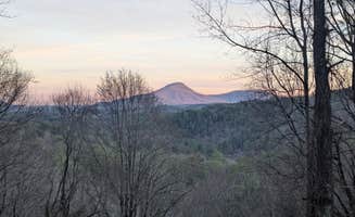
Dispersed camp sites at or near the summit of Cowrock Mountain offer wonderfully shaded spots with long range views of the Blue Ridge. Perfect spot for hammocks or tents right off the trail with large rocky outcrops for your views. Easy enough to set up a small fire ring right on the edge for night-time relaxing. There is a water source about .5 miles west on the AT at Baggs Creek Gap or ~1.5 miles east at Hogpen Gap. Closest road access is down the mountain about a mile west at Tesnatee Gap on GA Hwy 348 (Richard B Russell Scenic Hwy)
A relatively moderate 2.4 mile (round trip) hike with primitive camping/ backpacking campsites alongside High Shoals Creek. The trail contains 2 beautiful Georgia waterfalls, Blue Hole Falls and High Shoals Falls. The area is lush with mountain laurel, rhododendrons, and old-growth trees. The cool waters of High Shoals Creek offer rewarding refreshment after a day of exploring the various wildflowers and plant life while serving as a soothing sound to fall asleep too while stargazing.
I went to Highlands and found this site listed and really was looking forward to staying here. Said to be near Glenn Falls I found the falls but no turn off to be found and cell signal unless you are right in town is pretty spotty. I returned to town screen shot some directions and headed out toward the unknown.
When I arrived the pavement ended and continued onward a very primitive gravel road. Pretty rough in some places and very narrow, let’s just say I wouldn’t want to end up encountering another car.
After winding around the mountain roads finally I saw the “experimental forest” sign followed by the National Forest sign. Not far ahead was the campground kiosk.
it seemed pretty quiet there and I was happy to settle in only to discover as a solo female traveler it appeared there was a beer bust by some local hunters or good ol boys. They were getting pretty rowdy and while I could have simply moved to a further campsite ani was a little in fear that this wasn’t gonna be a really restful evening if they were going to be up drinking all night.
I opted to use this facility for a few moments as a day use area and really enjoyed the large forest around me but didn’t stay overnight because of the circumstances.
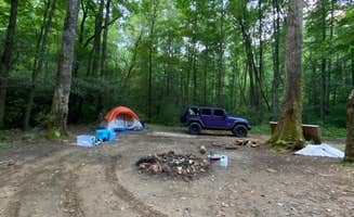
Sites were tree-filled and nice. Picnic tables and fire rings were at each site and sites were pretty well spread out. Very much so a dispersed site, I would be a bit concerned with larger rigs on the small road but small RVs or tents are great.
You can access this campsite by various means, but do your research and save yourself as many steps, because make no mistake, this is a serious hiking trail (a mile to a mile and a half, depending on route) up to the Fire Tower.
Part of the Appalachian Train, once you park your car or hike in, you'll make your way uphill over crude-cut rocks, tree roots, and muddy, narrow paths. Hiking poles are strongly recommended. The path down is just as treacherous as the path up, as moisture from the mountain drips down over craggy footholds.
While the path is popular with hikers, anyone camping should consider using a very small pack, especially since some of the trails have nothing but a chasm on one side.
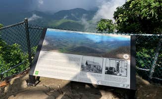
Once you make it to the Fire Tower, however, all is forgiven. The site from the bottom is breathtaking, and you can see, well, forever. Heading up the tower (the very top is closed to visitors and mothballed), you get an almost full 360º panorama of the surrounding valleys and mountains.
The camp site itself is very rustic, no amenities other than a rock fire ring, and does not face the vistas. There's a weak LTE signal at the top, but be prepared to lose your signal along the way.
Side note: I came through the Coweeta Hydrological Laboratory, which has numerous signs posted that you cannot camp there. However, it's part of the larger National Forest and it's not exactly clear where camping begins to be allowed, as there were several rustic sites along the trail at the upper end.
If you do come driving through the Coweeta Hydrological Laboratory path, be prepared for narrow, steep gravel lanes. And keep in mind that if you do park your car on one of the (few) spaces available, you're going to be very far from it, and the site didn't appear to be patrolled in any way.
Campground Review:
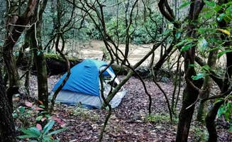
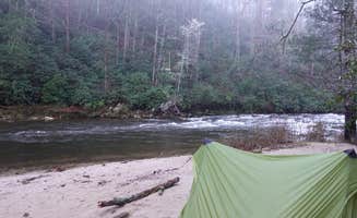
There are two ways to access this campsite and one definitely requires significantly more sweat (that’s the route we took). The backcountry site is located near the far trailhead at Glen Falls located at the end of a forestry road. We hiked in from the trailhead that most people use to access the falls and continued down the trail past the typical turnaround point until you reach the bottom of the valley. The site is on the nicer side for a backcountry campground as it is level and has multiple areas for tents along with a large fire pit surrounded by logs for sitting on. The main advantage of this site over others in the area is that it is located on the inside of a curve in the river so the creek surrounds almost the entire site giving easy access to water and a relaxing sound to help you sleep at night. The hike down from the upper trailhead is relatively steep and involves going down many (many) stairs but is well worth it for the views of Glen Falls. This is a well-traveled and also well cared for route and we saw many other hikers while we were there. However, most people do not make it all the way down to this site so you will most likely find a significant amount of privacy if you plan on camping here. Since it is National Forest you will have no issues with camping just make sure to follow leave no trace practice and keep your fire under control. I would also highly recommend a dip in the cool waters to help with the heat during the middle of the summer. Overall, this is a beautiful secluded campsite very close to Highlands that provides both tranquility and also some strenuous hiking.
...........................
****Product Review:** **
As a Ranger for The Dyrt, I get to test products while out adventuring. At this campground, I stayed dry using the Red Ledge Free Rein Jacket. After multiple rainy hikes and wet campground days some of my favorite features are:
Overall, for the very reasonable price of these raincoats, they are incredibly effective and comfortable and I would highly recommend seriously considering them for your next raincoat purchase.
Siler Bald is not to be confused with Silers Bald, which borders the NC/TN state line in the Great Smoky Mountains National Park. Siler Bald is actually in the Nantahala National Forest and is close to Wayah Bald along the Appalachian Trail. The shelter is aptly named after the adjacent mountain bald. I first went to Siler Bald many years ago but did not go to the trail shelter. This second time, I did go to the trail shelter, which is about nine-tenths of a mile past the Siler Bald summit if you are hiking north on the Appalachian Trail. If you are hiking from Wayah Bald, it is a little over three and a half miles. Since this is a trail shelter, it does not have electrical hookups. You will need to take a water filtration system for fresh water. Instead of searching for firewood, we used my old Coleman stove for dinner. Surprisingly, there were no other groups in the shelter the night we stayed there. The best things about this trail shelter are its proximity to the Appalachian Trail, the quietness you’ll experience since it is away from major highways, and its proximity to the Siler Bald summit. The summit provides a fantastic 360 degree view since it is a grassy bald, but it is a steep climb from the base to the summit. This is not an RV campground, and you do have to pack everything in(and out). You cannot go to the store to get supplies without hiking a long way, so be prepared. Overall, I loved it because of its peace and solitude.
Nice wide camping spot. Very primitive and if you desperately need toilet facilities, there are a couple of established campgrounds just down the road
We have camped at 3 sites at this campground and have loved all of them. We were very secluded and there was very little traffic on the dirt road. Love hearing all the wonderful sounds of nature and nothing else. Wonderful creek/river by every campsite we went to. Some have picnic tables but all have fire rings and lantern posts. There's only about 10-15 sites that you can actually drive up to but I'm sure there's more if you hike in.
I went in July and it was cool in day and cold at night nice , secluded
Great quietly secluded. Made an effort to go as far as I could. And even through the water in my 2015 Toyota sienna mobbed right on through. Enjoy the views!
This site is located at the top of a small peak a short way off of the main Whiterock Mountain Trail. The split is clearly marked and will take you up a short (slippery) climb to this incredible overlook. The campsite itself is large enough for 1 or 2 tents and has several nice established fire pits. Although there isn't a water source up top you will pass a small creek slightly off the trail that provides a good place to pump water before heading up to the peak. This section of trail is part of the Bartram trail which is a wonderful through hike starting at the border with Georgia and traveling all the way up through Franklin and ending at Cheoah Bald and Stecoah Gap. You can find detailed maps of the entire route on the NC Bartram Trail website where they mark out all the campsites and water options. Definitely check out my other reviews though since some of the marked sites are better than others. Overall, this specific site is well worth the short off-route trek. Make sure to watch both of my video reviews since I got a little confused thinking I had found the site but then realized I was wrong....
Couple things to know you don't need 4wd to get to the campsite. I do want to say though that the road down to the spot is a little wonky so be prepare for bumpy road. I will like to say there is a road literally 300 feet next to the campsite doesnt seem that busy but you might get a car once every 45 mins. Other wise the campsite is nice there was a good bit of trash thrown around. I tried cleaning up the best I can but be aware pls clean up after yourself. There are two campsite on opposite side of the road if the main one is taken. One of the nice things is if you have a tent you can get right next to the water definitely say beautiful area. Will go back.
There is room for two vehicles and multiple tent spots. Very secluded and fairly level. Overall a great spot. If it had an epic view I would have it at 5 stars. River is about .6 mile hike away and the road is not bad getting in. Basically 2 track forest road.
This is a backpacking campsite on the NC Bartram trail that sits right along the trail and has a clearing for about 1 tent or multiple hammocks. Although the site itself is fairly wooded you can walk 5 min up the trail to get to an opening in the trees and have some incredible views. Additionally, the water source nearby is only about a 10-15 min walk. This section of trail is part of the Bartram trail which is a wonderful through hike starting at the border with Georgia and traveling all the way up through Franklin and ending at Cheoah Bald and Stecoah Gap. You can find detailed maps of the entire route on the NC Bartram Trail website where they mark out all the campsites and water options. Definitely check out my other reviews though since some of the marked sites are better than others. This specific site sits right in the gap between two mountains where the trail dips downhill before heading back uphill. It is definitely one of the nicer sites that exist right alongside the trail and is fairly well established. Overall, I prefer the next site that is on the peak of Whiterock Mountain this is a pretty close second place and would be the better option if you are arriving late in the afternoon and need to get camp set up quick.
Great spot with room to turn around. Shaded and at trailhead of a trail down to creek and near a second trail to a waterfall. Had a few people during the day but evenings were totally quiet. A bit of extra vehicle clearance is helpful...slow and steady gets you to a great spot. No services here but good dispersed spot.
Large mountain top camp site. Moderate clearance vehicle is required to access, (or hike it) ;)
I camped here many times while attending the camp down the road. I have also brought many groups of campers here over my summers as a counselor. To get to the site you drive or walk through the river and end up in a large group site right by a small waterfall. If you have the place to yourself it is incredibly secluded and a wonderful spot. You can also hike up or down the stream to get to other beautiful small falls that are perfect for swimming in during the hot summers.
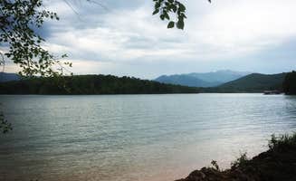
Great view of lake. Campsite is right on the water. This site is primitive. Previous campers didn’t take their trash with them. Only negative to this site.
. Location is actually about 1.5. Miles further than shown on map. Just keep going. Stayed for a week. About 7 campsites with fire rings. Great trails and people camping near were respectful. Recommend.
8 very well kept campsites. Almost all near a creek of some sort. Hiking trails near by. No facilities. Room for larger groups ~40 people max for the biggest site ~6 for the smallest
We drove here to find that the coordinates given by the app took us to a neighborhood and once you get there the pin that shows where the campsite is supposed to be has a sign saying “disaster area”. Don’t waste your time driving here unless the coordinates get updated.
We came looking for this campsite past dark and after a half hour of driving on a gravel road we gave up searching and just parked on the side of the road for the night.
In the morning we went hunting for the campground and ended up finding at least 10 campsites scattered throughout the mountain and road. The coordinates posted weren’t very helpful so the best way to find this location is to put into the GPS the name of the nearby retreat center called “Ramah Darom”. Once you get to the entrance keep continuing up the mountain. The road will stop being paved and you’ll have a gravel road to continue on that leads you to numerous sites.
The sites arnt difficult to find in the daytime, just know there’s no signs or pointers to tell you which way to go.
I’ll post some pictures to help you find where some of the sites are.
The sites are primitive, with just fire rings but its definitely a cute spot to spend the night.
I don’t recommend RV’s.
the directions get you to the general area fine. the campsites are hard to find in the dark - we ended up just stopping at the first clearing from a fork on the gravel road we saw to set up a tent. road is very bumpy, there’s a stream near some of the spots , we looked for a fire ring where we stopped in the morning and didn’t see one.
After one of my favorite stretches of hiking we got to this campsite along the AT. We were warned about bears in the area so were very cautious about hanging our bear bag a little extra distance away on the opposite side of the creek. The creek was absolutely freezing cold in July, it was great to rinse some clothes and ourselves off. It was definitely one of our best nights sleep listening to the water!
Three campsites in the immediate area. Two are on one side of the road. You have to cross thru one to get to the other. All three have creek access. We picked the single on the other side. Not a lot of flat ground options. Each site is huge. We decided to spread out but that meant having to do a lot of walking back and forth for stuff. You can pull your car into the site easily. It’s about a mile from the High Shoals Trailhead. Both waterfalls are lovely. One has a nice swimming hole. The closest town is Hiawasee. Had a grocery and an outfitters if you need supplies. There’s only two sit down restaurants—one had an hour wait; the other had run out of food.
Dont park where the map tells you, you can drive to the locations on a decent narrow dirt road.
When we first arrived, the camp site we chose was on the river, but also off the main road. This area seems to be popular for local dirt bikers, but we seen people fishing and relaxing all the same.
I would have gave 5 stars, but these sites are well used and has years of careless debris around. We also heard some folks shooting guns( in the distance), which isn’t a problem for us, but reduced the relaxing nature of the visit with all this combined.
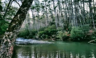
This river is amazing, low current makes its easy to walk in and there are a few little water falls we enjoyed hanging on for a bit.
Discover the beauty of dispersed camping near Baldwin, Georgia, where nature enthusiasts can find serene spots away from the crowds. With stunning views and a variety of landscapes, these locations offer a perfect escape for those looking to connect with the great outdoors.
Frequently Asked Questions
Which is the most popular dispersed campsite near Baldwin, GA?
According to TheDyrt.com, the most popular dispersed campground near Baldwin, GA is Cowrock Mountain with a 4.5-star rating from 2 reviews.
What is the best site to find dispersed camping near Baldwin, GA?
TheDyrt.com has all 38 dispersed camping locations near Baldwin, GA, with real photos and reviews from campers.
Keep Exploring