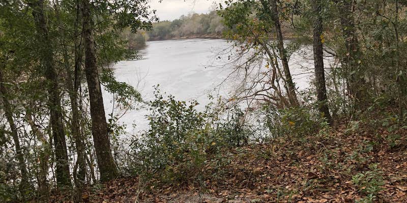

Within Suwannee River State Park, Peacock Slough River Camp operates as a boat-access facility along the Suwannee River Wilderness Trail. The Florida Department of Environmental Protection manages this river camp, which features five screened sleeping platforms with electricity, ceiling fans, and lighting. Each platform includes a picnic table and fire ring, while primitive tent sites provide additional camping options.
Kayakers and canoeists access the camp directly from the river using provided canoe racks and stairs leading up from the water. A bathhouse offers hot showers and ADA accessibility, with water spigots available at each platform and one primitive site. The camp includes wheelbarrows for transporting gear from boats to campsites, plus a large pavilion with additional picnic tables and grills. Reservations are available for groups, though individual sites operate first-come, first-served during some seasons.
Description
On this primitive site, visitors may enjoy biking, hiking, horseback riding, and wildlife viewing on administrative roads. The Peacock Slough River Camp is the fourth river camp between White Springs and Branford and provides 5 sleeping platforms, a picnic pavilion, restrooms with hot showers, and a tent-camping area.
Warning 1 Alert is In Effect
There is 1 alert for this campground. Camp safely!
Warning 1 Alert is In Effect
There is 1 alert for this campground. Camp safely!
The Suwannee River Wilderness Trail is a partnership of locations along the river whose purpose is to provide amenities for paddlers. The five River Camps at Dowling Park, Holton Creek, Peacock Slough, Adams Tract, and Woods Ferry are accessible by river only, and are not open to vehicular traffic. To maintain the wilderness experience, drive-in camping is not available. Many private, state and county locations are also available for overnight stays or restocking supplies.
RV Road Trip Guides


Map & DirectionsPeacock Slough River Camp is located in Florida near Mayo
Directions
Peacock Slough tract from Live Oak: Travel south on SR 51 to Luraville, turn left on 180th Street; travel approximately 100 yards, turn right on 203rd Road; travel south .5 miles; the entrance is on the left.
Coordinates
30.101325316695153 N
83.13696968555442 W
Connectivity
 T-Mobile5GGood Coverage
 VerizonLTESome Coverage
- AT&T5GGood Coverage
Connectivity
- T-Mobile5GGood Coverage
- VerizonLTESome Coverage
- AT&T5GGood Coverage
Access
- Boat-InSites accessible by watercraft.
Site Types
- Tent Sites
- Group
- Tent Cabin
Features
For Campers
- Picnic Table
- Firewood Available
- Phone Service
- Reservable
- Showers
- Toilets
- Alcohol
- Pets
- Fires
Drive Time
- 1 hr 8 min from Valdosta, GA
- 1 hr 9 min from Gainesville, FL
- 1 hr 18 min from Tallahassee, FL
- 1 hr 28 min from Ocala, FL


