Off-road enthusiasts and hikers will find Camp Dick Campground serves as a gateway to both motorized and foot trails in Roosevelt National Forest. The Middle St. Vrain trailhead begins directly from the campground's west side, providing access to the Buchanan Trail into Indian Peaks Wilderness and an extensive network of backcountry routes.
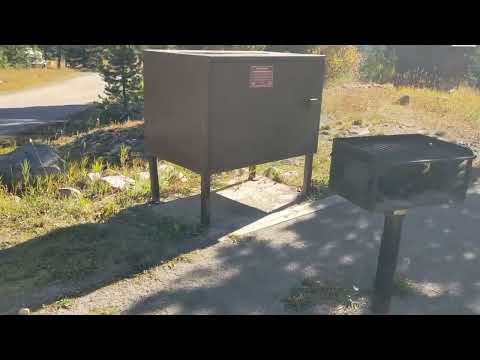
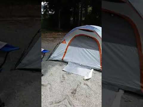
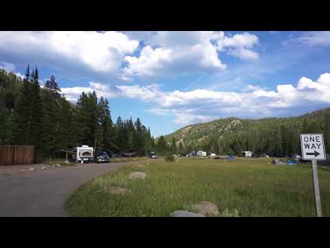
The campground accommodates about 40 sites across varied terrain, from open areas near the entrance loop to more forested spots along St. Vrain Creek. Karl G. notes that "sites inside the loop have no trees" while "better sites on the outside of the loop have trees and some are along the creek." Sites further up the hill offer thicker forest cover and more privacy. Each site includes a picnic table, fire pit, and bear-proof storage locker.
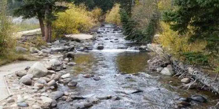
Creek access draws many campers for fishing and cooling off, though the constant flow of off-road vehicles creates dust and noise during busy periods. Peter I. found that "sites along the river" provide easy water access but "have no protection whatsoever" from weather. Wildlife sightings include moose families wandering through camp. The campground provides drinking water, pit toilets, and trash service but no cell coverage except near the entrance.
Access requires driving through Peaceful Valley campground first, and the road can become rough in poor weather. The season runs from mid-May through November, with reservations available through the Forest Service. Sites accommodate RVs up to 99 feet, though no hookups are provided. Campers seeking quieter alternatives might consider camping spots around Ward for different forest access points.
Description
Overview
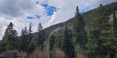
Camp Dick is the site of a Civilian Conservation Corps camp that was established in the 1930s. It is located just off the Peak to Peak Scenic Byway, on the Middle Saint Vrain Creek.
Recreation
The Middle Saint Vrain Creek is a good fly-fishing stream where anglers cast for rainbow, brown and cutthroat trout. Many trails in the vicinity are open to hiking and biking, including Sourdough and Buchanan Pass trails. The Indian Peaks Wilderness boundary is four miles from the west end of the campground. Mountain biking is allowed on the first five miles of Buchanan Pass Trail. Bikers can ride a loop from Peaceful Valley or Camp Dick, via Buchanan Pass Trail and Middle Saint Vrain Road, or Coney Cutoff and Coney Creek Roads and Sourdough Trail. The Middle Saint Vrain and Bunce School roads are popular among off-road vehicle enthusiasts. Guided horseback riding is available at Peaceful Valley Lodge, which is just over a mile away.
Facilities
Campsites will accommodate tents and RVs. Sites includes picnic tables and campfire ring with grill. Water spigots, vault toilets, and trash services are provided at the campground. Firewood may be purchased during the peak season. There are no electrical hook-ups, dump stations, or showers. Tents must remain on tent pads.
Natural Features
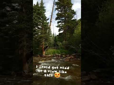
The campground is situated on the banks of the Middle Saint Vrain Creek in a glacial valley surrounded by mixed conifer and aspen forests and an open meadow.
Contact Info
For facility specific information, please call (530) 529-0578.
Nearby Attractions
The town of Allenspark is less than 10 miles north of the campground, and has a restaurant and a grocery store. Rocky Mountain National Park's main entrance is 25 miles north of the campground, in Estes Park. With lush valleys and craggy peaks reaching elevations higher than 14,000 feet, visitors are provided opportunities for countless breathtaking experiences and adventures. Scenic driving, hiking, backpacking, fishing, horseback riding and wildlife viewing are popular activities available within the park. Estes Park is a full-service community. Dining, shopping, rafting, fly fishing, horseback riding and golfing opportunities are available there. Lake Estes offers boating, sailboarding and fishing.
Charges & Cancellations
Modifications for this campground must be made through Recreation.gov or by calling the call center at 1-877-444-6777 PRIOR to your reservation start date. Customers and contact center agents cannot modify reservations on or after the check-in date.
Warning 1 Alert is In Effect
There is 1 alert for this campground. Camp safely!
Warning 1 Alert is In Effect
There is 1 alert for this campground. Camp safely!
STAGE 2 FIRE RESTRICTIONS IN EFFECT: Pursuant to 16 U.S.C. 551 and 36 C.F.R. 261.50(a), the following are prohibited on the National Forest System (NFS) lands in the Arapaho and Roosevelt National Forests and Pawnee National Grassland.1. Building, maintaining, attending, or using a fire, campfire, charcoal barbecue, or grill, except if using a device solely fueled by liquid or gas that can be turned on and off in an area barren or cleared of all flammable materials within three feet of the device. 36 CFR 261.52(a)2. Smoking, except in an enclosed vehicle or building. 36 CFR 261.52(d)3. Welding or operating an acetylene or other torch with open flame. 36 CFR 261.52(h)4. Using an explosive. 36 C.F.R. 261.52(b)5. Possessing or using a motor vehicle off NFS roads, except when parking in an area devoid of vegetation within 10 feet of the motor vehicle. 36 CFR 261.56.
RV Road Trip Guides


Map & DirectionsRoosevelt National Forest Camp Dick Campground is located in Colorado near Ward
Directions
From Denver, travel north on Interstate 25 north, to U.S. Highway 36 and continue west through Boulder, to Lyons. From Lyons, take Highway 7 for 12 miles to Highway 72, then continue south for four miles. Watch for signs for Peaceful Valley and Camp Dick Campgrounds. Turn west onto Middle Saint Vrain Road (County Road 92 & National Forest System Road 114) and proceed approximately one mile to Camp Dick.
Coordinates
40.13 N
105.5183333 W
Connectivity
 T-MobileNo Coverage
- VerizonNo CoverageVerified by 7 usersLast on 7/28/26
- AT&TNo Coverage
Connectivity
- T-MobileNo Coverage
- VerizonNo CoverageVerified by 7 usersLast on 7/28/26
- AT&TNo Coverage
Access
- Drive-InPark next to your site
- Walk-InPark in a lot, walk to your site.
- Boat-InSites accessible by watercraft.
Site Types
- Tent Sites
- RV Sites
- Standard (Tent/RV)
- Group
Features
For Campers
- Trash
- Firewood Available
- Reservable
- Drinking Water
- Toilets
- Alcohol
- Pets
For Vehicles
- Big Rig Friendly
Drive Time
- 42 min from Boulder, CO
- 1 hr 7 min from Fort Collins, CO
- 1 hr 8 min from Greeley, CO
- 1 hr 9 min from Denver, CO