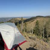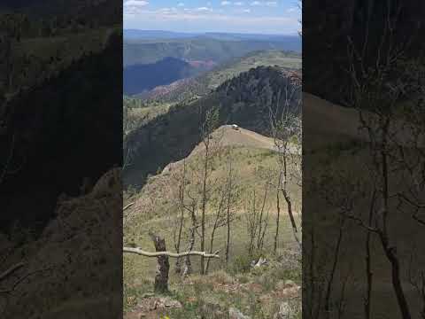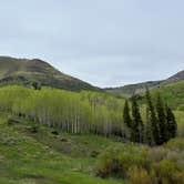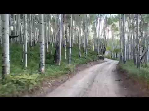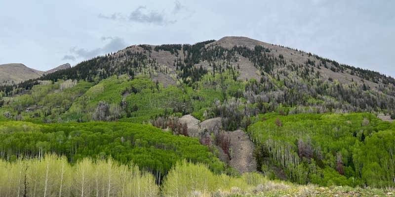
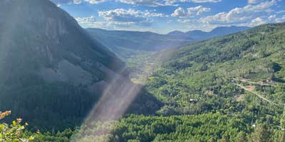
Hikers and off-road enthusiasts will find Last Dollar Road provides access to high-elevation dispersed camping with expansive valley views. This free Forest Service site sits along a network of dirt roads connecting Telluride and Ouray, requiring high-clearance vehicles and preferably 4WD capability. Multiple camping spots spread along the main road and branching spurs, with some tucked into forested areas and others positioned for open sightlines.
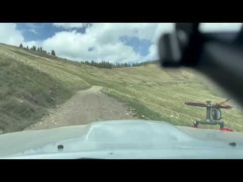
The road access determines much of the camping experience here. Kelsey W. notes "the road was rough.. we made it just fine in my hyundai tuscan but I will say, I was sh*ting myself driving it!" Most campers recommend approaching from the Telluride side via the airport route rather than the steeper, rockier eastern approach from Highway 62. The main camping area sits about 15-20 minutes up the gravel road, with additional sites accessible via rougher 4WD tracks.
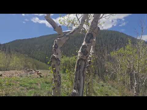
Campers can explore hiking trails including the Alder Creek trailhead located 0.7 miles down the road. A stream runs nearby, and dead fallen trees provide readily available firewood for evening campfires. The area attracts dirt bike traffic during daylight hours, though most riders respect camping areas. AT&T cell service reaches most sites, allowing connectivity despite the remote location.
Weather moves quickly at this elevation, with afternoon thunderstorms common during summer months. David experienced "50mph winds" during an overnight storm. Popular sunset viewing spots fill first, particularly on weekends, so early arrival helps secure preferred sites. The main lookout point sees frequent day-use visitors throughout the day.
Campers seeking additional options in the region can explore places to camp around Placerville or check nearby dispersed sites like Boondocks Last Dollar and Last Dollar Road #2. Plan for variable road conditions and pack accordingly for changing mountain weather.
Description
Please note that 4wd may be necessary.
In areas closed to the use of vehicles off forest roads, where developed parking sites are not provided, and where not otherwise prohibited, direct access to a suitable parking site within 300 feet of the road is permitted. Such travel must not damage the land or streams. Please select your route carefully, and do not cut live timber. Off road travel should be limited to when the ground is dry. The public is encouraged to camp in locations where others have previously camped and utilized existing routes to those camp areas. Campers are required to leave a clean camp, not to damage vegetation or pollute streams and lakes on the National Forest and implement “Leave No Trace” practices
Finding a site to camp and enjoy dispersed recreation activities in remote areas or in relative solitude has become a popular form of camping throughout the Forest. At some more popular areas,toilet facilities may be provided. Contact the local Forest Service office for current information and refer to the Motor Vehicle Use Map (MVUM) for each forest (Grand Mesa, Gunnison, and Uncompahgre National Forests). Dispersed camping is permitted in most areas of the Forest. Some caution should be used in selecting a site because of intermingled private lands within the National Forest. Recreation maps are available at all local Forest Service offices. Personnel at each office can answer questions on specific sites. Unlike developed campgrounds which are designed and maintained to protect the vegetation, soils, and natural setting, camping in undeveloped areas require more from the camper to help keep the site in the condition in which it was found. Dispersed camping must not occur within 100 feet of water sources (rivers, streams, ponds, or wetlands) or within 100 feet of any road or system trail. In some areas, dispersed camping is restricted to specific sites, contact the local Forest Service office for current information. Campsites can be occupied for no more than 14 days, then the site must be moved at least 3 miles away. Camping is also limited to a total of 28 days in a 60 day period.
RV Road Trip Guides


Map & DirectionsLast Dollar Road is located in Colorado near Placerville
Coordinates
38.00802486 N
107.96681518 W
Connectivity
 T-Mobile5GExcellent CoverageVerified by 2 usersLast on 7/26/26
 VerizonLTEGood CoverageVerified by 16 usersLast on 7/26/26
- AT&T5GExcellent Coverage
Connectivity
- T-Mobile5GExcellent CoverageVerified by 2 usersLast on 7/26/26
- VerizonLTEGood CoverageVerified by 16 usersLast on 7/26/26
- AT&T5GExcellent Coverage
Access
- Drive-InPark next to your site
- Walk-InPark in a lot, walk to your site.
Site Types
- Tent Sites
- RV Sites
- Standard (Tent/RV)
- Dispersed
- Group
Features
For Campers
- Phone Service
- Alcohol
- Pets
- Fires
DISPERSED CAMPING
Enjoy dispersed camping on government land and leave no trace. Pack in and pack out. No (or limited) services at this camping area. Permit may be required.
PERMIT might be REQUIRED
We curate permit requirements across the US for our PRO members. Try PRO to see if Last Dollar Road needs a permit.
Drive Time
- 2 hrs 8 min from Grand Junction, CO
- 2 hrs 48 min from Farmington, NM
- 5 hrs 3 min from Pueblo, CO
- 5 hrs 24 min from Colorado Springs, CO