Where the Conejos River flows through high-country terrain, Mix Lake sits within Rio Grande National Forest at an elevation that limits the camping season to summer months. This Forest Service campground accommodates RVs up to 22 feet and provides drinking water and restroom facilities for visitors exploring the area's lake and river access.
The campground operates from June through Labor Day, when snow conditions allow forest road travel. Campers looking for extended stays in the region can explore places to camp near Rio Grande National Forest for additional options. The Stunner campground lies two miles northwest for those comparing nearby sites.
Description
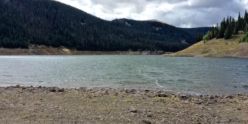
10,000-foot elevation. 22 campsites near Mix Lake. Convenient to the Conejos River, the San Juan Wilderness, Platoro Reservoir, and other nearby ponds and lakes. Numerous trailheads in the area. Mix Lake Campground is one mile west of Platoro in the Conejos River drainage. This is a good access point for the South San Juan Wilderness. Mix Lake, Platoro Reservoir, Conejos River, Lily Pond and Kerr Lake can all be accessed for fishing. Trail accesses include Lake Fork Trail 716 and Sawmill Gulch Trail. One can also visit the historic town of Platoro and the Mix Lake overlook is on-site. The campground has 22 sites with tables and fireplaces. 3 vault type toilets, refuse receptacles and pickup, ample parking with convenient trailer spaces and drinking water are provided
RV Road Trip Guides


Map & DirectionsMix Lake is located in Colorado near Rio Grande National Forest
Directions
Directions from Antonito, Colorado: Take Colorado Highway 17 west 23.0 miles to the Alamosa-Conejos River Road #250 at Elk Creek. Follow #250 23 miles up the Conejos River to Mix Lake.
Coordinates
37.35800013 N
106.54700055 W
Connectivity
 T-MobileNo Coverage
- VerizonNo Coverage
- AT&TNo Coverage
Connectivity
- T-MobileNo Coverage
- VerizonNo Coverage
- AT&TNo Coverage
Access
Site Types
- Tent Sites
- RV Sites
Features
For Campers
- Drinking Water
- Toilets
Drive Time
- 3 hrs 1 min from Santa Fe, NM
- 3 hrs 21 min from Farmington, NM
- 3 hrs 36 min from Pueblo, CO
- 4 hrs 16 min from Colorado Springs, CO

