Primitive camping near Carpinteria, California features several challenging backcountry options throughout Los Padres National Forest. The terrain rises from sea level to elevations above 6,000 feet, creating significant temperature variations between coastal and inland sites. Camping areas range from ocean-view boat-in sites to remote wilderness camps requiring significant hiking with full pack weight.
What to do
Hiking to waterfalls: Access the "punch bowls" from Big Cone Camp - Santa Paula Canyon, a primitive site reached via a moderate trail. "This is a fairly easy hike through what would not be considered a typical hike. It starts off going through Thomas Aquinas College, winding through horse property and oil fields, before finally opening up into Santa Paula Canyon," notes one camper who found it suitable for families.
Cross-island trekking: Plan a multi-day adventure on Santa Cruz Island - Del Norte Backcountry in Channel Islands National Park. "Hiked from Scorpion Harbor cross-island to Del Norte Camp, great way to see the island. Camped at site 1, had the most wind but also the best views of the ocean," reports a visitor who appreciated the solitude of sharing the campground with only one other group.
Stargazing: The open landscapes at Carrizzo Plain National Monument Dispersed offer exceptional night sky viewing. A camper noted, "The stars were also quite visible with minimal light pollution. The area is hilly and beautiful with enough flatness and openness to pitch a tent without issue."
What campers like
Wildlife viewing: Island foxes frequently visit campsites at Santa Cruz Island. "Saw lots of island foxes - so cute! Note that there are gear restrictions for the cruise (check the website). Also you have to PACK YOUR OWN WATER. And use the food storage boxes to protect your food from the foxes," advises a camper who backpacked to the site.
Solitude in mountain locations: Morrow Hill Dispersed provides quiet camping with elevated views. "We had a great and quiet night up there in our 21ft RV. But the road is a little tricky and we almost wouldn't have driven there. Make sure, you really stay at the place up the hill (coordinates) otherwise the landlord will clarify that you're on private property," warns one visitor.
Proximity to water sources: Several campers mention appreciating access to swimming areas during hot weather. At Big Cone Camp, one visitor shares that "From Big Cone Camp you can easily reach the waterfalls and pools that make this area known as the 'punch bowls'. Depending on weather and water conditions there are some nice water rock slides, and a few pools you can jump from the cliffs into."
What you should know
Restricted camping zones: Los Padres National Forest has specific no-camping areas clearly marked. At Los Padres NF - Dispersed Camp, a camper clarifies important restrictions: "There is a nice hike-in campsite about 1.5 miles up the Chorro Grande trail called Oak Camp. I think the other review here might be unintentionally implying that camping along the 33 is allowed. It isn't."
Weather extremes: Temperatures can drop significantly below forecasts, particularly in winter. At Carrizzo Plain, a camper reported, "It was about 15 degrees (F) colder than was forecasted (20 F vs 35 F) at night, so be prepared to be a bit chilly if visiting during the winter."
Wind exposure: High elevation sites typically receive strong winds. At Chorma Camp, a visitor observed the site is "situated high on a bluff it gets lots of wind, and with very little shelter around to break it, if you camp here you will get the brunt of it."
Tips for camping with families
Start with accessible options: Choose sites with reasonable hiking distances for children. A camper at Big Cone Camp recommends it because "it is one of my favorite spots simply because it is close and when my kids were young it was a fairly easy hike to get to, and there's a nice reward when you get there."
Pack extra water: Most primitive sites have no drinking water sources. For Santa Cruz Island camping, a visitor advises, "It's only 4-miles from harbor to campsite, but it's mostly uphill. My friends were beginner backpackers so it was a bit tiring, but it was over quick and I still think it's a great trip for beginners."
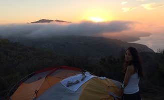
Prepare for dampness: Coastal sites often experience heavy fog. "When we woke up everything was damp from the seaside fog. But the fog made the views quite lovely," reports a camper at Santa Cruz Island - Del Norte Backcountry.
Tips from RVers
Access challenges: Several dirt roads become impassable during wet conditions. A camper at Carrizzo Plain notes, "Arrived on a drizzly day & tried going further down the road to other more secluded camping spots. However the dirt road was slick & minivan, loaded down, was slipping & sliding. Backtracked to a nice spot, camaflouged by a small hill."
Limited turnaround space: Most forest roads have minimal width for larger vehicles. At Figueroa Mountain Road Pullout, a camper observed, "The site is all up hill and really only has a small area where a few vans can fit. But the views are awesome."
Private property boundaries: Always verify exact locations of dispersed camping areas. At Morrow Hill Dispersed, visitors noted the importance of staying in designated areas: "Make sure, you really stay at the place up the hill (coordinates) otherwise the landlord will clarify that you're on private property."


