Dispersed camping near Witts Springs, Arkansas offers backcountry sites throughout the Ozark National Forest at elevations between 800-2,000 feet. The area experiences distinct seasonal changes with fall temperatures ranging from 40-70°F and summer highs regularly exceeding 90°F. During spring months (March-May), rainfall averages 5 inches per month, making creek crossings challenging on forest roads.
What to do
Waterfall hiking: 1.25-mile trek to unnamed falls from Adams Mountain Rd Dispersed Campsite. "The ATV trail is a nice hiking trail into the forest. A 1 1/4 mile hike takes you to a small unnamed waterfall, which may not be running during the dry season," notes camper Fred S.
Rock climbing access: Sam's Throne Recreation Area serves as a central hub for climbers. "There are a number of trails outside the main established trails. Our second day there we spent eight hours skirting along the bluffs and exploring what looked like beautiful fairy lands," shares Ashley F.
Creek exploration: The Middle Fork Illinois Bayou provides water access at multiple points. "Large clearing along the Middle Fork of the Illinois Bayou. Located on Middle Fork Road, about a 1/4 mile in from AR Hwy 27, near Hector, AR," reports Fred S. about this free camping option near Witts Springs.
What campers like
Stargazing opportunities: The remote location creates ideal night sky viewing. "Amazing peaceful campsite. Can be eerie pulling up at night but is so beautiful and peaceful. On the right dark night you can see every star in the sky," writes bri about Sam's Throne.
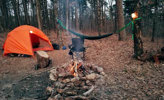
Private camping layouts: Many dispersed sites offer natural separation. "Private camping spots, with trees separating each site," notes Kelsey R. about the camping setup at Sam's Throne Recreation Area.
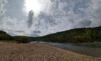
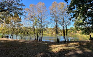
River beach access: Woolum Dispersed Area provides unique water features. "Right on the river with both a rock and sand beach currently. Fire rings. Only one other camper that's at the other end of the campground on memorial weekend," shares William M.
What you should know
WMA permit requirements: Wildlife Management Areas have specific rules. "100% of Wildlife Management Areas in the state of Arkansas require a Hunting license or WMA camping permit purchased though Arkansas Game and Fish... for $5," explains Poopy B. about Gene Rush Wildlife Management Area.
Limited amenities: Most sites lack basic facilities. "No running water or showers just two vault toilets. Some campsites have cell phone service. ATT had the best out of all of our phones," reports bri about Sam's Throne.
Road challenges: Forest roads can be difficult to navigate. "Road is kinda sketchy on the way up but the bluffs are fantastic!" warns Clayton R. about access to Sam's Throne.
Seasonal flooding: Water levels affect accessibility. "I just tried to make a trip up there at the end of April (2022) and the final stretch of access road was blocked off due to erosion according to NPS," reports John W. about Woolum.
Tips for camping with families
Wildlife viewing opportunities: Dawn and dusk offer best animal sightings. "Bambi and her mom also seem to live here," notes bri about regular deer sightings at Sam's Throne.
Swimming spot access: Brock Creek Lake View Dispersed offers water recreation. "Large open dispersed site set back from Charleston Road, just north of Bell Rd (Forest Road 1334)... There is a dirt ramp into the lake," explains Fred S.
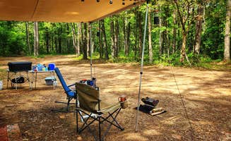
Group site availability: Some locations accommodate multiple families. "The site is large enough for 3 car/truck/campervan rigs. Area is level for rigs & tents, although the ground is mostly hard buried gravel - maybe uncomfortable to sleep without pads," warns Fred S. about Middle Fork Dispersed Site.
Tips from RVers
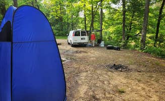
Site access limitations: Most dispersed sites accommodate smaller rigs only. "It's a small, level dirt site, mostly shaded in a small clearing in the trees... It's a pull-in site which can accommodate one vehicle - truck camper and smaller," notes Fred S. about Austin Trailhead Dispersed.
Leveling requirements: Uneven terrain needs preparation. "The dispersed site is a dirt surface with some embedded rocks jutting out. Some leveling may be required depending where the rig is parked," explains Fred S. about Brock Creek - Charleston Rd Dispersed.
Size-specific recommendations: Woolum works for larger trailers. "This is a very primitive campground, but it's one of our favorites! We can almost always find a spot to camp and it's super easy to pull our trailer into every spot there," recommends Shelly J.