Primitive camping near Greenbrier, Arkansas offers diverse options throughout the Ozark National Forest, with most sites situated at elevations between 500-1,500 feet. The region experiences distinct seasons with humid summers reaching 90+ degrees and mild winters, making spring and fall ideal camping periods. Many dispersed sites feature natural drainage systems due to the region's karst topography.
What to do
Hiking opportunities: Near Tackett Mountain Road Dispersed, campers can explore short forest trails. "There are no hiking trails here, although one can take a stroll along FR90231L which is less than a half-mile long," notes Fred S.
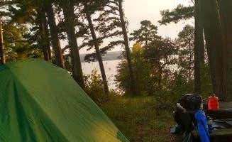
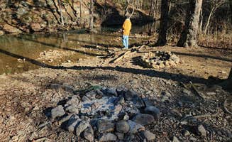
Fishing access: Several sites provide fishing access, particularly at Brock Creek Lake View Dispersed where "there is a dirt ramp into the lake" according to one reviewer, though water levels vary seasonally.
Stargazing: The Group Dispersed campsite on Charleston Road provides excellent night sky viewing due to minimal light pollution. "The site is open with little shade, making recharging with solar panels possible. Other than accommodating a group of OHV and offroad enthusiasts, and stargazing at night, there is nothing remarkable about this campsite," writes one camper.
What campers like
Privacy and quiet: Brown Creek Cascade Dispersed Campsite receives praise for its tranquility. "Very quiet; no vehicles passed by during the night. The sound from the creek was soothing," reports Fred S. Another camper mentioned, "Not many cars drive down the road, saw some people hiking."
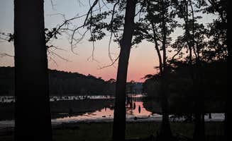
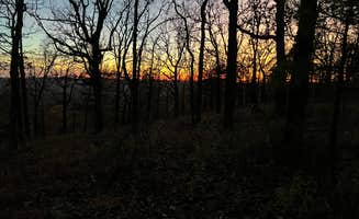
Lake views: Many campers appreciate waterfront sites. At Harris Brake Lake, Julian P. shares, "absolutely beautiful place the fireflies here are amazing! Nobody else was camping here which made for some quiet nights." Ashley T. adds, "Got here during sunset and it was beautiful."
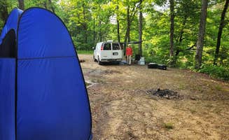
Accessible locations: Several sites feature relatively easy access from main roads. "This site is a level with a dirt and grass surface. The site can accommodate multiple vehicles; tent camping is possible," notes a reviewer about the Group Dispersed campsite on Charleston Road.
What you should know
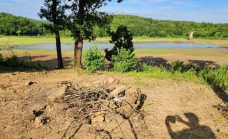
Variable conditions: Water levels at lakes can fluctuate significantly. At Camp Robinson Dispersed Site, Julie A. observed, "The lake has been partially drained to allow work to be done on stumps. The road back to it is well maintained and we had good cell reception with AT&T and Spectrum."
Wildlife challenges: Prepare for insects during warmer months. "There is a lot of ticks here i pulled 7 off of me and my dog in one night," warns Julian P. about Harris Brake Lake. Some sites also have poison ivy around their perimeters.
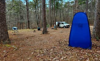
Site maintenance: Many sites have minimal upkeep. "Picked up a med bag of trash; cans, bottles, and paper. Looks better now. I definitely put on bug spray right away," reported Ken H. about his stay at Camp Robinson.
Tips for camping with families
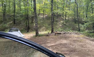
Choose established sites: Families often prefer sites with defined boundaries. At Charleston Road Dispersed, "The site has a dirt surface; not quite level, but more level toward the rear. It is a pull-in site which can accommodate one campervan and smaller."
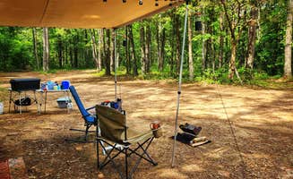
Bring activities: With limited amenities, pack entertainment. Arthur S. from Brown Creek notes, "Bring a chair if you want a comfortable seat, also hard to find decent wood to burn, had to walk a bit to find."
Be aware of hunting seasons: Some areas permit hunting nearby. "Sunday morning there were hunters out, so hearing gunshot pretty close to camp," mentions Arthur S. about Brown Creek Cascade Dispersed Campsite.
Tips from RVers
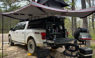
Size restrictions: Most dispersed sites accommodate smaller rigs only. At Base of North Fork Pinnacle Dispersed, Fred S. notes, "This dispersed campsite can accommodate 3 or 4 small to midsize rigs. Tent and hammock camping is possible."
Road conditions: Access roads vary widely in quality. "The ride on Forest Road 132 from the east (Hwy 9) is bumpy/rocky in several places. Erosion seems to be getting worse over time on this unpaved road. I aired-down the tires for ride comfort."
Leveling needs: Prepare for uneven terrain. At Brock Creek - Charleston Road Dispersed, "Some leveling may be required depending where the rig is parked," according to a visitor, while other sites like Brock Creek Lake View have "a dirt surface with some embedded rocks."


 Legend