Within the Coronado National Forest, Reef Townsite Group Area sits high among ponderosa pines at the end of a challenging five-mile mountain road. This Forest Service group campground operates seasonally from mid-March through October, requiring reservations and accommodating parties willing to tackle the steep, rocky access route.
The narrow dirt and rock road demands careful navigation, with sections running close to steep drop-offs and occasional passing turnouts. Reviewers consistently note the drive takes around 45 minutes for the final four miles, though Jane J. found her "Dodge Caravan handled it slow-but-sure." Higher clearance vehicles fare better on the rocky terrain, and conditions can deteriorate quickly with weather.
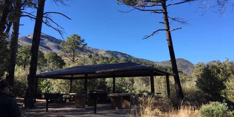
Campsites spread among tall pines with good spacing between spots. An interpretive loop trail with historical signs tells the story of the area's former mining operations, while another trail leads to cliff edges overlooking the desert valley below. Campers report finding pools of cool water in a canyon accessible by hiking northeast from the back of the campground. The Old Sawmill Spring Trail begins across the road, connecting to the Carr Peak Trail system.
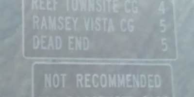
The elevated location provides relief from desert heat and supports wildlife including javelina, bears, and mountain lions. Cell service disappears in the final mile of road access. For those seeking additional mountain camping options, Ramsey Vista Campground lies nearby on similar forest terrain.
Description
Overview
This high-mountain group campground and day use area is located on a site that was once occupied by the old mining town of Reef. Many relics of Reef's mining history, including the remains of the town's old water system, are still visible in and around the campground. Groups of up to 50 people can enjoy walking an interpretive history trail, hiking, horseback riding and watching wildlife in this cool mountain setting.
Recreation
Reef Townsite Loop Trail, an interpretive trail that highlights the mining history of this area and showcases beautiful views, begins and ends at the northeastern edge of the campground. The national forest has a variety of hiking and mountain biking trails for those who wish to leave the facility for a day trip.
Facilities
Reef Townsite can accommodate one group of up to 50 people at a time. Facilities include a picnic shelter that contains six picnic tables, two large group barbecue grills and two food preparation tables, as well as toilets, a parking area and a large shaded area for tents.
Natural Features
This site rests on the "Reef" rock formations in the in the Huachuca Mountains. At an elevation of 7,200 feet, it provides a cool respite from the heat of surrounding lower deserts in summer. The Coronado National Forest covers 1.78 million acres of southeastern Arizona and southwestern New Mexico. Elevations range from 3,000 to 10,720 feet in 12 widely scattered mountain ranges, or "sky islands," that rise dramatically from the desert floor, supporting biologically diverse plant communities.
Fee Info
RV Road Trip Guides


Map & DirectionsReef Townsite Group Area is located in Arizona near Fort Huachuca
Directions
From Tucson, Arizona, drive east on I-10 to exit 302 to State Route 90. Drive south 25 miles through Sierra Vista. Proceed 8 miles south of Sierra Vista on State Route 92 and turn west onto Carr Canyon Road/Forest Road 368. Forest Road 368 is a narrow gravel road with steep mountain grades, tight switchbacks and recomended for vehicles with good clearance. Contact Sierra Vista Ranger District Office if you have questions or want to know current conditions.
Address
4070 S Avenida Saracino
Hereford, AZ 85615
Coordinates
31.4291667 N
110.2905556 W
Connectivity
 T-Mobile5GGood Coverage
 VerizonLTESome CoverageVerified by 2 users
- AT&TLTESome Coverage
Connectivity
- T-Mobile5GGood Coverage
- VerizonLTESome CoverageVerified by 2 users
- AT&TLTESome Coverage
Access
- Drive-InPark next to your site
Site Types
- Tent Sites
- RV Sites
- Standard (Tent/RV)
- Group
Features
For Campers
- Picnic Table
- Reservable
- Drinking Water
- Toilets
- Pets
- Fires
Drive Time
- 34 min from Sierra Vista, AZ
- 1 hr 29 min from Tucson, AZ
- 3 hrs 23 min from Phoenix, AZ
- 4 hrs 9 min from Las Cruces, NM


