Peaks Valley Preserve is located near varied terrain with flatlands and hills. The area experiences temperatures ranging from 40°F in winter to 90°F in summer. Nearby attractions include Chiricahua National Monument and Fort Bowie National Historic Site.
Description
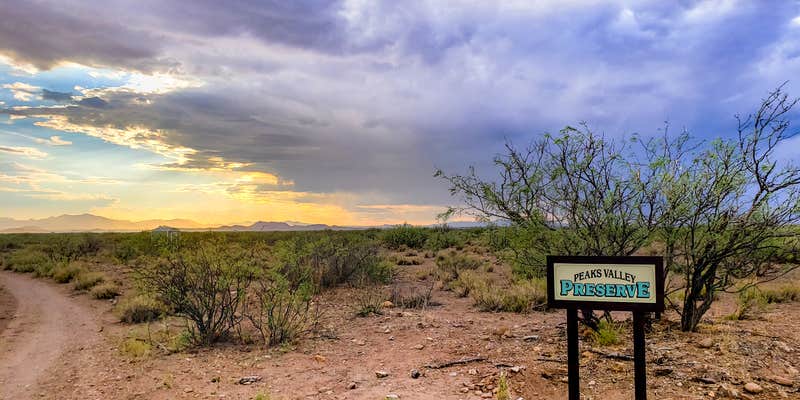
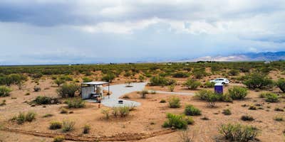
Peaks Valley Preserve was created to be a space where people can camp out in the wild, but still have amenities- like power (solar power generator, not enough for RV though), water, and a bathroom. This 5 acre property was developed with nature in mind, and we aimed to keep it as natural as possible as most of the land was left wild, for your hiking and viewing pleasure! Primary vegetation are Mesquite trees, Cholla cactus, Turpentine bushes, Yucca. Tons of privacy, as there are few neighbors nearby and the roads bordering the property are lightly travelled. Road was recently expanded to be levelled and widened. Feel free to hike around the 5 acres, boundaries are the road to the South and East, and private property signs to the North and West. This is a natural area, so be wary of wildlife dens, tracks, and scat.
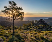
Settled only a few miles from the gorgeous Chiricahua mountains in the charming rural community of Sunizona, there are ample opportunities to see wildlife (coyote, javelina, jackrabbits, unique birds and more have all been spotted on the property), and explore the area. From the nearby Turkey Creek (runs in the summer and must be crossed to access the property), to the 360 degree views of "Sky Island" mountain ranges, this property is centrally located to allow full exploration of everything Cochise County has to offer! In the winter, be sure to see the Sandhill Cranes during their migration- an incredible sight to behold. There is plentiful hiking in the surrounding areas, and on occasions you can spot Coatis, mountain lions, eagles, and maybe even a jaguar!
Immerse yourself, not only in the beautiful nature, but also the rich history this area has to offer. From the Native American tribes who called this place home, to the rise and fall of the Wild West, journeying through this land certainly takes you back in time! Be sure to see the world's largest Rosebush in Tombstone, you won't regret it. There are numerous ghost towns in the area as well, worth the visits!
The weather in this region is wonderful- just be wary of heat in the early summer and monsoons/storms in the mid/late summer. AWD/4x4 vehicles recommended, but not required as the property is off a well maintained dirt road. During monsoon season, the creek may flow, making SUV/trucks recommended.
Nearby towns: Sunsites, Tombstone, Bisbee, Sierra Vista, Portal, Tucson (1.5 hours away)
Nearby attractions: Chiricahua National Monument, Dragoon mountains, Cochise Stronghold, Dos Cabezas Peaks, Whitewater Wildlife Draw, Ash/Ramsey Canyon (hummingbirds galore!)
RV Road Trip Guides
Location
Private CampgroundPeaks Valley Preserve is located in Arizona
Directions
-From HWY 191, turn onto HWY 181 for 10 miles (mile marker 48) -Navigate to the intersection of HWY 181 and Single Tree Lane, on your left -After .5 miles, turn right onto Uncle Curtis Lane -After .3 miles, turn left onto Cross Creek Rd -After 1.5 miles, turn left onto Night Owl Lane -After .5 miles, turn left onto S Los Gatos Trail -After 1 mile, keep right on S Los Gatos Trail (Past where Google says to turn, this is incorrect) -After .3 miles, turn right on S Los Gatos Trail (yes, there are multiple of the same road names here!) -After .2 miles, arrive at the property- look for the PEAKS VALLEY PRESERVE sign! -When you see the Peaks Valley Preserve sign (on your left) continue straight on Los Gatos Trail for another .10 miles -Parking areas will be on the left of the road. Parking areas are graveled and are along the perimeter of the property. -Entrance to main camp area is just past parking on the left, look for the graveled entrance area. -Main camping site is behind the grill, in front of the irrigation trench. -Enjoy!
Coordinates
31.8882282 N
109.54408527 W
Connectivity
- T-Mobile5GExcellent Coverage
- VerizonLTESome Coverage
- AT&T5GExcellent Coverage
Connectivity
- T-Mobile5GExcellent Coverage
- VerizonLTESome Coverage
- AT&T5GExcellent Coverage
Access
- Drive-InPark next to your site
- Walk-InPark in a lot, walk to your site.
Site Types
- Tent Sites
- RV Sites
- Standard (Tent/RV)
Features
For Campers
- Picnic Table
- Firewood Available
- Phone Service
- Reservable
- Drinking Water
- Toilets
- Alcohol
- Pets
- Fires
For Vehicles
- Pull-Through Sites
Drive Time
- 1 hr 14 min from Sierra Vista, AZ
- 1 hr 24 min from Tucson, AZ
- 3 hrs 19 min from Las Cruces, NM
- 4 hrs 1 min from El Paso, TX


