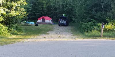
Spread across 2.2 miles of winding paved roads within the Peshtigo River State Forest, Governor Thompson State Park Campground occupies a remote corner of northern Wisconsin where cellular service drops to minimal levels. The campground's 50-site layout disperses campers across multiple loops, with most sites tucked into individual wooded pockets that provide natural screening between neighbors. "Almost all the campsites are private and hidden away in their own little spots," notes Tammie R..
The forest setting creates an atmosphere where wildlife encounters are common. Campers report hearing bears and coyotes at night, while ticks present a persistent challenge during warmer months, particularly for those exploring the hiking trails. Several reviewers found multiple ticks after trail walks, despite thorough inspections. The campground maintains clean shower and restroom facilities, with additional pit toilets distributed throughout the loops.
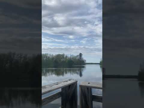
Water access centers on a small lake suitable for kayaking and swimming, though the water turns dark once campers wade in past the shoreline. A boat launch provides access to Cauldron Falls Reservoir for those with watercraft. The park offers boat-in camping sites on an island, requiring about 40 minutes of paddling from the launch area. Hiking trails wind through the property, and wild raspberry bushes grow throughout the campground area.
RVs up to 50 feet can access sites with full hookups, while tent campers find level spots among both electric and non-electric options. The campground operates year-round with reservations available through the Wisconsin state park system. Out-of-state visitors pay significantly higher fees, including required park admission stickers. For additional camping options in the region, consider Old Veterans Lake Campground, located less than two miles away. This location works best for campers comfortable with remote settings and minimal connectivity.
Description
With more than 2,800 acres of woods, a family campground, picnic and beach area, hiking and skiing trails, and 6 miles of shoreline on Caldron Falls Flowage, visitors will find an atmosphere perfect for relaxation and recreation. The park is adjacent to the Peshtigo River, a popular free-flowing river for fly-fishing and canoeing. A 100-site family campground and 3 boat access campsites on the south shore of Caldron Falls Flowage are available. An enclosed shelter at the Woods Lake beach area is a terrific facility for group events and is also reservable.
RV Road Trip Guides

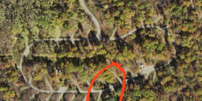
Map & DirectionsGovernor Thompson State Park Campground is located in Wisconsin near Athelstane
Directions
From Crivitz, travel northwest on County Highway A to County Highway X (four way stop). Turn left on County Highway X. Continue on Highway X past the High Falls Reservoir bridge and then turn right on Parkway Road. Go north about .5 mile on Parkway Road and then turn left on Ranch Road. Go west on Ranch Road about 1 mile to Paust Lane. Turn right (north) on Paust Lane to enter the park.
Address
N10008 Paust Lane
Crivitz, WI 54114
Coordinates
45.34239619 N
88.23900567 W
Connectivity
 T-MobilePossible CoverageVerified by 24 usersLast on 6/23/26
 VerizonNo Coverage
 AT&TLTESome CoverageVerified by 2 usersLast on 6/23/26
Connectivity
- T-MobilePossible CoverageVerified by 24 usersLast on 6/23/26
- VerizonNo Coverage
- AT&TLTESome CoverageVerified by 2 usersLast on 6/23/26
Access
- Drive-InPark next to your site
- Walk-InPark in a lot, walk to your site.
- Hike-InBackcountry sites.
- Boat-InSites accessible by watercraft.
Site Types
- Tent Sites
- RV Sites
- Standard (Tent/RV)
- Group
- Tent Cabin
Features
For Campers
- ADA Access
- Trash
- Picnic Table
- Firewood Available
- Phone Service
- Reservable
- WiFi
- Showers
- Drinking Water
- Electric Hookups
- Toilets
- Alcohol
- Pets
- Fires
For Vehicles
- Sanitary Dump
- Sewer Hookups
- Water Hookups
- Pull-Through Sites
- 30 Amp Hookups
- 50 Amp Hookups
- Big Rig Friendly
Contact
General Info
Reservations
Drive Time
- 1 hr 14 min from Green Bay, WI
- 1 hr 34 min from Appleton, WI
- 1 hr 53 min from Wausau, WI
- 1 hr 54 min from Oshkosh, WI