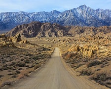
Orderville Gulch Trailhead in Utah features rugged terrain with canyons and rocky landscapes. Temperatures can range from highs in the 90s during summer to lows in the 20s in winter. Nearby attractions include Zion National Park and the Coral Pink Sand Dunes State Park, offering additional exploration opportunities for campers.
Description
While hiking in Orderville Gulch, you experience sheer cliffs that tower overhead. If you plan to travel the entire length of the canyon, you will need experience using ropes to down-climb, or rappel 15 feet. You will also need a permit from Zion National Park because you will exit in the Temple of Sinawava. This is typically done as a day trip. If exiting the canyon at the upstream Orderville Gulch trailhead, it usually takes approximately 4 to 6 hours round trip. If you exit downstream and exit in Zion National Park, it will take approximately 8 to 12 hours. A permit is required from Zion National Park to exit at the Temple of Suawava. Mileage: Various lengths, depending on how far down the canyon you would like to hike. 12.3 miles from the Orderville Gulch Trailhead to the Temple of Sinawava.
RV Road Trip Guides

Map & DirectionsOrderville Gulch Trailhead is located in Utah near Orderville
Directions
From Highway 9, take The North Fork County Road. After 5 Ѕ miles, the road will turn to dirt. Once you’ve left pavement, travel on the North Fork Road for 7 miles. There is a sign on the west side of North Fork Road indicating that route 92 accesses Orderville Gulch. If you do not have a four-wheel-drive, high-clearance vehicle, park on the eastern side of the gate and follow the route for 3 miles to the Orderville Gulch Trailhead. BLM route 92 beyond the gate, requires a four-wheel-drive, high clearance vehicle. This route is not recommended for travel in a passenger car. These routes may be impassable during the winter and monsoonal months due to snow, mud, or washouts. The dirt portion of the North Fork County Road is impassable when wet due to its clay base. When wet, the road becomes mud, which is impassable even for four-wheel-drive, high-clearance vehicles. It is most often impassable in winter and monsoonal months.
Coordinates
37.33530927 N
112.83340255 W
Connectivity
 T-MobileNo CoverageVerified by 1 user
- VerizonNo Coverage
 AT&T5GExcellent Coverage
Connectivity
- T-MobileNo CoverageVerified by 1 user
- VerizonNo Coverage
- AT&T5GExcellent Coverage
Access
Site Types
- Tent Sites
Features
Drive Time
- 1 hr 40 min from St. George, UT
- 3 hrs 22 min from Las Vegas, NV
- 4 hrs 3 min from Flagstaff, AZ
- 5 hrs 15 min from Prescott Valley, AZ

