Dispersed camping sites near Lewiston, Utah provide access to Cache National Forest at elevations ranging from 5,200 to 8,000 feet. Summer temperatures typically range from 50-85°F while dropping to 30-40°F at night at higher elevations. Most dispersed sites in this area require campers to practice Leave No Trace principles and remain accessible from May through October.
What to do
Mountain biking trails: Green Canyon offers extensive trail systems for mountain bikers. "Cool rock visuals above a majority of the sites. Also tons of trails and mountain bikers. Met some climbers working on a sketch little project on one of the many many boulders," notes one Green Canyon Dispersed Campground visitor.
Cross-country skiing: Winter recreation options exist despite road closures. "In the winter months the road is closed, and is groomed by a local group named Nordic United. They groom it for cross country skiing several times a week and after every good storm. Trail is also used during the winter for snowshoeing, as well as Fat Tire snow biking."
Hiking to unique spots: The area contains several notable hiking destinations. "There are many different places to visit throughout the area such as the 'Plane Crash' site, Beaver Creek, old logging trails, and more," explains a camper at Franklin Basin Dispersed Camping.
What campers like
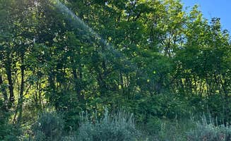
Riverside camping: Many sites sit directly adjacent to water features. "It's a very pretty canyon with a creek running through it," notes a reviewer at Smithfield Dispersed Campsite. Another camper adds, "Stayed here for two nights, at the end of a dead end road, close to the creek. Real easy place to be."
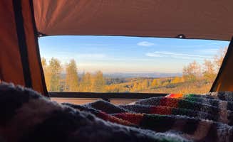
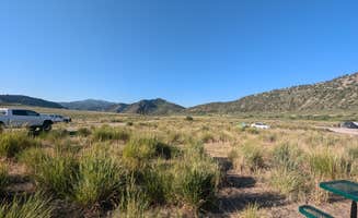
Panoramic views: The mountainous terrain provides scenic vistas. "The views are beautiful, but it can get quite blustery. We weren't able to have a fire when we stayed there," explains a visitor to Dispersed camping near Monte Cristo.
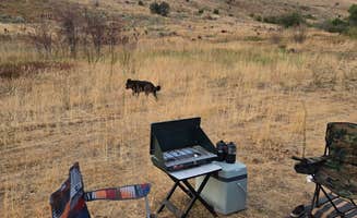
Privacy options: Site layouts vary from social to secluded. "There are close spots for small couples and large groups and also more private spacious spots for people with pets like me," notes a Green Canyon camper. For those seeking total isolation, "Ended up driving this road up to Idaho to find a bigger spot and some solitude. Took the dirt road for about 30 minutes and got the most perfect spot. Nobody was near us and the view was amazing."
What you should know
Fire restrictions: Seasonal fire bans occur regularly. "We went at the beginning of June, it was a bit chilly some mornings and at night, so come prepared," warns a Franklin Basin camper, highlighting the need for alternate heat sources when fire restrictions are in place.
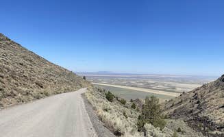
Road conditions: Access varies significantly by location. "This road is rough and very bumpy," notes one Franklin Basin visitor, while another mentions, "2wd friendly road for MILES. You can drive well into Idaho. You can drive for about 1.5 hours up in here and see amazing river meadow mountain views."
Site occupation patterns: During peak season, finding free camping near Lewiston can require strategy. "Tons of land, tons of campsites.. but most are 'occupied' by empty trailers with no other vehicles or people around," reports one Franklin Basin visitor. For Curtis Creek / Arbs Basin, the experience differs: "We stayed here for the night on our rooftop tent. It's very quiet, barely any people. There's man made firepits made out of rocks of people who have stayed here."
Tips for camping with families
Bathroom access: Plan accordingly for limited facilities. "Pit toilets and the entrance and a little bit up the road, very clean!" reports a Green Canyon visitor. Most sites lack toilets entirely, requiring self-contained solutions.
Site selection timing: Arrive early to secure suitable spots. "I went by myself on a Friday afternoon and it was super busy but there were still some spots for just a car right off the side of the road which worked fine for me since I was car camping, but I would be cautious if you aren't car camping to make sure you show up earlier than I did (6pm)," advises a Franklin Basin camper.
Weather preparation: Temperature fluctuations require layering strategies. "It was a bit chilly some mornings and at night, so come prepared," notes one camper about early June conditions at higher elevations near Lewiston.
Tips from RVers
Size limitations: Many dispersed sites accommodate only smaller rigs. "Not sure where precious reviewer went but the GPS coordinates are for a dirt pull out beside a narrow spring. A mile further uphill on dirt road is a small camping area," reports a visitor to Heart Mountain Spring, highlighting the importance of accurate location information.
Level surfaces: Finding flat parking for larger vehicles requires scouting. "About 1/4 mile down a dirt road from Hwy 39 is a good single boondocking spot with a great view. Not for large RVs. Our 17 ft trailer with 4x4 was tricky to get into the spot because the loop was so small," notes a Monte Cristo camper.
Road clearance needs: Some access roads require specific vehicle capabilities. "No warning that the road narrows with no turn around about a mile into the campground, or the trees are overgrown which scratched up my sides. The only spaces large enough for my 23 ft RV were occupied," warns a Smithfield visitor.


 Scout
Scout