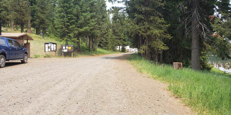
Within Umatilla National Forest, Penland Lake provides multiple camping options including tent sites, RV spots, and walk-in areas near the water's edge. The US Forest Service manages this established campground with basic amenities like vault toilets and trash service, plus ADA accessibility and cell coverage for connectivity needs.
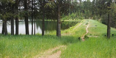
Campers report mixed water quality conditions, with some noting leeches present during wading activities. The lake supports fishing and boating rather than swimming, while tent sites cluster close to the shoreline with designated parking areas. Site spacing varies significantly—waterfront spots sit quite close together, but campsites around Umatilla National Forest farther from the lake offer more room to spread out.
Description
Fall asleep to the sound of crickets and frogs chirping and croaking and wake up to Blue Gill and Rainbow Trout jumping at the bit. This campground is set on the shore of Penland Lake, which also abuts private land and land owned by Oregon Department of Fish and Wildlife (ODFW). Penland is popular on summer weekends and offers access to fishing, boating, and swimming opportunities. There are seven campsites and two vault toilets on the National Forest portion of the campground, with more campsites located on the adjacent ODFW property. There is also a boat ramp, fishing dock, and benches located on the dam. Picnic tables are available for Day Use on the lakefront as well. There is no potable water or garbage service; please pack out all garbage and dispose of it at home.
Warning 1 Alert is In Effect
There is 1 alert for this campground. Camp safely!
Warning 1 Alert is In Effect
There is 1 alert for this campground. Camp safely!
Air Quality at this campground may currently be unhealthy. Please check with the campground before making a reservation.
RV Road Trip Guides


Map & DirectionsPenland Lake is located in Oregon near Ukiah
Directions
From Heppner, Oregon (1 hour): Head south while following Main street which turns into Oregon Highway-207 South. For 0.7 miles south of Heppner take a left turn onto Heppner Spray Willow Creek Road (Forest Service Road 53 and County Road 678) for 22.4 miles. After passing Cutsforth Park, climbing Coalmine Hill, and passing Coalmine Hill campground, continue on the Western Route (Forest Service Road 53 and County Road 678) for 0.2 miles. Turn right to take Forest Service Road 21 (County Road 603) for 2.8 miles. Then take a left on Forest Service Road 2103 (Penland Lane and County Road 849)for two miles. Take a left turn onto Forest Service Road 2103-030, at 0.3 miles you have arrived. From Pendleton, Oregon (1 hour and 54 minutes): Take Southwest Emigrant Avenue to US Highway-395 South for 47.4 miles. At a four-way intersection take a right onto the Western Route Road (Forest Service Road 53, The Blue Mountain Scenic Byway, and County Road 244) for 21.7 miles. Turn left onto Forest Service Road 21 (County Road 603) for 2.8 miles. Then take a left on Forest Service Road 2103 (Penland Lane and County Road 849) for two miles. Take a left turn onto Forest Service Road 2103-030, at 0.3 miles you have arrived.
Coordinates
45.11600034 N
119.31700027 W
Connectivity
 T-MobileNo Coverage
- VerizonNo Coverage
- AT&TNo Coverage
Connectivity
- T-MobileNo Coverage
- VerizonNo Coverage
- AT&TNo Coverage
Access
- Drive-InPark next to your site
- Walk-InPark in a lot, walk to your site.
- Boat-InSites accessible by watercraft.
Site Types
- Tent Sites
- Standard (Tent/RV)
- Group
- Tent Cabin
Features
For Campers
- ADA Access
- Trash
- Phone Service
- Pets
Drive Time
- 1 hr 55 min from Kennewick, WA
- 2 hrs 13 min from Walla Walla, WA
- 3 hrs 3 min from Yakima, WA
- 3 hrs 47 min from Bend, OR


