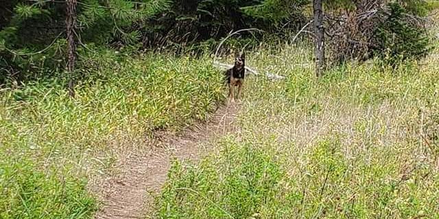
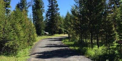
A large cul-de-sac layout defines Coalmine Hill, a free Forest Service campground along Road 53, the Blue Mountain Scenic Highway, in Umatilla National Forest. The five picnic tables are spread around the loop, most sites sit under tree cover, and a pit toilet is the only facility on-site. The campground skews toward equestrian use, with a wooden horse corral available, and the loop is wide enough for horse trailers and RVs to maneuver. Sites sit close together, the ground runs uneven in places, and highway noise carries into camp. A short trail leads to Gibson Caves, with a roughly 2.5-mile round trip. Cutsforth Park Campground is less than a mile away for campers wanting a different setup, and campgrounds near Heppner cover additional options in the broader area.
Description
Coalmine Hill is just off the paved Blue Mountain Scenic Byway (also called the Western Route). The Campground serves as access to the Bald Mountain, Hells Half Acre, and Willow Creek trails, offering a 7.5 mile-long loop experience for hikers and equestrians. Once inside the campground's large parking area, there is an information board on the northeast side. Past the information board runs the Bald Mountain hiking trail leading to Gibson Cave, which is 1.25 miles from the parking lot. The cave is really a shallow overhanging shelter with an interpretive sign describing its history.Once you've reached Gibson's cave, continue up the Bald Mountain trail until you reach a nice view point. The mountain's view point overlooks the drainages in between Coalmine Hill (to the northwest) and Little Bald Mountain (to the east), providing fantastic views and tranquility. About five miles southwest of the campground is Penland Lake; follow the Blue mountain Scenic Byway and Forest Service Road 21 and 2103, until you've reached Penland Lake where there are fishing and nonelectric boating opportunities. . Coalmine Hill Campground provides one larger, separate site near the entrance and the remaining five sites are located along the tree edges of the large parking area. There is one vault toilet and a travel access information board. This campground was constructed to serve double-duty as a snow park in the winter. There is no potable water or garbage service, so please pack out all garbage and dispose of it at home.
RV Road Trip Guides


Map & DirectionsCoalmine Hill is located in Oregon near Heppner
Directions
From Heppner, Oregon (40 minutes): Head south on Oregon Highway 206 until you've reached the edge of town. Take a left turn onto Willow Creek Road (County Road 678) and continue to make your way to and through the mountains for 22.3 miles. Coalmine Hill Campground will be on the left at the top of Coalmine Hill. From Ukiah, OR (41 minutes): Head west on Oregon Highway 244 for about two miles. Once you've reached a four way stop, go straight, west bound, and follow Forest Service Road 53 for about 20 miles. Coalmine Hill Campground will be on the right.
Coordinates
45.18200092 N
119.33200075 W
Connectivity
 T-MobileNo Coverage
- VerizonNo Coverage
 AT&T5GGood Coverage
Connectivity
- T-MobileNo Coverage
- VerizonNo Coverage
- AT&T5GGood Coverage
Access
Site Types
- Tent Sites
- RV Sites
- Standard (Tent/RV)
- Group
- Equestrian
Features
For Campers
- Picnic Table
- Drinking Water
- Toilets
- Alcohol
- Pets
- Fires
Drive Time
- 1 hr 39 min from Kennewick, WA
- 2 hrs 6 min from Walla Walla, WA
- 2 hrs 48 min from Yakima, WA
- 3 hrs 32 min from Bend, OR


