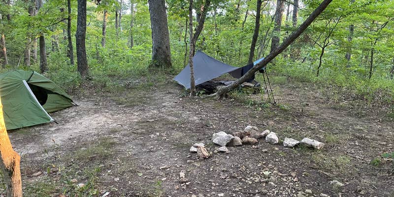
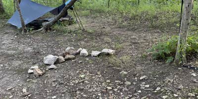
Free dispersed camping awaits at this state park backpacking site, where rough access roads lead to open terrain near both creek and lake. The site provides multiple tent setup areas and a metal fire pit, with campfires, pets, and alcohol all permitted. Cell service remains available despite the backcountry feel.
Campers can make reservations for this drive-in accessible location, though the challenging road conditions require careful navigation. The combination of free camping and basic amenities makes it well-suited to budget-conscious campers comfortable with primitive conditions and rough vehicle access.
Description
Lone Spring Trail consists of sections on the north and the south of Hwy KK. The trail is named for a perennially flowing spring that emerges in the valley at the base of a ridge. It loops through Northwood's Wild Area and crosses Big Sugar Creek, a designated state natural area. The southwestern part of the trail goes through a more open woodland that is being restored to its original condition by the use of prescribed burns. This trail is marked in a clockwise direction. Trail parking is provided along Highway KK. White Connector 7 is available to shorten one's trip. A connecting spur to the north allows the option to hike to Shady 80 Lake, and White Connector 6 to the south provides access to Big Sugar Creek Trail. There is also a spur that leads to the backpack camp.
Map: https://www.mostateparks.com/sites/mostateparks/files/TrailMap-lonespring.pdf
Reservation Info
Register here: https://mostateparks.com/register-backcountry-camp-cuivre-river-state-park
Backpackers must register before starting their trip. Camping is free, but registration is required.
Equestrian camping is not allowed on the trail.
Overnight parking for Backcountry Campsite 1: Park at the Lone Spring trailhead, located at the intersection of Lincoln Hills Road and State Highway KK. Trailhead location: 39.06570, -90.93258
Overnight parking for backcountry campsites 2, 3 and 4: at the trailhead parking lot of Big Sugar Creek Trail, which is located off of Lincoln Hills road, adjacent to Park Road. Trailhead location: 39.04522, -90.92688
RV Road Trip Guides


Map & DirectionsLone Spring Trail Backpacking Campsite(s) is located in Missouri near Troy
Coordinates
39.06907566296438 N
90.94500953291607 W
Connectivity
 T-MobileNo Coverage
 VerizonLTESome Coverage
 AT&T5GGood Coverage
Connectivity
- T-MobileNo Coverage
- VerizonLTESome Coverage
- AT&T5GGood Coverage
Access
- Drive-InPark next to your site
Site Types
- Dispersed
Features
For Campers
- Phone Service
- Reservable
- Alcohol
- Pets
- Fires
DISPERSED CAMPING
Enjoy dispersed camping on government land and leave no trace. Pack in and pack out. No (or limited) services at this camping area. Permit may be required.
PERMIT might be REQUIRED
We curate permit requirements across the US for our PRO members. Try PRO to see if Lone Spring Trail Backpacking Campsite(s) needs a permit.
Drive Time
- 51 min from St. Louis, MO
- 1 hr 24 min from Columbia, MO
- 1 hr 34 min from Jefferson City, MO
- 1 hr 52 min from Springfield, IL


