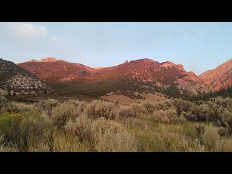
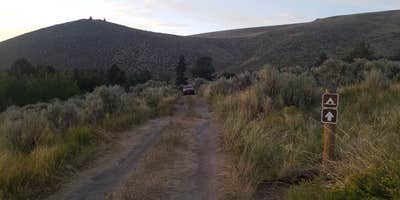
Where the sagebrush transitions to juniper at 7,200 feet elevation, Mt. Borah Trailhead and Camping Area serves as the staging point for Idaho's highest peak. The Forest Service campground sits roughly 19 miles from Mackay, accessed by driving across the visible scarp from the 1983 Mt. Borah earthquake. Each site includes a picnic table and metal fire ring, with vault toilets available but no water source on-site.
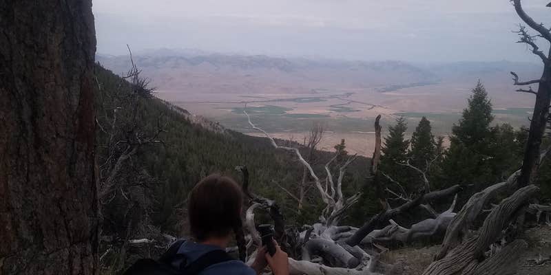
The elevation provides cooler temperatures than the Big Lost River Valley below, with adequate shade despite sparse large trees. Campers pay $5 per night for these primitive sites. The trailhead begins the brutal 5,200-foot ascent over 3.5 miles to Borah's summit, making this the logical overnight base for alpine starts before 6 AM. For those preferring lake fishing to peak bagging, Mackay Reservoir offers water access 13 miles southeast.
Description
This area serves as a base camp for climbing the tallest mountain in Idaho. It has 5 campsites, accessible vault toilet, No drinking water, safety and informational signs. Nearby areas of interest include Earthquake site and Mackay Reservoir.
Reservation Info
The following passes are good for a 50% reduction in camping fees: SENIOR PASS – Available for $10.00 to US Citizens 62 years and older. Must be purchased in person with proof of age such as a driver’s license. ACCESS PASS – Available FREE of charge to US citizens that have been medically determined to have a permanent disability that severely limits one or more major life activities. Must be maintained in person with written proof of disability.
RV Road Trip Guides

Map & DirectionsMt. Borah Trailhead and Camping Area is located in Idaho near Mackay
Directions
From Mackay: Take US Highway 93 approximately 20 miles north of Mackay to the Borah Peak Access Road. Follow the Borah Peak Access Road 3 miles to the trailhead. From Challis: Take Us Highway 93 south of Challis to the Borah Peak Access Road. Follow the Borah Peak Access Road 3 miles to the trailhead. From Sun Valley/Ketchum: Take Highway 75 (main street) to Sun Valley Road. Turn northeast onto Sun Valley Road. This road turns into Trail Creek Road (closed in winter). Follow this road to Highway 93. Turn left on Highway 93. Follow this road 4.5 miles to the Borah Peak Access Road. Follow the Borah Peak Access Road 3 miles to the trailhead.
Coordinates
44.13360139 N
113.83729318 W
Connectivity
 T-MobileNo Coverage
- VerizonNo Coverage
- AT&TNo Coverage
Connectivity
- T-MobileNo Coverage
- VerizonNo Coverage
- AT&TNo Coverage
Access
- Drive-InPark next to your site
- Hike-InBackcountry sites.
Site Types
- Tent Sites
Features
For Campers
- Picnic Table
- Toilets
- Alcohol
- Pets
- Fires
Drive Time
- 1 hr 55 min from Idaho Falls, ID
- 2 hrs 10 min from Pocatello, ID
- 2 hrs 42 min from Twin Falls, ID
- 3 hrs 42 min from Boise, ID