








T
Tammy F. Guide
GuideLake Chatuge Dispersed
A sign on the gate says that the area has been closed "due to vandalism and unauthorized activity".
Several dispersed camping areas dot the Chattahoochee National Forest near Murrayville, Georgia. Primitive sites are found along forest service roads and creek-side locations, with notable areas including Justus Creek, Dicks Creek Falls, Preacher's Rock, and Jones Creek dispersed campgrounds. These free sites typically feature simple clearings with established fire rings but lack amenities. Camping locations range from creek-adjacent spots to mountain overlooks along the Appalachian Trail, with sites like Cowrock Mountain offering ridge-top camping opportunities.
Access to most dispersed sites requires travel on unpaved forest roads that range from well-maintained gravel to rough, rutted paths. High-clearance vehicles are recommended for reaching sites like Jones Creek and Indian Grave Gap, while some locations like Justus Creek and High Shoals Falls require hiking in. Most areas permit campfires when no fire bans are in effect, but campers must bring their own water as drinking sources are generally unavailable. A review noted that at Jones Creek, "you can drive to the locations on a decent narrow dirt road," though the area "seems to be popular for local dirt bikers." Camping duration is typically limited to 14 days in a 30-day period.
These primitive camping areas provide varying degrees of seclusion and natural features. Creekside sites offer the peaceful sound of running water, while higher elevation spots deliver mountain views. One camper described High Shoals Falls Trail as "a relatively moderate 2.4 mile hike with primitive camping/backpacking campsites alongside High Shoals Creek" where "the cool waters of High Shoals Creek offer rewarding refreshment." Sites at Dicks Creek Falls include "5 or 6 spots available for first come first serve camping" with "a couple closer to water but most are more remote." Campers should be prepared for minimal facilities, pack out all trash, and practice Leave No Trace principles, as several reviews mentioned finding debris from previous visitors.
"They have a couple closer to water but most are more remote. There is a 3 mile long dirt road to travel on."
"It was along the road and there were a few cars driving past during the night but not enough to bother us or make us feel unsafe at all."
"Off the road trail leading up to Appalachian trail and incredible view. Very steep rocky switchbacks towards the top. Dispersed sites above the view, decent large spot near vault toilet."
"Dont park where the map tells you, you can drive to the locations on a decent narrow dirt road. When we first arrived, the camp site we chose was on the river, but also off the main road."
"We were warned about bears in the area so were very cautious about hanging our bear bag a little extra distance away on the opposite side of the creek."
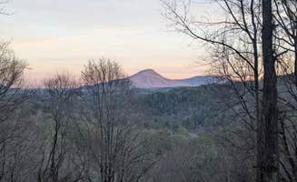
"Dispersed camp sites at or near the summit of Cowrock Mountain offer wonderfully shaded spots with long range views of the Blue Ridge."
"This section of the AT isn’t easy breezy, but it levels out and the trees thin out on the mountain ridges to relatively open, flat land for camping Ran into som AT’ers packing up for the morning."
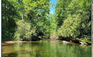
"All three have creek access. We picked the single on the other side. Not a lot of flat ground options. Each site is huge."
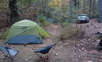
"Tents to the west, anything including a small off-road camper for the two sites to the east of the road."
"A relatively moderate 2.4 mile (round trip) hike with primitive camping/ backpacking campsites alongside High Shoals Creek."
"Rough drive up, AWD recommended. Great secluded campsites 0.5-1.0 mile hike-in. Moderate hike, downhill to campsite, uphill to get out."
"A 4wd with moderate clearance is helpful. Wonderful stream running through the campsite."
"This is by far my favorite place we’ve been off grid camping. It’s more Jeep friendly than full size vehicles, to get a spot down by the creek."
GuideA sign on the gate says that the area has been closed "due to vandalism and unauthorized activity".
GuideOff the road trail leading up to Appalachian trail and incredible view. Very steep rocky switchbacks towards the top. Dispersed sites above the view, decent large spot near vault toilet.
GuideRough drive up, AWD recommended. Great secluded campsites 0.5-1.0 mile hike-in. Moderate hike, downhill to campsite, uphill to get out. Larger group sites near creek, great small site right across from Blue Hole.
 Guide
The spot I found wasn’t the same site I heard in the reviews. It was a peaceful stay near a creek. It looked like an opening on the other side of the creek if you crossed it but I wasn’t about that life that night lol it was late.

 Scout
Great location small river but absolutely NO Cell service of any kind.

 Traveler
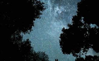
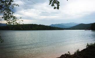
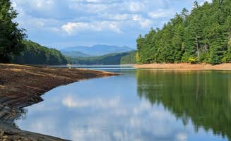
This spot is gorgeous, clean, and a must stop if you're in the area. Orange-ish beaches with a stunning blue green lake full of life. On a clear night, the sky is crystal and shining with all the stars you can imagine. Highly recommend buying wood for campfires though.
 Traveler
Multiple creekside spots for large groups. We have over 12 adults and 8-9 cars. No cell service. Dog friendly.
 Guide
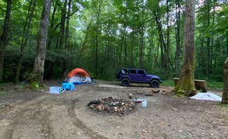
These sites are not where Dyrt says they are. The previous reviewer described them well and they have a couple of small creeks running past. Tents to the west, anything including a small off-road camper for the two sites to the east of the road. This is one of those sites I'll probably return to
The true location is just south of the High Falls Trailhead. 34.80718,-83.72466
 Scout
Great site, plenty of space, very private and peaceful.
Primitive camping opportunities surround Murrayville, Georgia within the Chattahoochee National Forest, where elevations range from 1,800 to 4,000 feet. The region features a humid subtropical climate with four distinct seasons, making spring and fall particularly popular for dispersed camping. Many sites are positioned near mountain streams that swell after rainfall, requiring careful site selection during wet periods.
Swimming in natural pools: At Corbin Creek Tray Mountain, the creek forms several natural swimming spots. According to a camper, "Wood was a little wet as it had rained 2 days prior so might be worth bringing your own. Also worth it if you're into astrophotography as all of tray mountain sits within the few dark areas within north Georgia."
Waterfall hiking: Several trails lead to cascades throughout the forest. One camper at Miller Branch Camp noted, "Single spot off of the road but very nice! Pretty much have the woods and mountains to yourself," making it a good basecamp for waterfall exploration.
Stargazing: The region offers some of North Georgia's darkest skies. A visitor to Corbin Creek mentioned, "The stars were a beauty to see... Also worth it if you're into astrophotography as all of tray mountain sits within the few dark areas within north Georgia."
Appalachian Trail access: Several dispersed camping areas sit within a mile of AT access points, allowing for day hikes on the famous long-distance trail without committing to a thru-hike.
Creek-side locations: Camping next to running water ranks high among visitor preferences. A reviewer of Justus Creek Campsite shared, "The creek was absolutely freezing cold in July, it was great to rinse some clothes and ourselves off. It was definitely one of our best nights sleep listening to the water!"
Mountain views: Ridge-top sites offer long-range vistas. A camper at Cowrock Mountain reported, "Halfway through the hike you're greeted by a flat rock face and these views," adding that the area offers "wonderfully shaded spots with long range views of the Blue Ridge."
Vehicle access to remote areas: Many appreciate driving to otherwise remote-feeling campsites. A camper at Corbin Creek described it as "Hike in style camp with the convenience of having your vehicle. A 4wd with moderate clearance is helpful. Wonderful stream running through the campsite."
Solitude options: Despite some popular areas, quiet camping remains available. One camper noted of Cowrock Mountain, "Dispersed camp sites at or near the summit of Cowrock Mountain offer wonderfully shaded spots with long range views of the Blue Ridge. Perfect spot for hammocks or tents right off the trail."
Weather preparedness: Mountain weather changes quickly. Pack for temperature swings, especially at higher elevations where sites like Preacher's Rock are exposed to elements.
Vehicle requirements: Many forest roads require high-clearance 4WD vehicles. A camper at Indian Grave Gap Campsite noted, "There are three routes up the mountain so you never have to double back... There is one site that would support a large group or even a camper (or two) if you can get them up the steep rocky hunting trail."
Water sources: Most sites require bringing all drinking water. While creeks run through many campgrounds, treatment is necessary. A camper at Indian Grave Gap mentioned, "All three have creek access. We picked the single on the other side. Not a lot of flat ground options."
Competition for sites: Popular areas fill quickly on weekends. A camper observed at Indian Grave Gap, "Three campsites in the immediate area. Two are on one side of the road. You have to cross thru one to get to the other."
Local activities: Understand what recreation occurs nearby. One visitor noted, "This area seems to be popular for local dirt bikers... We also heard some folks shooting guns (in the distance), which isn't a problem for us, but reduced the relaxing nature of the visit."
Site selection strategy: Choose sites with natural features that entertain children. A camper at Corbin Creek remarked, "Wonderful stream running through the campsite," providing built-in entertainment.
Waterfall proximity: Several sites offer short hikes to waterfalls. A visitor to Indian Grave Gap reported, "It's about a mile from the High Shoals Trailhead. Both waterfalls are lovely. One has a nice swimming hole."
Flat terrain consideration: Look for sites with adequate flat space. An Indian Grave Gap camper noted, "Each site is huge. We decided to spread out but that meant having to do a lot of walking back and forth for stuff."
Town access planning: Know the distance to supplies and facilities. As one Indian Grave Gap camper shared, "The closest town is Hiawasee. Had a grocery and an outfitters if you need supplies. There's only two sit down restaurants—one had an hour wait; the other had run out of food."
Small RV options: Most dispersed sites accommodate small rigs only. According to one visitor, "There is one site that would support a large group or even a camper (or two) if you can get them up the steep rocky hunting trail."
Access considerations: Forest roads vary significantly in quality. A camper noted, "It's more Jeep friendly than full size vehicles, to get a spot down by the creek. But it is possible to get a full size 4*4 truck down the switch back."
Site selection: Look for established pull-offs. One camper explained, "Sites were mostly clean with rock fire pits," indicating previous use that may accommodate small vehicles.
Dispersed camping limits: Forest Service regulations typically limit stays to 14 consecutive days. Plan accordingly and scout potential spots during daylight hours.
Frequently Asked Questions
Which is the most popular dispersed campsite near Murrayville, GA?
According to TheDyrt.com, the most popular dispersed campground near Murrayville, GA is Winston's Spot with a 5.0-star rating from 1 review.
What is the best site to find dispersed camping near Murrayville, GA?
TheDyrt.com has all 29 dispersed camping locations near Murrayville, GA, with real photos and reviews from campers.
Keep Exploring