
Fishing and boating give campers the main reasons to stay at Hales Landing Park, an Army Corps of Engineers site on Lake Seminole roughly 8 miles from camping near Bainbridge. The campground has 24 level gravel and clay sites, with water and electric hookups at each, plus a single dump station on site. No pets are allowed. The setting is forested and low-lying, which means heat, humidity, and bugs can be significant in summer. Bring a surge protector for the older electrical boxes, and plan to arrive by Thursday if you want a spot on weekends, as no reservations are taken.
Description
Overview
Hales Landing Park is located on the Flint River in Southwest Georgia. The lake and surrounding area provide a variety of outdoor recreational opportunities for fishing, camping, boating, picnicking, hiking, biking and birding.__
Recreation
Lake Seminole is known as one of the best sites for sports fishing in America. Extensive stump and grass beds provide abundant cover where anglers fish for largemouth, hybrid, striped and white bass. Sizable populations of catfish, crappie and bream are also present. Over 79 species of fish have been identified in the lake.
Facilities
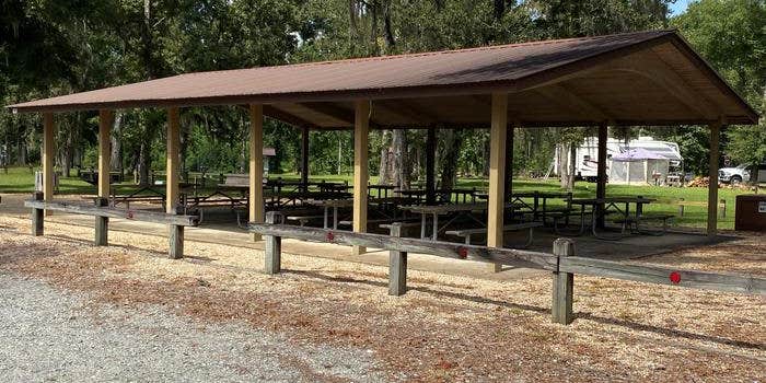
Hales Landing Park has restroom facilities within walking distance to the shelter. A boat ramp provides access to the lake. There are 10 picnic tables and a grill located at the shelter. Potable water and electricity area available.__
Natural Features
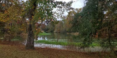
Lake Seminole has a surface area of 37,500 acres with 376 miles of shoreline. A pine and hardwood forest covers the rolling hills around the lake.______ A variety of wildlife makes its home around Seminole Lake, including raccoons, alligators, ring-necked ducks, canvasbacks, scaup, hawks, bald eagles, black vultures, tortoises and snakes.
contact_info
For facility specific information, please call (229) 662-2001.
RV Road Trip Guides


Map & DirectionsHales Landing Park is located in Georgia near Bainbridge
 Public Campground
Directions
From Bainbridge: Take Hwy 253/ Spring Creek Hwy South approximately 9 miles. Turn left onto Hales Landing Road. The road will dead end into the park.__
Coordinates
30.847607 N
84.660188 W
Connectivity
 T-MobileNo CoverageVerified by 2 usersLast on 10/25/26
 VerizonLTESome CoverageVerified by 2 usersLast on 9/12/26
 AT&T5GExcellent Coverage
Connectivity
- T-MobileNo CoverageVerified by 2 usersLast on 10/25/26
- VerizonLTESome CoverageVerified by 2 usersLast on 9/12/26
- AT&T5GExcellent Coverage
Access
- Drive-InPark next to your site
- Walk-InPark in a lot, walk to your site.
- Hike-InBackcountry sites.
- Boat-InSites accessible by watercraft.
Site Types
- Tent Sites
- RV Sites
- Standard (Tent/RV)
- Group
Features
For Campers
- ADA Access
- Trash
- Phone Service
- Showers
- Drinking Water
- Electric Hookups
- Toilets
- Alcohol
For Vehicles
- Sanitary Dump
- Big Rig Friendly
Drive Time
- 56 min from Tallahassee, FL
- 1 hr 4 min from Dothan, AL
- 1 hr 9 min from Albany, GA
- 1 hr 52 min from Panama City, FL



