Best Dispersed Camping near Running Springs, CA

Looking for the best Running Springs dispersed camping? The Dyrt can help you find the best dispersed campsites for your next trip. From secluded to easily reachable, we offer dispersed campsites near Running Springs just for you.

Best Dispersed Sites Near Running Springs, CA (23)

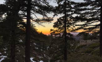
    Camper-submitted photo from East Flats
    Camper-submitted photo from East Flats
    Camper-submitted photo from East Flats
    Camper-submitted photo from East Flats
    Camper-submitted photo from East Flats
    Camper-submitted photo from East Flats
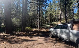
    Camper-submitted photo from Holcomb Valley Climbers Camp
    Camper-submitted photo from Holcomb Valley Climbers Camp
    Camper-submitted photo from Holcomb Valley Climbers Camp
    Camper-submitted photo from Holcomb Valley Climbers Camp
    Camper-submitted photo from Holcomb Valley Climbers Camp
    Camper-submitted photo from Holcomb Valley Climbers Camp
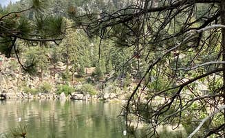
    Camper-submitted photo from Mill Creek Dispersed Camping
    Camper-submitted photo from Mill Creek Dispersed Camping
    Camper-submitted photo from Mill Creek Dispersed Camping

    3. Mill Creek Dispersed Camping

    5 Reviews
    4 Photos
    310 Saves
    Fawnskin, California

    Dispersed, or undeveloped, camping provides more solitude and an opportunity to “rough it.” There are many camping opportunities in general forest areas as well as in wilderness areas. Know before you go: Before traveling visit or call the nearest Ranger Station for current fire restrictions and area closures. No wood or charcoal campfires (check current fire restrictions before you go). Vehicles must remain on roads and associated pullouts. Do not clear vegetation. Portable gas-powered stoves, lanterns and fire rings with a fuel-shutoff valve allowed with a California Campfire Permit and five feet clearance from vegetation. Camp at least 200 feet from springs, water, meadows, trails and roads. Camp at least a quarter-mile from designated campgrounds, picnic areas, trailheads. Camp at least a quarter-mile from private property and state highways. Pack out all trash. Leave no trace!

    • Pets
    • Fires
    • Tents
    • Dispersed
    • Alcohol
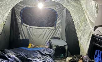
    Camper-submitted photo from San Gorgonio Summit Camp
    Camper-submitted photo from San Gorgonio Summit Camp
    Camper-submitted photo from San Gorgonio Summit Camp
    Camper-submitted photo from San Gorgonio Summit Camp
    Camper-submitted photo from San Gorgonio Summit Camp
    Camper-submitted photo from San Gorgonio Summit Camp

    4. San Gorgonio Summit Camp

    5 Reviews
    55 Photos
    170 Saves
    Forest Falls, California

    Limited, but free wilderness permits for day hiking and overnight camping are required for the San Gorgonio Wilderness and the Cucamonga Wilderness Permits – they are issued by the San Gorgonio Wilderness Association, a Forest Service partner. Parts of the San Gorgonio Wilderness, including the San Bernardino Peak Trail, are still closed due to the El Dorado fire.

    Upon completion of your reservation request. you will receive a download. Please retain this download as your permit reservation. You may keep a copy on your phone and show it to a ranger as verification of your permit or you can print it out. If you do not receive a permit use the contact link here: https://www.sgwa.org/contact-us

    The Vivian Creek Trail is the shortest and the steepest route to the summit of Mt. San Gorgonio, located in the San Gorgonio Wilderness on the Sand to Snow National Monument. One and two-tenths miles from the trailhead is Vivian Creek Camp (7,100'). Campsites are located upslope to the right of the trail after reaching the stream: one is halfway up the slope, and the other is at the top of the slope (no camping within 200 feet of the trail or creek). One and three-tenths miles from Vivian Creek Camp is Halfway Camp (8,100'). Water is obtained from the creek 200 yards before camp. Two and three-tenths miles further is High Creek Camp (water available - 9,200'). The summit of San Gorgonio (11,499') is 3 miles beyond High Creek. The upper end of this trail offers outstanding views of Yucaipa Ridge and Galena Peak, as well as sweeping panoramic views from the top of Mt. San Gorgonio. General info: No water available. No campfires allowed. Portable gas stoves are allowed with a valid California Campfire Permit. No camping within 200 feet of the trail or creek Wilderness Permit Required - this is a very popular trail, especially on summer weekends. It is suggested you request your permit in advance. Wilderness Permit applications are accepted up to 90 days in advance of your trip. Permits can be obtained from sgwa.org. Fee: Adventure Pass Required $5/day or $30/year. Interagency Passes also accepted.

    • Pets
    • Dispersed
    • Alcohol
    • No image available

      5. Bear Lake

      1 Review
      53 Saves
      Big Bear Lake, California

      The number of visitors admitted to the wilderness is limited. On summer weekends some wilderness areas may fill to capacity well in advance. Wilderness campsites are accessible by foot and/or horseback only and require a free wilderness permit, which may be reserved up to three months in advance. Use of certain trailheads that have facilities like restrooms require an Adventure Pass or an Interagency Pass, which must be displayed on the parked vehicle. When camping in the wilderness, lightweight stoves are recommended. Campfires are not allowed in Wilderness areas on the San Bernardino National Forest. No wood or charcoal campfires (Read the current fire restrictions) Vehicles must remain on roads and associated pullouts Do not clear vegetation Portable gas-powered stoves, lanterns and fire rings with a fuel-shutoff valve allowed with a California Campfire Permit and five feet clearance from vegetation. Camp at least 200 feet from springs, water, meadows, trails and roads Camp at least a quarter-mile from designated campgrounds, picnic areas, trailheads Camp at least a quarter-mile from private property and state highways Pack out all trash Leave no trace For more information, please read the Forest Order on use of dispersed areas: https://www.fs.usda.gov/Internet/FSE_DOCUMENTS/stelprdb5155166.pdf

      • Pets
      • Fires
      • Phone Service
      • Dispersed
      • Alcohol
      Camper-submitted photo from High Creek Camp - San Gorgonio Wilderness
      Camper-submitted photo from High Creek Camp - San Gorgonio Wilderness
      Camper-submitted photo from High Creek Camp - San Gorgonio Wilderness
      Camper-submitted photo from High Creek Camp - San Gorgonio Wilderness
      Camper-submitted photo from High Creek Camp - San Gorgonio Wilderness
      Camper-submitted photo from High Creek Camp - San Gorgonio Wilderness

      6. High Creek Camp - San Gorgonio Wilderness

      2 Reviews
      11 Photos
      28 Saves
      Forest Falls, California

      Group size limited to 12 people and 8 pack/riding animals per group. No campfires allowed. Portable gas stoves are allowed with a valid California Campfire Permit.

      Limited, but free wilderness permits for day hiking and overnight camping are required for the San Gorgonio Wilderness and the Cucamonga Wilderness Permits – they are issued by the San Gorgonio Wilderness Association, a Forest Service partner. Parts of the San Gorgonio Wilderness, including the San Bernardino Peak Trail, are still closed due to the El Dorado fire.

      Upon completion of your reservation request. you will receive a download. Please retain this download as your permit reservation. You may keep a copy on your phone and show it to a ranger as verification of your permit or you can print it out. If you do not receive a permit use the contact link here: https://www.sgwa.org/contact-us

      The Vivian Creek Trail is the shortest and the steepest route to the summit of Mt. San Gorgonio, located in the San Gorgonio Wilderness on the Sand to Snow National Monument. One and two-tenths miles from the trailhead is Vivian Creek Camp (7,100'). Campsites are located upslope to the right of the trail after reaching the stream: one is halfway up the slope, and the other is at the top of the slope (no camping within 200 feet of the trail or creek). One and three-tenths miles from Vivian Creek Camp is Halfway Camp (8,100'). Water is obtained from the creek 200 yards before camp. Two and three-tenths miles further is High Creek Camp (water available - 9,200'). The summit of San Gorgonio (11,499') is 3 miles beyond High Creek. The upper end of this trail offers outstanding views of Yucaipa Ridge and Galena Peak, as well as sweeping panoramic views from the top of Mt. San Gorgonio. General info: No water available. No campfires allowed. Portable gas stoves are allowed with a valid California Campfire Permit. No camping within 200 feet of the trail or creek Wilderness Permit Required - this is a very popular trail, especially on summer weekends. It is suggested you request your permit in advance. Wilderness Permit applications are accepted up to 90 days in advance of your trip. Permits can be obtained from sgwa.org. Fee: Adventure Pass Required $5/day or $30/year. Interagency Passes also accepted.

      • Pets
      • Fires
      • Reservable
      • RVs
      • Dispersed
      • Drinking Water
      Camper-submitted photo from Vivian Creek Camp
      Camper-submitted photo from Vivian Creek Camp
      Camper-submitted photo from Vivian Creek Camp
      Camper-submitted photo from Vivian Creek Camp
      Camper-submitted photo from Vivian Creek Camp
      Camper-submitted photo from Vivian Creek Camp

      7. Vivian Creek Camp

      1 Review
      9 Photos
      40 Saves
      Forest Falls, California

      Limited, but free wilderness permits for day hiking and overnight camping are required for the San Gorgonio Wilderness and the Cucamonga Wilderness Permits – they are issued by the San Gorgonio Wilderness Association, a Forest Service partner. Parts of the San Gorgonio Wilderness, including the San Bernardino Peak Trail, are still closed due to the El Dorado fire.

      Upon completion of your reservation request. you will receive a download. Please retain this download as your permit reservation. You may keep a copy on your phone and show it to a ranger as verification of your permit or you can print it out. If you do not receive a permit use the contact link here: https://www.sgwa.org/contact-us

      The Vivian Creek Trail is the shortest and the steepest route to the summit of Mt. San Gorgonio, located in the San Gorgonio Wilderness on the Sand to Snow National Monument. One and two-tenths miles from the trailhead is Vivian Creek Camp (7,100'). Campsites are located upslope to the right of the trail after reaching the stream: one is halfway up the slope, and the other is at the top of the slope (no camping within 200 feet of the trail or creek). One and three-tenths miles from Vivian Creek Camp is Halfway Camp (8,100'). Water is obtained from the creek 200 yards before camp. Two and three-tenths miles further is High Creek Camp (water available - 9,200'). The summit of San Gorgonio (11,499') is 3 miles beyond High Creek. The upper end of this trail offers outstanding views of Yucaipa Ridge and Galena Peak, as well as sweeping panoramic views from the top of Mt. San Gorgonio. General info: No water available. No campfires allowed. Portable gas stoves are allowed with a valid California Campfire Permit. No camping within 200 feet of the trail or creek Wilderness Permit Required - this is a very popular trail, especially on summer weekends. It is suggested you request your permit in advance. Wilderness Permit applications are accepted up to 90 days in advance of your trip. Permits can be obtained from sgwa.org. Fee: Adventure Pass Required $5/day or $30/year. Interagency Passes also accepted.

      • Pets
      • Fires
      • Reservable
      • Dispersed
      • Alcohol
      Camper-submitted photo from Stockton Flats Yellow Post Sites 3-8
      Camper-submitted photo from Stockton Flats Yellow Post Sites 3-8
      Camper-submitted photo from Stockton Flats Yellow Post Sites 3-8
      Camper-submitted photo from Stockton Flats Yellow Post Sites 3-8
      Camper-submitted photo from Stockton Flats Yellow Post Sites 3-8
      Camper-submitted photo from Stockton Flats Yellow Post Sites 3-8

      8. Stockton Flats Yellow Post Sites 3-8

      4 Reviews
      6 Photos
      255 Saves
      Wrightwood, California

      These remote camping sites offer isolated scenic locations ideal for tent and car camping or a relaxing picnic far from the crowds. Other than a pit for campfires, these sites do NOT contain the amenities found at developed campgrounds. There is no water, no picnic tables, no restrooms nearby, and no trash containers. Please pack it in - pack it out! All sites are first-come, first-served. Campfire permits are required for any type of fire use - campfires, charcoal BBQ's, or stoves. Campfires may not be allowed certain times of the year. See Current Conditions below or call the Lytle Creek Ranger Station (909-382-2851). These Yellow Post Sites are reached via Forest Road 3N06. Please refer to the Yellow-post site map available by clicking on this link or for free at the Lytle Creek Ranger Station. High-clearance vehicles are recommended for reaching all sites. Four-wheel drive vehicles may also be required depending on current road conditions.

      • Pets
      • Fires
      • Tents
      • Group
      • Dispersed
      • Alcohol
      Camper-submitted photo from Rim of the World Byway (near 15 fwy south) Dispersed
      Camper-submitted photo from Rim of the World Byway (near 15 fwy south) Dispersed
      Camper-submitted photo from Rim of the World Byway (near 15 fwy south) Dispersed
      Camper-submitted photo from Rim of the World Byway (near 15 fwy south) Dispersed
      Camper-submitted photo from Rim of the World Byway (near 15 fwy south) Dispersed
      Camper-submitted photo from Rim of the World Byway (near 15 fwy south) Dispersed

      9. Rim of the World Byway (near 15 fwy south) Dispersed

      1 Review
      14 Photos
      42 Saves
      Lytle Creek, California

      Please remember to LNT at dispersed campgrounds

      • RVs
      • Tents
      • Standard (Tent/RV)
      • Dispersed
      • No image available
      Showing results 1-10 of 23 campgrounds

      Recent Dispersed Reviews in Running Springs

      39 Reviews of 23 Running Springs Campgrounds


      • TThe Dyrt PRO User
        Camper-submitted photo from South Ridge Yellow Post Sites
        Sep. 27, 2024

        South Ridge Yellow Post Sites

        Awesome dispersed site with amazing views

        Very nice to find a campsite this private on a weekend in southern California elevation is high enough that temperatures were very enjoyable (mid 80's)

      • Ciara W.The Dyrt PRO User
        Camper-submitted photo from East Flats
        Aug. 7, 2024

        East Flats

        Wildlife but super dusty!

        Starlink internet here was great and we stayed 2 days to work here. Saw multiple deer walking by our site.

        Easy to drag in dust and very annoying. We easily found a spot for our van.

      • SThe Dyrt PRO User
        Camper-submitted photo from East Flats
        Aug. 1, 2024

        East Flats

        Great secluded location

        First time car camping. Solo trip with my fur babies. Trails a little rough but good thing I have X-Mode on my Subaru. Lol. Arrived around 5:30pm on a Wednesday. Drove past a few campers. A few with big RV’s. Closest camper is about 30 yards away. Could barely hear their generator running. Planned on staying a few nights but after the first night I was told there was a big archery event and that the whole campground was reserved so I had to pack up and leave.

      • Leslie R.The Dyrt PRO User
        Camper-submitted photo from Heaton flats
        Jul. 29, 2024

        Heaton flats

        Not always allowed

        Camping outside esablished campgrounds within the Angeles National Forest is sometimes prohibited, you have to be on top of reading recently published orders on https://www.fs.usda.gov/alerts/angeles. Currently, camping is allowed for 7 days or less, see here: https://www.fs.usda.gov/alerts/angeles/alerts-notices/?aid=78080 The people I saw camping here looked to have been set up somewhat permanently though. I wouldn't feel comfortable setting up a tent here, but it could be an okay rest area at the beginning/end of the hike to Bridge to Nowhere.

      • DThe Dyrt PRO User
        Camper-submitted photo from Mill Creek Dispersed Camping
        Jul. 23, 2024

        Mill Creek Dispersed Camping

        Over a dozen sites

        There are lots of sites on this road. The closer you are to the road the more dust will get in your site from the vehicles passing. The road here. I went a to the second fork after the Bluff lake fork. There’s a private campground near the Bluff Lake entrance which made noises i can hear from my site which was before Bluffs lake fork. There are over a dozen sites along the main road. If you can pull in, it’s a site. Some better than others and spaced out so you may not see your neighbors from your site. 2x4 accessible as long as it’s not muddy or after snow. I saw a Prius on the trail.

      • Laura M.The Dyrt PRO User
        Camper-submitted photo from Ord Mountain Dispersed
        Jul. 7, 2024

        Ord Mountain Dispersed

        Actual location 34.684300, -116.960600

        I did the best I could with finding the exact location on the map using The Dyrt's current capabilities to add a new location.  This site is located at 34.684300,-116.960600, across the 247 road from Sawtooth Canyon Campground / New Jack City rock climbing area. Hopefully someone can go in at some point and fix the location to be more precise.

        We checked this place out but didn’t stay. We liked the beautiful wide open surroundings, the good cell reception, and the easy access from the main road, but it seemed like this is a place better suited for bigger groups, especially those who will be riding ATVs or dirt bikes around. So, if you’re looking for a big open space to hang out with a big group where you can be loud and not disturb anyone, this would be a good place for it. We also heard gun shots nearby so further down the road is probably a good shooting area. 

        Obviously no amenities so please pack in/ pack out. It was surprisingly not too trashed so that was nice. We made it down the dirt road fine in our 26 ft class c. Proceed at your own comfort level, but it seems like a road that would be ok for any rig (maybe not a class A?) if you go slow and watch for dips and bumps.

      • CThe Dyrt PRO User
        Camper-submitted photo from East Flats
        Jun. 28, 2024

        East Flats

        Quiet & Fresh Air

        We are here RN! It is so peaceful and the air is so fresh! Pines, and clear blue skies! What more can you ask for a few hours away from LA proper…

      • Dickie Simmons  S.The Dyrt PRO User
        Camper-submitted photo from Mill Creek Dispersed Camping
        Jun. 16, 2024

        Mill Creek Dispersed Camping

        Convenient free camping just outside of town

        Great free camping when campgrounds are booked. Easy to navigate with GPS. Many large and small sites along the road. Some spots more secluded than others.  Smaller rigs, medium clearance and lite off-road capabilities recommended. Good cellular reception in my particular location.

      • Francisco F.The Dyrt PRO User
        Camper-submitted photo from Mill Creek Dispersed Camping
        Jun. 8, 2024

        Mill Creek Dispersed Camping

        Beautiful Spot For 4x4, But NOT For RVs

        My husband and I were looking for good boondocking spots yesterday and we decided to check out this spot, after finding it on The Dyrt and a few other sites. It's definitely a beautiful place, and most of the road to the site is paved, but the road up to the actual spot is gravel, with lots of potholes and washboard areas, which would make it difficult for an RV. But the biggest issue for RVs is an area of the road that is very steep and immediately turns into a hairpin turn that we didn't even want to try in our 4x4, since the road is very thin and our SUV (a 2009 Nissan Pathfinder) is kind of thick. I'm sure it's probably nothing for people who are used to using their 4x4 for more than regular driving in the snow, etc., but it was too dodgy for us. There is no way that even a Class C rig would be able to take that steep incline and immediately do that sharp turn. And since there's nowhere to turn around in that spot, you'd have to back your rig down the incline and then quite a ways down the pitted, gravel road to get out of it. 

        It's full of trees and seems fairly remote, but we had 5 cars pass us as we were backing away from the incline, so it's obviously a busy spot - you wouldn't be there alone, and this was on a Thursday.

      • Alexis O.The Dyrt PRO User
        Camper-submitted photo from East Flats
        Jun. 7, 2024

        East Flats

        great spacious area

        loved this spot. easy to find & very lowkey, with ample spaces to choose from. no amenities & great cell service.

      • JThe Dyrt PRO User
        Camper-submitted photo from Stockton Flats Yellow Post Sites 3-8
        May. 27, 2024

        Stockton Flats Yellow Post Sites 3-8

        Prepare the climb; also not for big RVs

        The turn is not marked well, in fact the coordinates are a little bit off. If you miss the turn like we did you have to go 5 miles or more to get a turnabout big enough to turn around. You climb a big steep hill to get to the turn in. On the way back down from the turnaround we almost burned out or brakes. We decided not to go to the site because it looked like a one lane road and too tight for our 35 ft bumper pull. Disappointed because pictures from others looked great and it is a beautiful area. We found a spot near the road that I’ll post for others.

      • eThe Dyrt PRO User
        Camper-submitted photo from Holcomb Valley Climbers Camp
        Nov. 8, 2023

        Holcomb Valley Climbers Camp

        Site of gold discovery in the 1800s.

        If you’re into panning for gold you just might find some along Holcomb Creek. There are active claims in the area so be respectful. Once you leave the pavement the going gets slower along the trails. You definitely need a high clearance vehicle. There are campgrounds in the area and also yellow post campsites. There wasn’t many other vehicles around the times I’ve been out there. Nice scenery and peaceful.

      • Cyndy & Selena R.The Dyrt PRO User
        Camper-submitted photo from East Flats
        Jun. 19, 2023

        East Flats

        East Flats-very nice

        Camping at East Flats was great in mid-June. There are a number of campers, but remote locations are easily found. If you bring pets, be aware they may upset Rattlesnakes.

      • Patrizia H.The Dyrt PRO User
        Camper-submitted photo from East Flats
        Feb. 20, 2023

        East Flats

        Awesome spot with internet reception!

        Many even spots even for bigger vehicles. Very quiet and I even have internet (Telekom)!

      • Panda V.
        Camper-submitted photo from Stockton Flats Yellow Post Sites 3-8
        Sep. 7, 2022

        Stockton Flats Yellow Post Sites 3-8

        Great spot for dispersed camping

        First time headed out here and it was a great spot for a disconnected weekend. Trail was fun (definitely needed 4x4) and the sites around has good shade and good size open spots. Best to get there early as possible to secure a spot.

      • s
        Camper-submitted photo from Holcomb Valley Climbers Camp
        Apr. 25, 2022

        Holcomb Valley Climbers Camp

        OFF THE GRID

        Arriving at the campground, the deposit place, obviously on weekends we were not thrilled by everyone around us, as well as the loud noise until past the curfew. So we decided the next day to go a little further in the woods where you’re no longer in the campground base. So this is called wild camping. And that was amazing not a single sound far from everybody, off the grid.

        We went in April, and still had a little bit of snow. All the trail roads are mostly for 4 x 4 vehicles that really enjoy just going at it throughout the day. A lot of fun to witness that. The wild hikes surrounding the campground are really fun. Just remember where you camped. It seems like fires aren’t allowed during certain periods. Just be aware, we brought our own off the ground stove. And it was perfectly fine.

      • Eileen S.The Dyrt PRO User
        Camper-submitted photo from Mill Creek Dispersed Camping
        Nov. 11, 2021

        Mill Creek Dispersed Camping

        Dispersed Camping Near Big Bear

        First come first served dispersed camping just outside Big Bear. Near bike trails. Was not crowded mid week, but spots were filling up closer to the weekend. There are a lot of flat spots to choose from.


      Frequently Asked Questions

      • Which is the most popular dispersed campsite near Running Springs, CA?

        According to TheDyrt.com, the most popular dispersed campground near Running Springs, CA is East Flats with a 4.6-star rating from 8 reviews.

      • What is the best site to find dispersed camping near Running Springs, CA?

        TheDyrt.com has all 23 dispersed camping locations near Running Springs, CA, with real photos and reviews from campers.