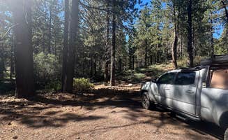
Primitive camping near Grand Terrace, California provides opportunities for backcountry experiences at elevations ranging from 4,000 to 11,500 feet in the nearby San Bernardino National Forest. The varied terrain creates distinct camping conditions across seasons, with summer temperatures averaging 80°F in the lower elevations and winter often bringing snow accumulation at higher elevations. Cell service varies significantly throughout these dispersed camping areas, with several sites reporting surprisingly strong connectivity despite their remote locations.
What to do
Hiking direct from camp: At High Creek Camp, campers can access the San Gorgonio Summit trail system. One camper noted, "The sound of the water is the best part of this campground in my eyes. As well as it is a great place to stay as a overnight to break up a summit trip."
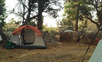
Rock climbing access: Holcomb Valley Climbers Camp provides direct access to bouldering and climbing routes. A reviewer explained, "This area is used almost exclusively by rock climbers, but anyone is welcomed. As long as you follow the guidelines for the area, you can set up your tent anywhere you see a spot."
Gold panning opportunities: Some dispersed camping areas near Big Bear contain historic gold mining sites. One camper at Holcomb Valley shared, "If you're into panning for gold you just might find some along Holcomb Creek. There are active claims in the area so be respectful."
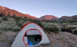
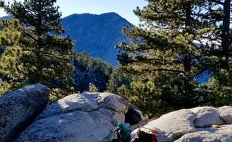
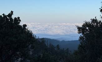
Summit camping experience: For advanced backpackers, San Gorgonio Summit Camp offers an unforgettable high-elevation experience at 11,500 feet. A camper described, "There are a few campspots that people have outlined with a rock barrier to protect from wind, although it was still insanely difficult to set up camp in that blowing wind and cold air."
What campers like
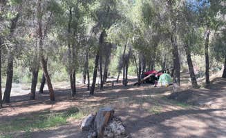
Natural sound buffering: The spacing between sites at Mill Creek Dispersed Camping provides acoustic privacy. A camper noted, "There are over a dozen sites along the main road. If you can pull in, it's a site. Some better than others and spaced out so you may not see your neighbors from your site."
Wildlife viewing: Multiple dispersed camping areas offer wildlife observation opportunities. At East Flats, a camper reported, "Starlink internet here was great and we stayed 2 days to work here. Saw multiple deer walking by our site."
Quick getaway proximity: The relative closeness to urban areas makes these primitive camping spots popular for short escapes. A camper at East Flats shared, "We are here RN! It is so peaceful and the air is so fresh! Pines, and clear blue skies! What more can you ask for a few hours away from LA proper."
Cell service for remote work: Surprisingly, many primitive camping sites near Grand Terrace maintain usable cell service. One camper at Mill Creek reported, "Good cellular reception in my particular location," while another at East Flats mentioned, "Many even spots even for bigger vehicles. Very quiet and I even have internet (Telekom)!"
What you should know
Permit requirements: Some backcountry camping areas require wilderness permits. San Gorgonio Summit Camp requires advance planning, as one camper advised, "You have to get your permit early in the summer season because of that!"
Road condition challenges: Many dispersed camping areas have difficult access roads. At Stockton Flats Yellow Post Sites, a camper warned, "The turn is not marked well, in fact the coordinates are a little bit off. If you miss the turn like we did you have to go 5 miles or more to get a turnabout big enough to turn around."
Seasonal closures: Forest roads and some camping areas close seasonally due to weather conditions. A reviewer noted, "The trail was closed as of May 7, 2023, No idea when it will be open."
Weekend crowding: Despite the primitive nature of these sites, weekends can become busy. A camper at Holcomb Valley observed, "Arriving at the campground, the deposit place, obviously on weekends we were not thrilled by everyone around us, as well as the loud noise until past the curfew."
Tips for camping with families
Dust management strategies: Parents should bring extra clothing for children as the environment can be dusty. A camper with children at Holcomb Valley shared, "It's secluded and has enough trees for a hammock. Our kids loved being able to explore, but they were covered in sand/dirt by the end of the trip."
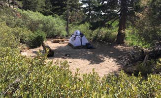
Site selection for privacy: Families may prefer camping deeper in the forest for more seclusion. A reviewer at Holcomb Valley suggested, "So we decided the next day to go a little further in the woods where you're no longer in the campground base. So this is called wild camping. And that was amazing not a single sound far from everybody, off the grid."
Navigation markers: When exploring with children, establish clear landmarks. One camper recommended, "The wild hikes surrounding the campground are really fun. Just remember where you camped."
Water recreation options: Some primitive camping areas offer natural water features for children. A camper at Bear Lake mentioned, "Nice clean off grid best place so far Rick water slides."
Tips from RVers
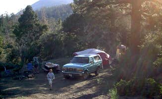
Trailer-friendly spots: Some dispersed camping areas accommodate large trailers better than others. At Coon Creek Yellow Post, a camper advised, "1st spots on the left are big rig friendly, you do have about a mile of dirt road before you get to them. Many spots that fill on the weekend quickly, road gets rougher the more you continue up to the cabin, if you have a bigger trailer and don't find any spots in the first few locations turn around."
Clearance requirements: RV owners should research vehicle requirements before attempting access roads. A reviewer at Stockton Flats noted, "Great for campers that meet 2 criteria 1) You have a Jeep, Truck it similar vehicle that can go off-road. 2) You enjoy dispersed camping (no water/restrooms etc)."
Brake management on steep descents: RVers should use caution on mountain roads. One camper warned, "On the way back down from the turnaround we almost burned out or brakes."
RV size limitations: Larger RVs face significant challenges on forest roads near Grand Terrace. A camper at Mill Creek Dispersed Camping cautioned, "The road up to the actual spot is gravel, with lots of potholes and washboard areas, which would make it difficult for an RV. But the biggest issue for RVs is an area of the road that is very steep and immediately turns into a hairpin turn that we didn't even want to try in our 4x4."