Fishing and water access draw campers to Shirttail Creek, which sits alongside Sugar Pine Reservoir in Tahoe National Forest. The campground runs year-round and accommodates rigs up to 100 feet, with a dump station down the road. Bear activity has been reported by at least one camp host, so food storage is worth taking seriously. Noise levels can vary, with some nights running loud depending on neighbors. Firewood is provided free at the host site. Forbes Campground is about half a mile south for campers who want a different setup.
Description
Overview
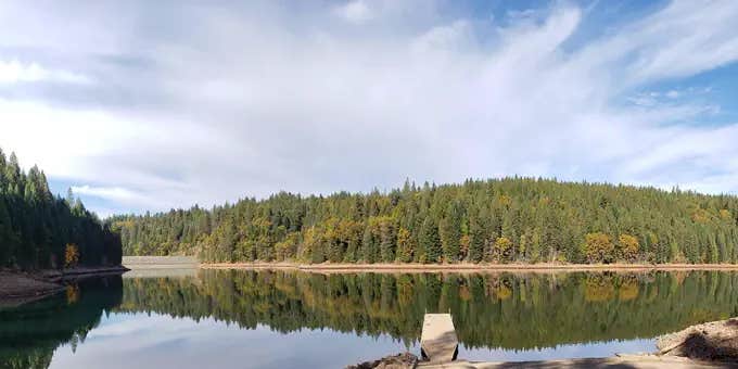
Shirttail Campground is located on the north shore of Sugar Pine Reservoir, in the Tahoe National Forest, 15 miles from Foresthill. Visitors enjoy the area for its fishing, boating, OHV, and hiking opportunities. This facility is operated and maintained by the Tahoe National Forest.
Recreation
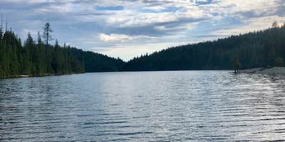
Fishing, swimming and both motorized and non-motorized boating are popular activities on the reservoir. A paved, non-motorized accessible trail connects recreation sites on the north shore with recreation sites on the south shore and has interpretive signs and shaded benches for rest breaks. The North Fork of the American River is nearby, with additional fishing, white water boating, and swimming. Many miles of hiking, biking and off-road vehicle trails are in the surrounding area.
Facilities
The campground offers single and double family campsites and one triple site; a few of the campsites are accessible. Picnic tables, campfire rings and grills are provided, as well as vault toilets and drinking water. Firewood is available for purchase from the host.
Natural Features
Sugar Pine Reservoir covers 160 acres at an elevation of 3600 feet. The campground lies above the north shoreline, in a forest of manzanita and ponderosa pine. Summertime temperatures are warm during the day and cool at night.
Nearby Attractions
Shirttail Creek Campground is a recreation site within the Sugar Pine Recreation Area which includes an additional family campground, a group campground, a boat ramp, and a day use picnic site, as well as a trail that circles the entire lake. The North Fork American Wild And Scenic River can be accessed near by. Other recreation opportunities include many hiking, equestrian, mountain biking, and OHV trails.
Fee Info
Single campsites (8 people) $24.00, double campsites (16 people) $48.00, triple campsite (24 people) $72.00.
Warning 1 Alert is In Effect
There is 1 alert for this campground. Camp safely!
Warning 1 Alert is In Effect
There is 1 alert for this campground. Camp safely!
Attention Campers: Sugarpine Dump Station is closed for repairs. We apologize for the inconvenience.
RV Road Trip Guides

Map & DirectionsShirttail Creek is located in California near Gold Run
Directions
From either east bound or west bound Interstate 80 take exit 121, Auburn Ravine Road to Foresthill. Continue east for 17 miles, to Foresthill. Travel through town, about 9 miles, to Forest Road 10/Sugar Pine Road. Turn left and continue 9 miles to the Sugar Pine Campgrounds road (approximately 1 mile after crossing the Sugar Pine Reservoir dam). Turn right and continue about 1.5 miles, turn left into the campground.
Address
22830 Foresthill Road
Foresthill, CA 95631
Coordinates
39.141923 N
120.786486 W
Connectivity
 T-MobileNo Coverage
- VerizonNo Coverage
- AT&TNo Coverage
Connectivity
- T-MobileNo Coverage
- VerizonNo Coverage
- AT&TNo Coverage
Access
- Drive-InPark next to your site
- Walk-InPark in a lot, walk to your site.
Site Types
- Tent Sites
- RV Sites
- Standard (Tent/RV)
Features
For Campers
- Trash
- Firewood Available
- Phone Service
- Reservable
- Drinking Water
- Toilets
- Alcohol
- Pets
For Vehicles
- Sanitary Dump
- Big Rig Friendly
Drive Time
- 1 hr 10 min from Sacramento, CA
- 1 hr 30 min from Yuba City, CA
- 1 hr 53 min from Reno, NV
- 2 hrs 24 min from Carson City, NV

